
Ancient Jerusalem c.44 BCE Map and Guide Wall Chart Premium Reference Poster - Useful Charts
Item #: UC-22
Shop for more related posters in these collections:
We Also Recommend
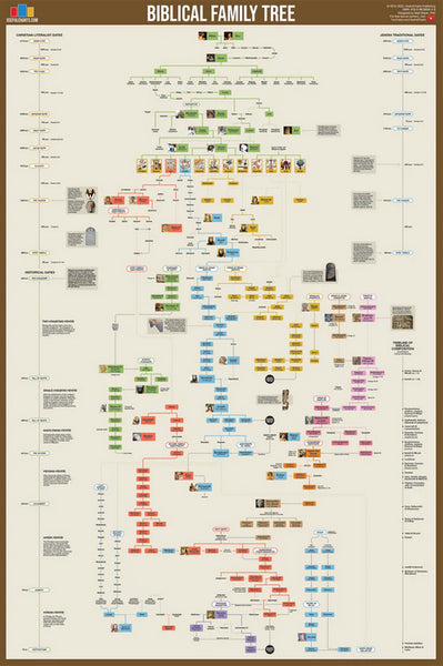
Biblical Family Tree and Historical Timeline Wall Chart Premium Reference Poster - Useful Charts
Item # UC-17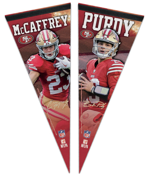
Christian McCaffrey and Brock Purdy San Francisco 49ers Signature Series Premium Felt NFL Collector's Pennant Set - Wincraft 2023
Item # WI-PP-2471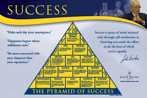
Coach John Wooden's "Pyramid of Success" Motivational Inspirational Wall Poster - Classic Edition
Item # JWC-01-CL
Coach John Wooden's "Pyramid of Success" Motivational Inspirational Wall Poster - Executive Edition
Item # JWC-01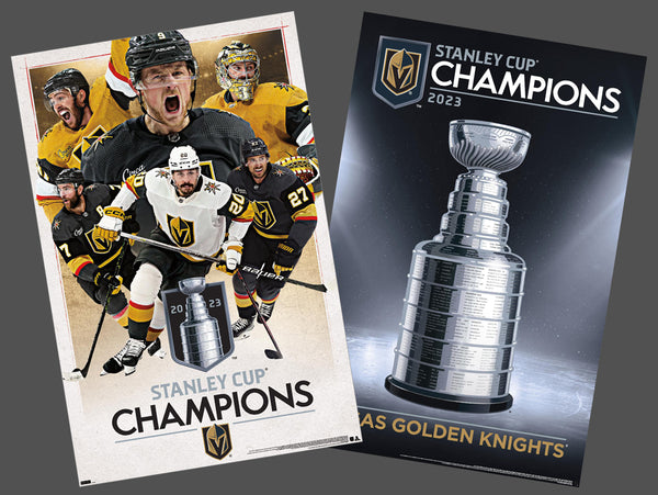
COMBO: Vegas Golden Knights 2023 Stanley Cup Champions Commemorative 2-Poster Set - Costacos Sports
Item # CN23052-23053
Connor McDavid "Superstar" Edmonton Oilers NHL Hockey Poster - Costacos Sports 2022
Item # CN22885-22
Dak Prescott "Lone Star Great" Dallas Cowboys QB NFL Action Poster - Costacos Sports 2022
Item # CN22714-22
Denver Nuggets 2023 NBA Champions Official Commemorative Poster - Costacos Sports
Item # CN23048-23Detroit Lions Official NFL Football Team Helmet Logo Neon-Style Poster - Costacos Sports
Item # CN23842-23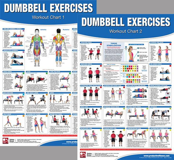
Dumbbell Exercises Workout 2-Poster Professional Wall Chart Combo - Productive Fitness
Item # PFP-DUMBELLS
Fitness Gym Motivational "Challenge Your Limits" Inspirational Quotes Wall Poster - Trends Int'l.
Item # CN15817-17
Ford F-Series Pickup Truck Evolution (26 Models Since 1948) Autophile Poster - Eurographics
Item # EU2400-0950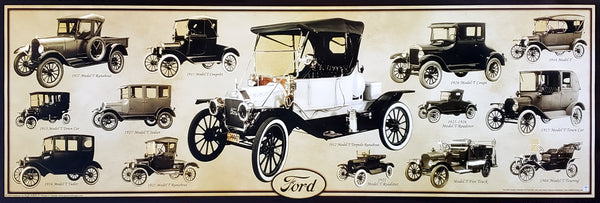
Ford Model T Automobiles (1908-1927) Official Ford Motor Company Commemorative Poster - Aquarius
Item # SB-P2030
Ford Mustang 50th Anniversary "Evolution" (29 Classic Sportscars) Autophile Poster - Eurographics
Item # EU2450-0684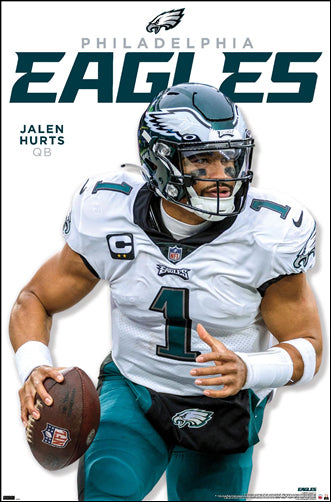
Jalen Hurts "Roll Out" Philadelphia Eagles QB NFL Action Wall Poster - Costacos 2023
Item # CN23943-23
Josh Allen "Touchdown Roar" Buffalo Bills QB NFL Action NFL Poster - Costacos 2023
Item # CN23937-23
Josh Allen and Stefon Diggs "Superstar Duo" Buffalo Bills NFL Action Poster - Costacos Sports
Item # CN21292-21
Kansas City Chiefs Super Bowl LVII (2023) CHAMPIONS 6-Player Commemorative Poster - Costacos
Item # CN22969-23
Kansas City Chiefs Super Bowl LVIII (2024) CHAMPIONS 8-Player Commemorative Poster - Costacos
Item # CN23874-24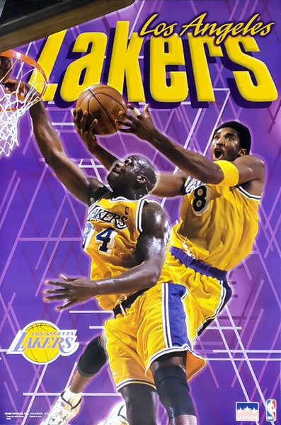
Kobe Bryant and Shaquille O'Neal "Showtime" Los Angeles Lakers Poster - Starline 1999
Item # S3568
LeBron James "Showtime 6" Los Angeles Lakers Official NBA Poster - Costacos 2022
Item # CN22691-22
Marilyn Monroe "Pumping Iron" (Hollywood 1952) Poster Print - Image Conscious.
Item # IC-H353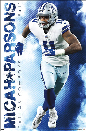
Micah Parsons "Prowler" Dallas Cowboys Linebacker NFL Action Poster - Costacos Sports 2022
Item # CN22653-22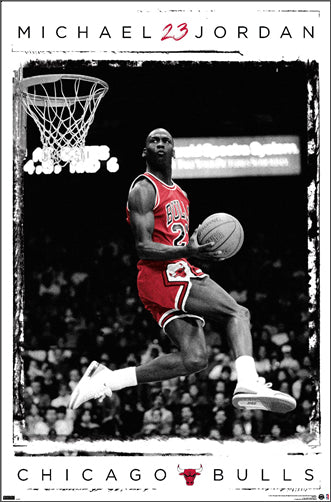
Michael Jordan "1987 Slam Dunk Classic" Chicago Bulls Commemorative NBA Poster - Costacos Sports 2022
Item # CN21923-22
Michael Jordan "23 Soaring Slam" Chicago Bulls Commemorative NBA Poster - Costacos Sports 2022
Item # CN21928-22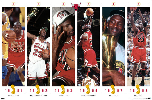
Michael Jordan "Championship History" Chicago Bulls Commemorative NBA Poster - Costacos Sports 2023
Item # CN24362-23
Michael Jordan "Cloudburst" Chicago Bulls Commemorative NBA Basketball Action Poster - Costacos Sports 2023
Item # CN23327-23
Michael Jordan "Fly" Chicago Bulls Slam Dunk Inspirational NBA Poster - Costacos Sports 2022
Item # CN21927-22
Michael Jordan "Six-Foot Slam" Chicago Bulls HUGE Door-Sized Poster - Costacos 1997
Item # CN8364-97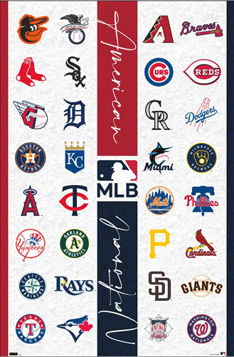
MLB Major League Baseball Logos (All 30 Teams) Poster - Costacos Sports
Item # CN23396-23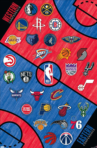
NBA Basketball Full Court Team Logos Poster (All 30 Teams) - Costacos Sports
Item # CN22878-22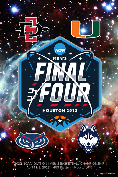
NCAA 2023 Men's Basketball Championships FINAL FOUR Official Poster (SDSU, FAU, Miami, UConn) - ProGraphs
Item # PG-078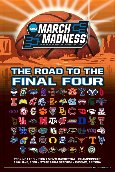
NCAA March Madness 2024 Men's Basketball Championships Official Poster (68-Team Tournament Field)
Item # PG-081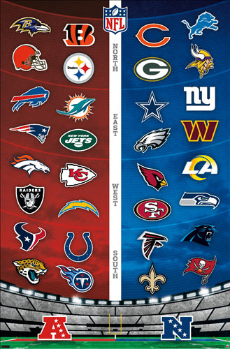
NFL FOOTBALL LOGOS Official Wall Poster (All 32 Team Emblems) - Costacos Sports
Item # CN22539-22
NFL Football Logos Official Wall Poster (All 32 Team Helmets) - Costacos Sports
Item # CN22538-22
Nick Bosa "Superstar" San Francisco 49ers NFL Action Wall Poster - Costacos 2023
Item # CN23944-23
Patrick Mahomes "Go Deep" Kansas City Chiefs Official NFL Football Wall Poster - Costacos 2022
Item # CN22663-22
Patrick Mahomes "Gunslinger" Kansas City Chiefs Official NFL Football Wall Poster - Trends International
Item # CN17494-18
Philadelphia Eagles "Dynamic Duo" (Jalen Hurts & Devonta Smith) NFL Action Wall Poster - Costacos Sports 2022
Item # CN21330-22
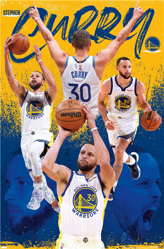
Stephen Curry "Superstar" Golden State Warriors NBA Basketball Poster - Costacos Sports 2022
Item # CN22877-22
Steve Prefontaine "The Gift" c.1972 Motivational Action Poster - Running Past
Item # RP001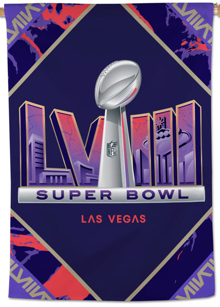
Super Bowl LVIII (Las Vegas 2024) Official NFL Championship Event 28x40 BANNER Flag - Wincraft Inc.
Item # WI-FL-432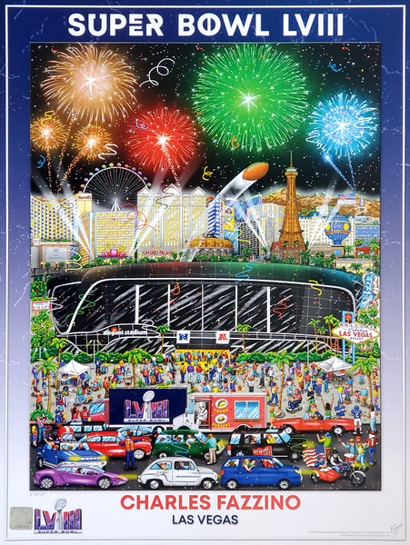
Super Bowl LVIII (Las Vegas 2024) Official NFL Football Commemorative Pop Art Poster - Fazzino
Item # FAZ-046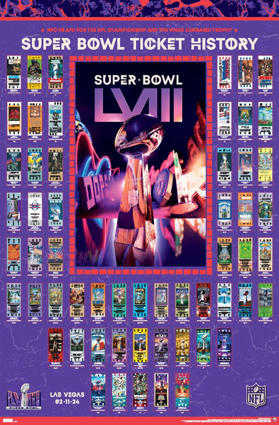
Super Bowl LVIII (Las Vegas 2024) Official NFL SUPER TICKETS Game History Poster - Costacos Sports
Item # CN24797-24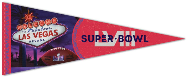
Super Bowl LVIII (Las Vegas 2024) Official Premium Felt Commemorative Event Pennant - Wincraft
Item # WI-PP-2462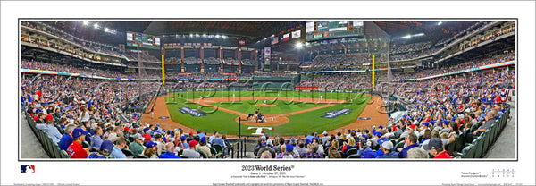
Texas Rangers "World Series Action 2023" Globe Life Field Panoramic Poster Print - Everlasting Images (TX-454)
Item # EI390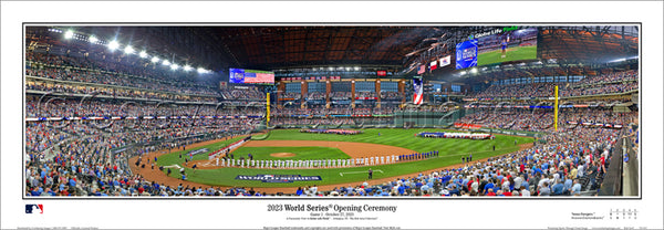
Texas Rangers "World Series Majesty 2023" Globe Life Field Panoramic Poster Print - Everlasting Images (TX-453)
Item # EI389
Texas Rangers 2023 World Series CHAMPIONS Commemorative Wall Poster - Costacos Sports
Item # CN23441-23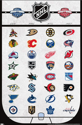
The NHL Hockey Universe All 32 Team Logos Official Poster - Costacos Sports
Item # CN22889-22
Biblical Family Tree and Historical Timeline Wall Chart Premium Reference Poster - Useful Charts
Item # UC-17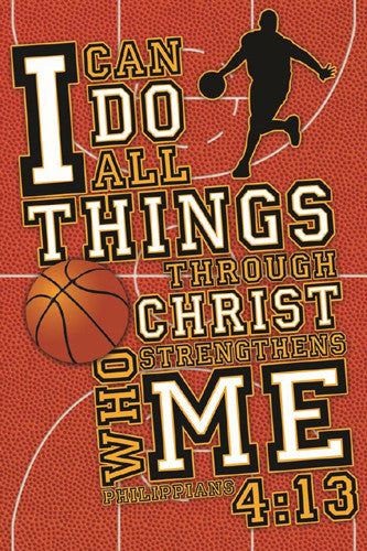
Basketball Prayer (Philippians 4:13) Biblical Motivational Sports Poster - Slingshot
Item # SL-144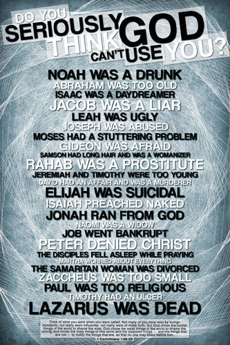
Do You Seriously Think God Can't Use YOU? (Weak Heroes of the Bible) Poster - Slingshot
Item # SL-101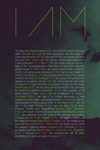
I Am Christian Inspirational Biblical Quotations Poster - Slingshot Publishing
Item # SL-185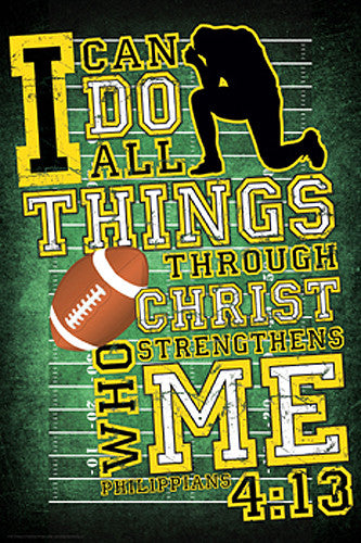
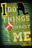
Football Prayer (Philippians 4:13) Christian Athlete Motivational Poster - Slingshot
Item # SL-119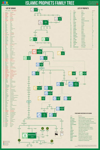
Islamic Prophets Family Tree Wall Chart Premium Reference Poster - Useful Charts
Item # UC-18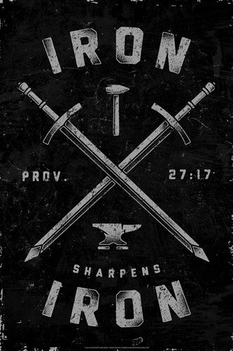
Iron Sharpens Iron (Proverbs 27:17) Biblical Inspirational Poster - Slingshot
Item # SL-660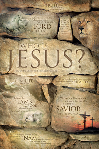
Who is Jesus? (10 Verses) Biblical Inspirational Poster - Slingshot
Item # SL-645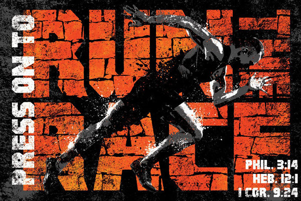
Press On to Run the Race (Runner's Prayer) Christian Athlete Motivational Poster - Slingshot
Item # SL-685
The Lion of Judah (Hosea 11:10) Biblical Inspirational Poster - Slingshot Publishing
Item # SL-520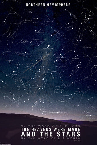
Map of the Stars "By the World of the Lord" (Psalm 33:6) Astrology Poster - Slingshot Publishing
Item # SL-595
Righteous Dog "Praise the Lord" (Psalm 150:6) Biblical Inspirational Poster - Slingshot Publishing
Item # SL-146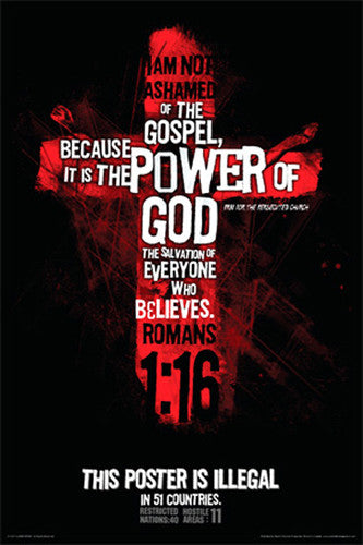
Romans 1:16 ("Illegal in 51 Countries") Christian Biblical Inspirational Poster - Slingshot Publishing
Item # SL-054
Christian Inspirational "I Will Pour Out My Spirit" (Acts 2:17) Poster - Slingshot Publishing
Item # SL-135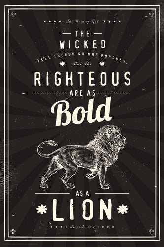
Proverbs 28:1 "Bold as a Lion" Inspirational Poster - Slingshot Publishing
Item # SL-141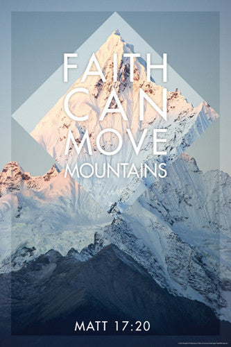
Faith can Move Mountains (Matthew 17:20) Christian Inspirational Poster - Slingshot Publishing
Item # SL-170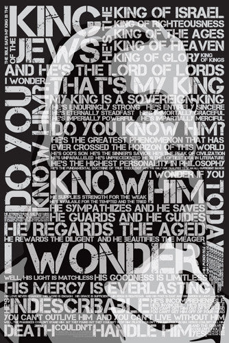
Jesus Christ "That's My King" Poster - Slingshot Publishing
Item # SL-105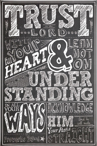
Trust in the Lord (Proverbs 3:5-6) Inspirational Poster - Slingshot Publishing
Item # SL-124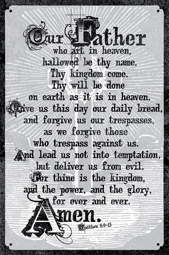

Christ Died For Us (Burning Heart, Romans 5:8) Poster - Slingshot Publishing
Item # SL-126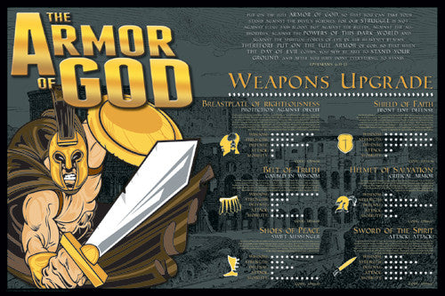
Armor of God (Ephesians 6:11-13) Inspirational Poster - Slingshot
Item # SL-131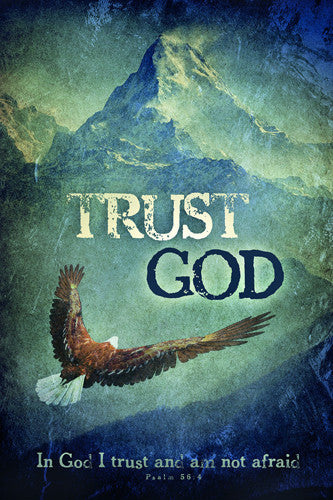
Trust God (Psalm 56:4) Soaring Eagle Over Mountains Biblical Inspirational Poster - Slingshot
Item # SL-630
God is So Cool (Christian Gekko) Inspirational Poster - Slingshot Publishing
Item # SL-515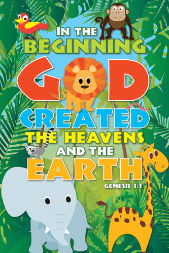
Creation Jungle (Genesis 1:1) Inspirational Poster - Slingshot Publishing
Item # SL-120
Imperfect Girl (God Still Loves Me) Christian Inspirational Poster - Slingshot Publishing
Item # SL-058
He is Making All Things New (Revelation 21:5) Christian Inspirational Poster - Slingshot
Item # SL-134
Glorious Creator (Revelation 4:11) Animal Kingdom Inspirational Poster - Slingshot
Item # SL-130
Amazing Grace Christian Hymn Lyrics Inspirational Wall Poster - Slingshot Publishing
Item # SL-065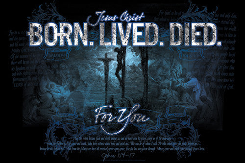
Jesus Christ "Born. Lived. Died. For You." (John 1:14-17) Inspirational Poster - Slingshot
Item # SL-123
White Horse "Faithful and True" (Revelation 19:11) Inspirational Poster - Slingshot Publishing
Item # SL-145
BOLD AS A LION Proverbs 28:1 Biblical Wisdom Inspirational Poster - Slingshot Publishing
Item # SL-155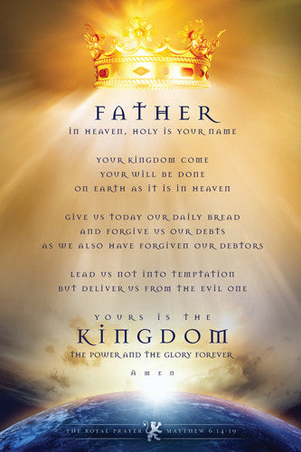
The Royal Prayer (Matthew 6:14-19) Christian Inspirational Poster - Slingshot Publishing
Item # SL-580
Imperfect Guy Christian Inspirational Poster - Slingshot Publishing
Item # SL-093
Hope Anchors the Soul (Hebrews 6:19) Religious Inspirational Poster - Slingshot
Item # SL-575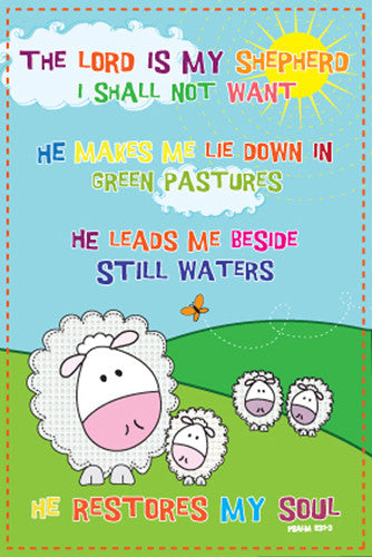
Psalm 23 "Mellow Sheep" Biblical Inspirational Poster - Slingshot Publishing
Item # SL-076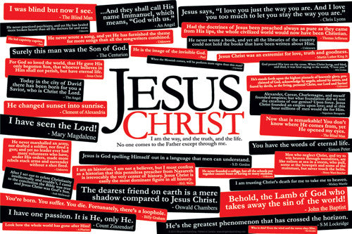

Heaven is Where I Belong Christian Inspirational Poster - Slingshot
Item # SL-099
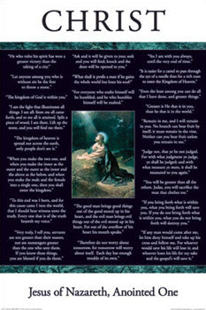
Jesus Christ of Nazareth "Wisdom" (22 Quotes) Poster - Aquarius Images
Item # AQ24535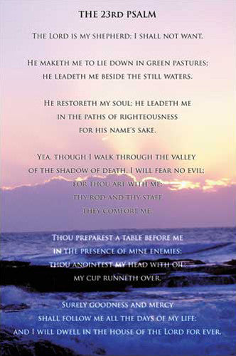
Courage and Faith (Psalms 23) Biblical Inspirational Poster - Eurographics Inc.
Item # EU2400-0011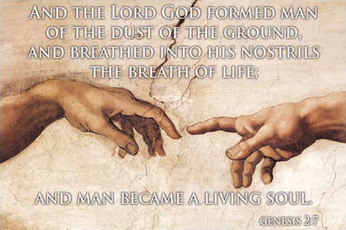
Genesis 2:7, Michelangelo's Hands of Creation - Eurographics Inc.
Item # EU2400-0013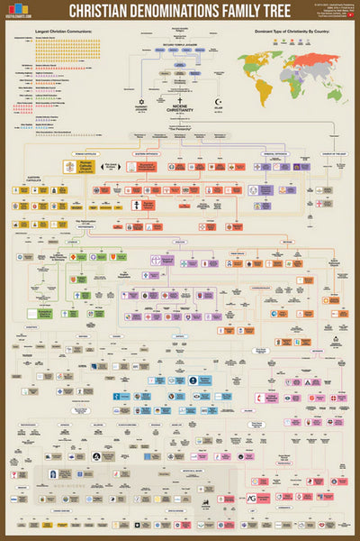
Christian Denominations Family Tree and Historical Timeline Wall Chart Premium Reference Poster - Useful Charts
Item # UC-27
2 Timothy 4:7 "Fought The Good Fight, Kept the Faith" Biblical Inspirational Poster - Slingshot Publishing
Item # SL-560
Heart on Fire (Romans 12:11) Christian Biblical Inspirational Poster - Slingshot
Item # SL-680
God's Girl (1 Peter 3:3-4) Christian Inspiratonal Poster - Slingshot Publishing
Item # SL-122

I Am Made With a Sense of Wonder (Psalm 139.13) Biblical Inspirational Poster - Slingshot
Item # SL-690
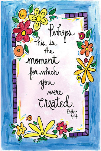
Perhaps This is the Moment (Esther 4:14) Girls Biblical Inspirational Poster - Slingshot
Item # SL-650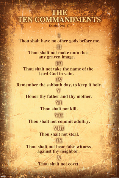
The Ten Commandments (Exodus 20:1-17) Biblical Laws Poster - Pyramid America
Item # PP-PAS0887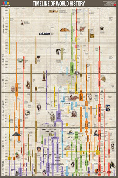
Timeline of World History (Human Civilization from 3,000 BCE to Present) Premium Wall Chart Poster
Item # UC-01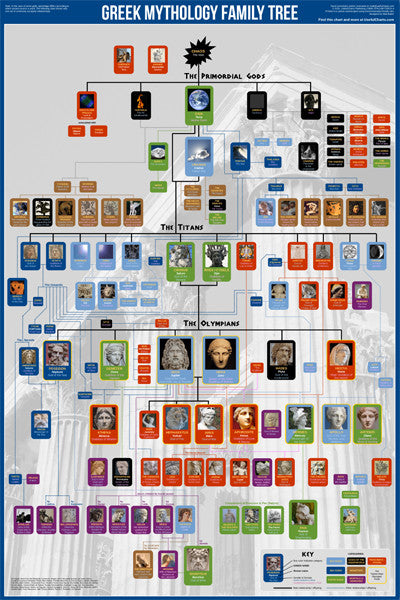
Greek Mythology Family Tree Wall Chart Premium Reference Poster - Useful Charts
Item # UC-04
Biblical Family Tree and Historical Timeline Wall Chart Premium Reference Poster - Useful Charts
Item # UC-17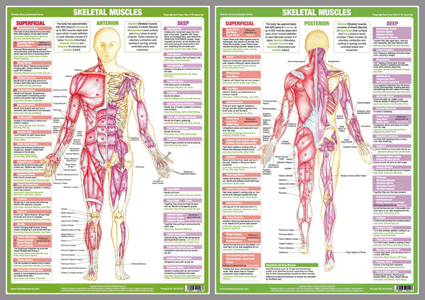
Major Skeletal Muscles Anatomy Wall Chart Poster Set (2 Posters) - Chartex Ltd.
Item # CX-MAJORMUSC-2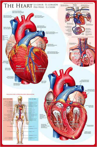
Anatomy of The Human Heart Wall Chart Poster - Eurographics
Item # EU2450-0257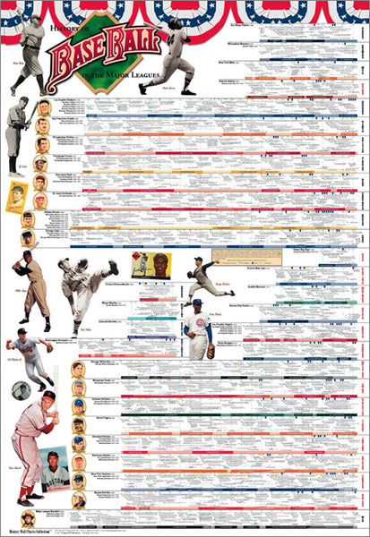
History of Major League Baseball Wall Chart Poster (to 2016) - Vanguard Sports Publishing
Item # V002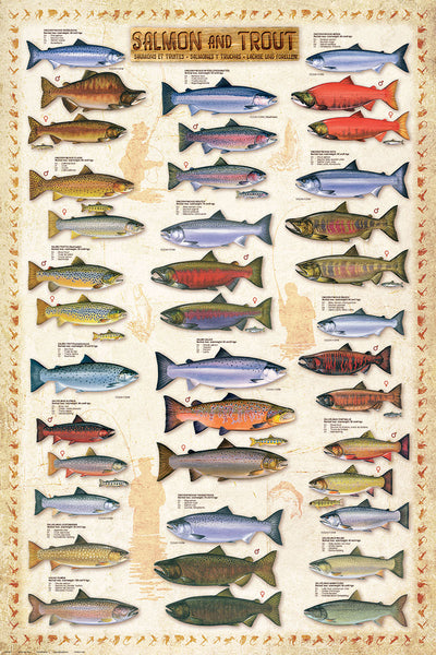
Salmon and Trout Fishing Wall Chart (17 Species) Poster - Eurographics
Item # EU2450-0311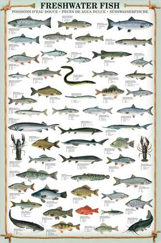
Freshwater Fish (53 Species) Wall Chart Poster - Eurographics
Item # EU2450-0312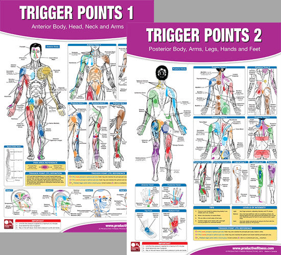
Trigger Points Massage Therapy Fitness Anatomy 2-Poster Wall Chart Set - PFP
Item # PFP-TP-SET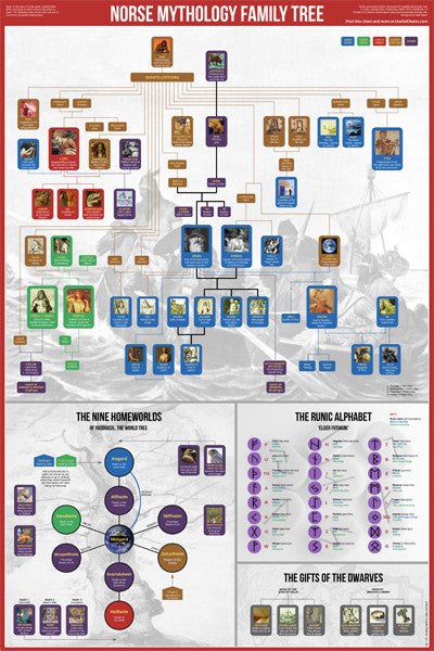
Norse Mythology Family Tree Wall Chart Premium Reference Poster - Useful Charts
Item # UC-05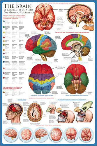
Anatomy of The Human Brain Wall Chart Poster - Eurographics
Item # EU2450-0256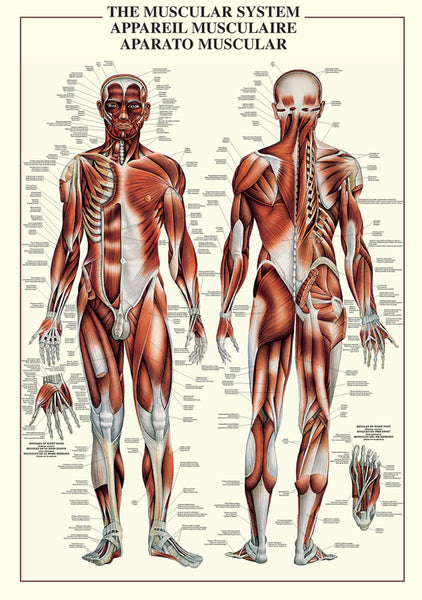
The Muscular System Human Anatomy Wall Chart Reference Poster - Ricordi Arte/Eurographics
Item # EU2450-4460
Islamic Prophets Family Tree Wall Chart Premium Reference Poster - Useful Charts
Item # UC-18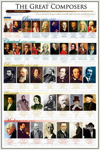
The Great Composers of History Classical Music Wall Chart Poster - Eurographics Inc.
Item # EU2450-2007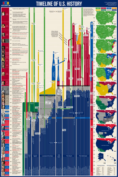
Timeline of U.S. History (American History from 1565 to Present) Premium Wall Chart Poster
Item # UC-03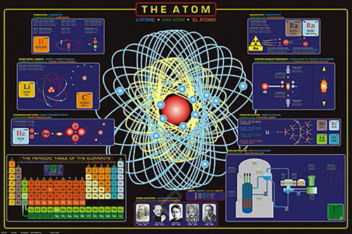
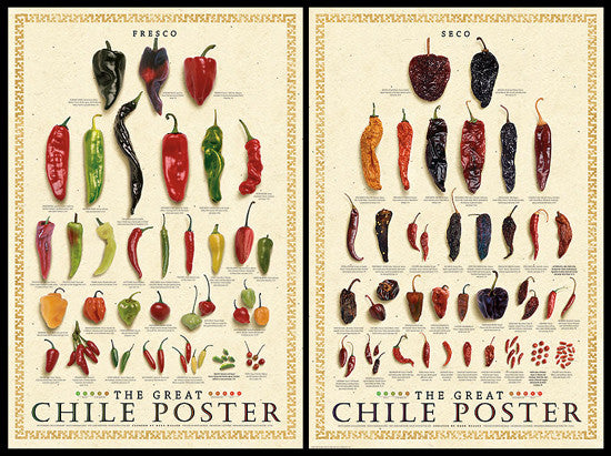
The Great Chile Poster 2-Poster Combo (Fresco & Seco) - American Image
Item # IC-CHILEPOSTERS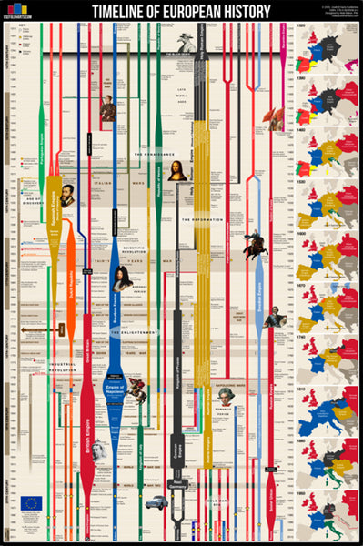
Timeline of European History (History from 14th Century CE to Present) Premium Wall Chart Poster
Item # UC-02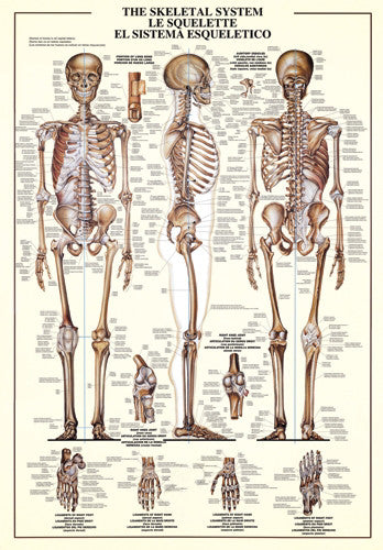
The Skeletal System Human Anatomy Large 27x39 Wall Chart Poster - Nuova
Item # EU2450-3970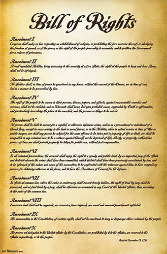
The Bill of Rights (First Ten Amendments to the United States Constitution) Poster - Trends International
Item # CN6908-13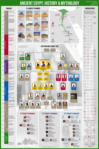
Ancient Egypt History and Mythology Premium Timeline Educational Wall Chart Poster
Item # UC-06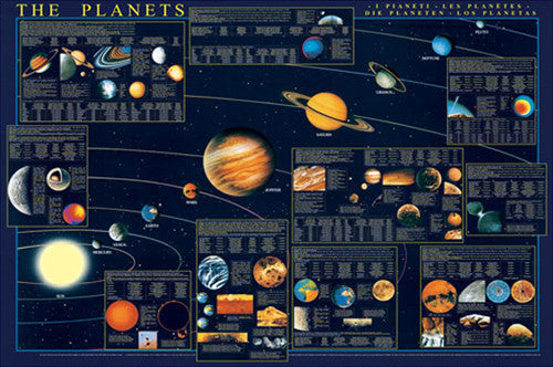
The Planets of the Solar System Science Educational 27x39 Poster - Eurographics Inc.
Item # EU2450-4790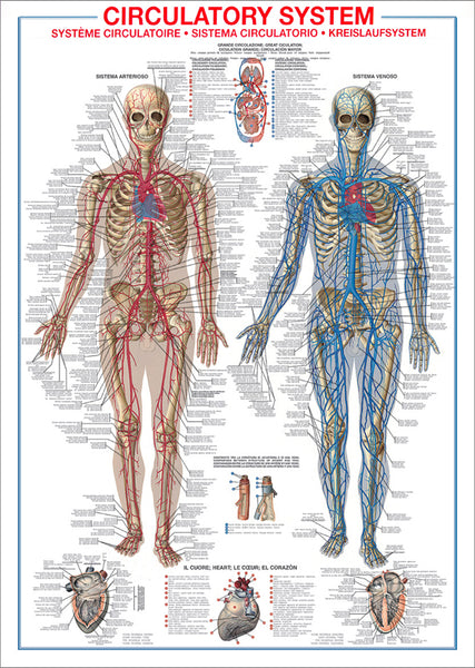
The Circulatory System Human Anatomy Wall Chart 27x39 Reference Poster - Ricordi Arte/Eurographics
Item # EU2450-4940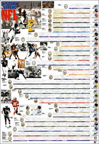
History of the NFL Football Wall Chart Poster - Vanguard Sports
Item # V003
Evolution and Classification of Life Wall Chart Premium Reference Poster - Useful Charts
Item # UC-12
The Wisdom of Albert Einstein Poster (22 Quotations) - Eurographics Inc.
Item # EU2400-0287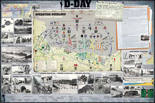
D-Day WWII Normandy Invasion Military History Wall Chart Poster - Eurographics Inc.
Item # EU2450-0295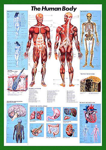
The Human Body Anatomy Large 27x39 Wall Chart Poster - Nuova Arti Grafiche
Item # EU2450-1570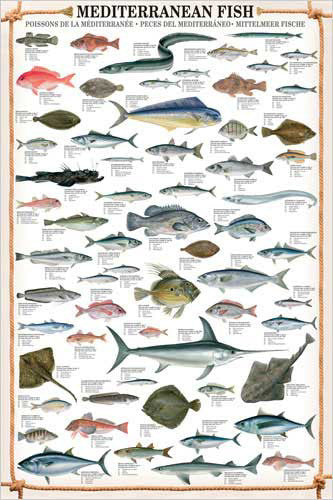
Mediterranean Fish Wall Chart Poster (61 Saltwater Species) Poster - Eurographics
Item # EU2450-0315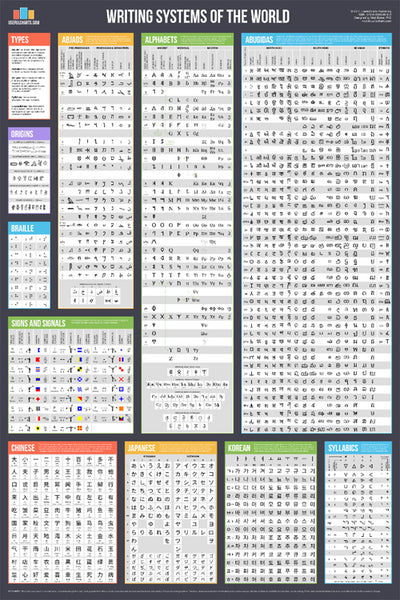
Writing Systems of the World Educational Reference Wall Chart Poster - Useful Charts
Item # UC-08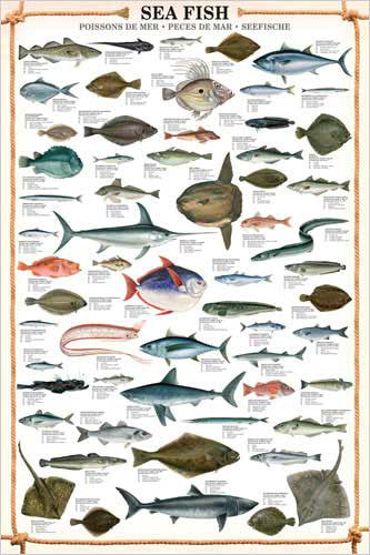
Sea Fish Wall Chart (59 Saltwater Species) Poster - Eurographics
Item # EU2450-0313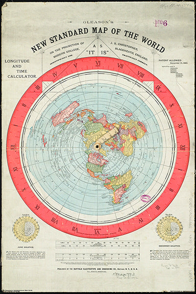
Gleason's New Standard MAP OF THE WORLD (1892) 24x36 Wall POSTER Reproduction - Posterservice Inc. 2020
Item # PS-11565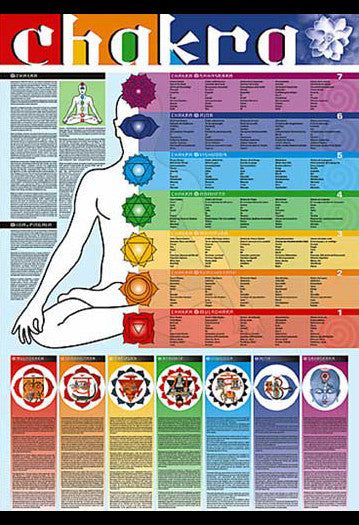
Chakras of the Human Body Yoga Wall Chart - Ricordi Arte 2005
Item # EU2450-4960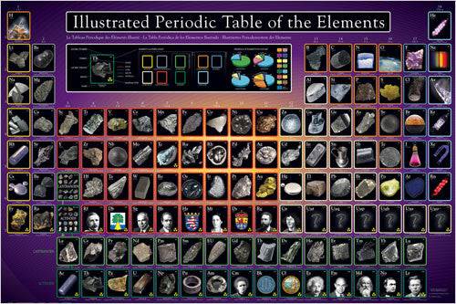
Illustrated Periodic Table of the Elements Poster - Eurographics Inc.
Item # EU2450-0258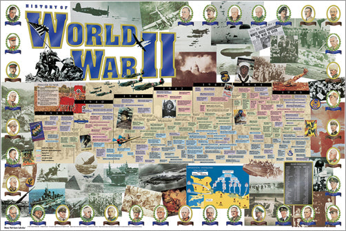
History of World War II Educational Wall Chart Poster - Vanguard Publishing
Item # V005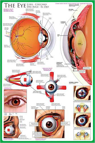
Anatomy of The Human Eye Wall Chart Poster - Eurographics Inc.
Item # EU2450-0260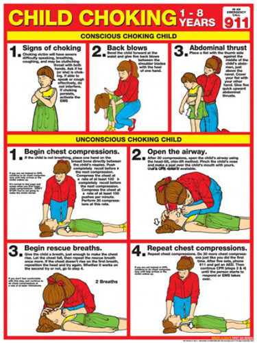
Child Choking First Aid Wall Chart Poster (2013 ARC Guidelines)- Fitnus Corp.
Item # FI-FA05
Top 10 Legendary Black Sports Figures Historical Wall Chart Poster - African-American Athletes
Item # EU2450-0003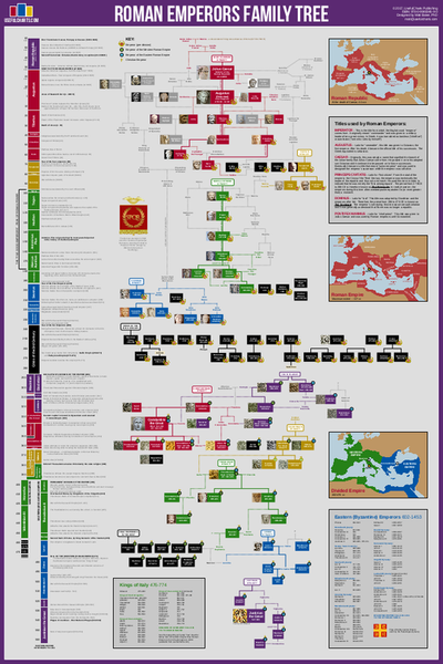
Roman Emperors Family Tree Wall Chart Premium Reference Poster - Useful Charts
Item # UC-09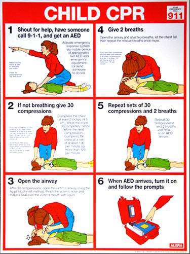
Child CPR First Aid Wall Chart Poster (2017 AHA Guidelines) - Fitnus Corp.
Item # FI-FA02A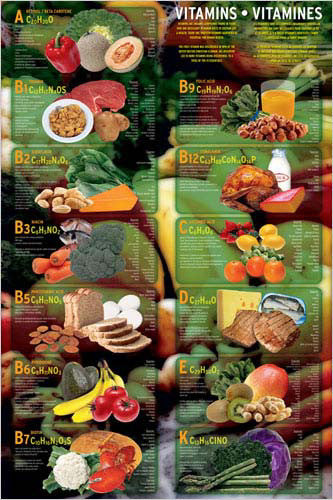
Vitamins Food Nutritional Wall Chart Poster - Eurographics
Item # EU2450-1016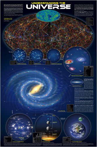
Understanding the Universe Educational Wall Chart Poster - Eurographics Inc.
Item # EU2450-0279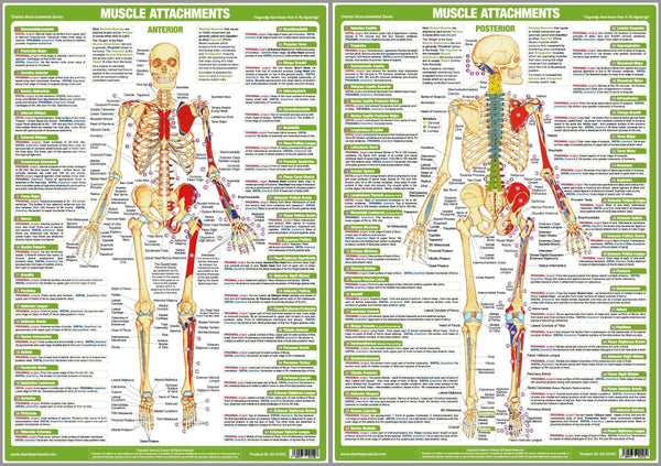
Major Muscle Attachments Human Physical Anatomy 2-Poster Combo Set - Chartex Ltd
Item # CX-MUSCATT-2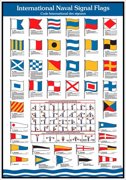
International Naval Signal Flags for Yachting and Sailing Wall Chart Poster - Eurographics Inc.
Item # EU2450-2740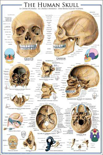
Anatomy of The Human Skull Wall Chart Poster - Eurographics
Item # EU2450-0306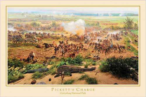
Gettysburg Cyclorama "Pickett's Charge Detail" Civil War Poster - Eurographics Inc.
Item # EU2400-0281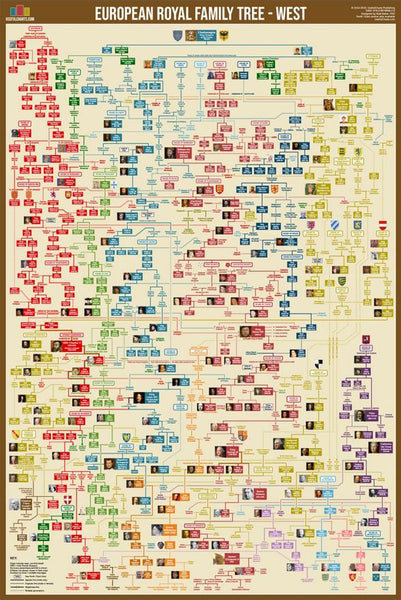
Western European Royal Family Tree Wall Chart Premium Reference Poster - Useful Charts
Item # UC-15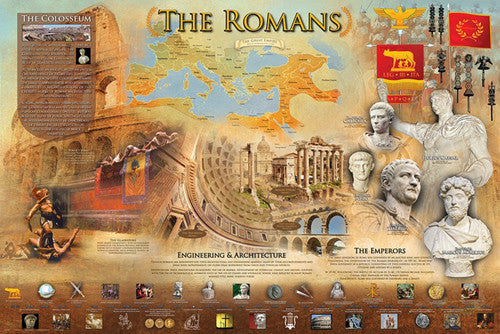
The Romans Classical Civilization Roman Empire Educational Historical Poster - Eurographics Inc.
Item # EU2450-0584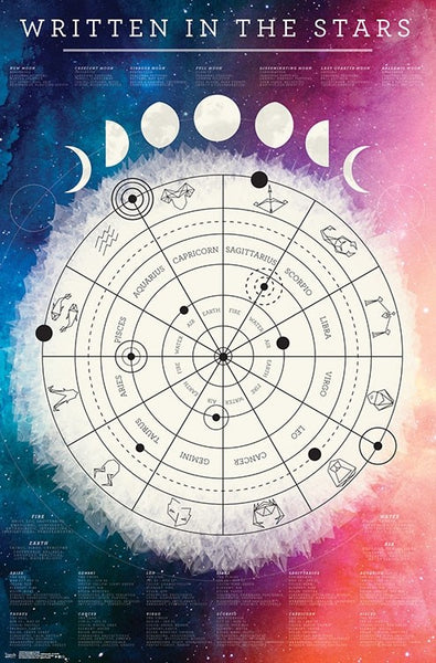
Astrology "Written in the Stars" Astrological Wall Chart Poster - Trends International
Item # CN17836-19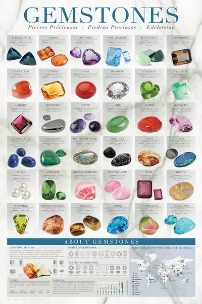
Gemstones (Geology Minerals for Jewelry) Wall Chart Poster - Eurographics Inc.
Item # EU2450-0582
Biblical Family Tree and Historical Timeline Wall Chart Premium Reference Poster - Useful Charts
Item # UC-17
Basketball Prayer (Philippians 4:13) Biblical Motivational Sports Poster - Slingshot
Item # SL-144
Do You Seriously Think God Can't Use YOU? (Weak Heroes of the Bible) Poster - Slingshot
Item # SL-101
I Am Christian Inspirational Biblical Quotations Poster - Slingshot Publishing
Item # SL-185
Football Prayer (Philippians 4:13) Christian Athlete Motivational Poster - Slingshot
Item # SL-119
Islamic Prophets Family Tree Wall Chart Premium Reference Poster - Useful Charts
Item # UC-18
Desiderata Inspirational Life Advice Poem 24x36 Wall Poster - Posterservice Inc.
Item # PS-10415
Iron Sharpens Iron (Proverbs 27:17) Biblical Inspirational Poster - Slingshot
Item # SL-660
Who is Jesus? (10 Verses) Biblical Inspirational Poster - Slingshot
Item # SL-645
Press On to Run the Race (Runner's Prayer) Christian Athlete Motivational Poster - Slingshot
Item # SL-685
The Lion of Judah (Hosea 11:10) Biblical Inspirational Poster - Slingshot Publishing
Item # SL-520
Map of the Stars "By the World of the Lord" (Psalm 33:6) Astrology Poster - Slingshot Publishing
Item # SL-595
Righteous Dog "Praise the Lord" (Psalm 150:6) Biblical Inspirational Poster - Slingshot Publishing
Item # SL-146
Romans 1:16 ("Illegal in 51 Countries") Christian Biblical Inspirational Poster - Slingshot Publishing
Item # SL-054
Proverbs 28:1 "Bold as a Lion" Inspirational Poster - Slingshot Publishing
Item # SL-141
Faith can Move Mountains (Matthew 17:20) Christian Inspirational Poster - Slingshot Publishing
Item # SL-170
Jesus Christ "That's My King" Poster - Slingshot Publishing
Item # SL-105
Trust in the Lord (Proverbs 3:5-6) Inspirational Poster - Slingshot Publishing
Item # SL-124
Armor of God (Ephesians 6:11-13) Inspirational Poster - Slingshot
Item # SL-131
Trust God (Psalm 56:4) Soaring Eagle Over Mountains Biblical Inspirational Poster - Slingshot
Item # SL-630
God is So Cool (Christian Gekko) Inspirational Poster - Slingshot Publishing
Item # SL-515
Creation Jungle (Genesis 1:1) Inspirational Poster - Slingshot Publishing
Item # SL-120
Imperfect Girl (God Still Loves Me) Christian Inspirational Poster - Slingshot Publishing
Item # SL-058
Amazing Grace Christian Hymn Lyrics Inspirational Wall Poster - Slingshot Publishing
Item # SL-065
Jesus Christ "Born. Lived. Died. For You." (John 1:14-17) Inspirational Poster - Slingshot
Item # SL-123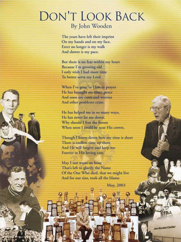
Coach John Wooden's "Don't Look Back" Motivational Inspirational Wall Poster
Item # JWC-02
White Horse "Faithful and True" (Revelation 19:11) Inspirational Poster - Slingshot Publishing
Item # SL-145
BOLD AS A LION Proverbs 28:1 Biblical Wisdom Inspirational Poster - Slingshot Publishing
Item # SL-155
The Royal Prayer (Matthew 6:14-19) Christian Inspirational Poster - Slingshot Publishing
Item # SL-580
Imperfect Guy Christian Inspirational Poster - Slingshot Publishing
Item # SL-093
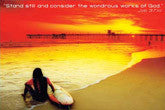
Success in Life (Ralph Waldo Emerson Quote) Sunset at Rocky Ocean Coast Inspirational Poster - Trends International
Item # CN9417
Hope Anchors the Soul (Hebrews 6:19) Religious Inspirational Poster - Slingshot
Item # SL-575
Psalm 23 "Mellow Sheep" Biblical Inspirational Poster - Slingshot Publishing
Item # SL-076
Heaven is Where I Belong Christian Inspirational Poster - Slingshot
Item # SL-099
Jesus Christ of Nazareth "Wisdom" (22 Quotes) Poster - Aquarius Images
Item # AQ24535
Courage and Faith (Psalms 23) Biblical Inspirational Poster - Eurographics Inc.
Item # EU2400-0011
Genesis 2:7, Michelangelo's Hands of Creation - Eurographics Inc.
Item # EU2400-0013
Christian Denominations Family Tree and Historical Timeline Wall Chart Premium Reference Poster - Useful Charts
Item # UC-27
2 Timothy 4:7 "Fought The Good Fight, Kept the Faith" Biblical Inspirational Poster - Slingshot Publishing
Item # SL-560
Heart on Fire (Romans 12:11) Christian Biblical Inspirational Poster - Slingshot
Item # SL-680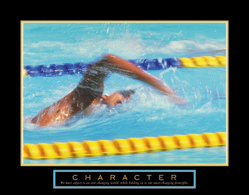
Swimming "Character" Inspirational Motivational 22x28 Poster - Front Line
Item # F102120
Healing Rocks "Balance" Tao Wisdom Motivational - Front Line
Item # F102472
I Am Made With a Sense of Wonder (Psalm 139.13) Biblical Inspirational Poster - Slingshot
Item # SL-690
Perhaps This is the Moment (Esther 4:14) Girls Biblical Inspirational Poster - Slingshot
Item # SL-650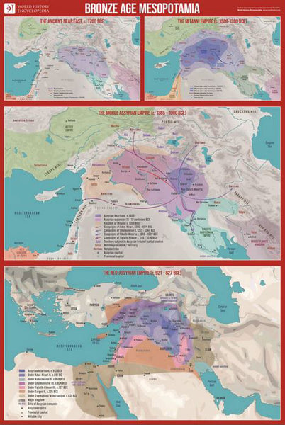
Bronze Age Mesopotamia (1700-600 BCE) Maps Premium 24x36 Reference Poster - Useful Charts/World History Encyclopedia
Item # UC-23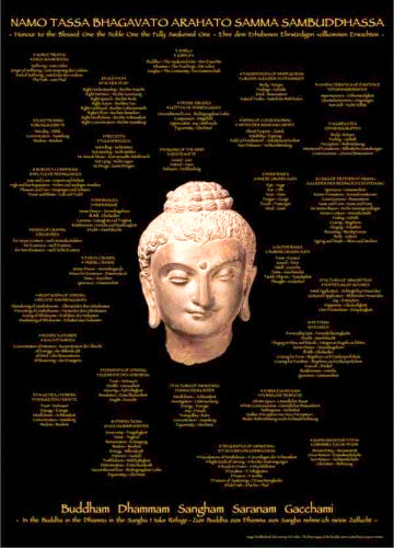
Buddhha Wisdom "Namo Tassa Bhagavato" Buddhist Enlightenment Poster (29 Lists) - Tushita Publishing
Item # TUS-TIB1022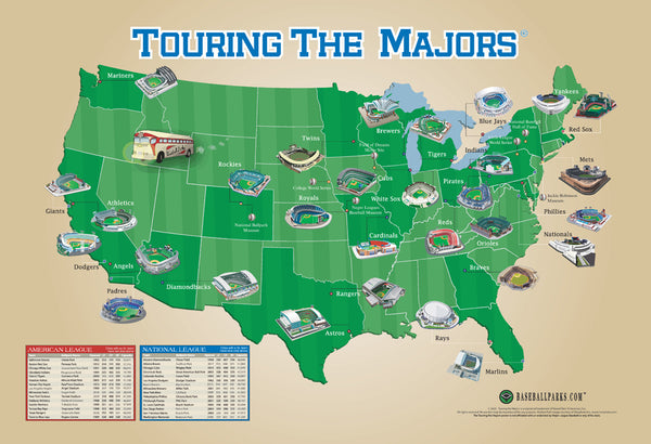
Touring the Majors MLB Ballparks Map of America Poster - Grand Slam Enterprises
Item # GSM-01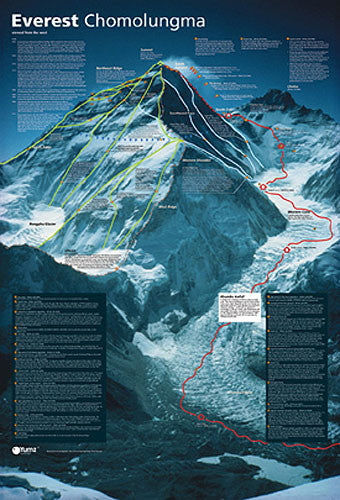
Mount Everest Revealed Mountain Climbing Wall Chart Poster - Yumz
Item # YU-01
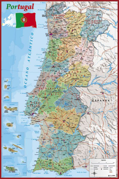
Map of Portugal Wall Chart Poster (Regions, Capitals, Cities, Roads, Rivers, etc.) - Grupo Erik
Item # GE-GPE4799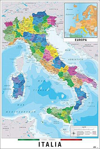
Map of Italy Italia Wall Chart Poster (Regions, Capitals, Cities, Roads, Rivers, etc.) - Grupo Erik
Item # GE-GPE5125
Gleason's New Standard MAP OF THE WORLD (1892) 24x36 Wall POSTER Reproduction - Posterservice Inc. 2020
Item # PS-11565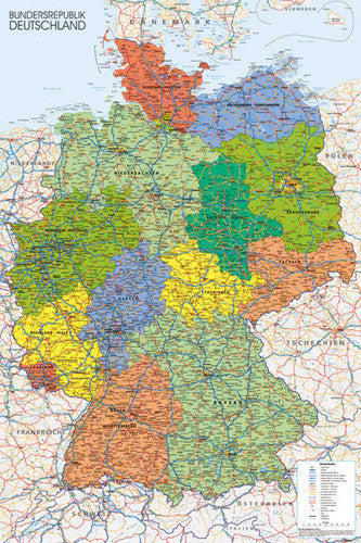
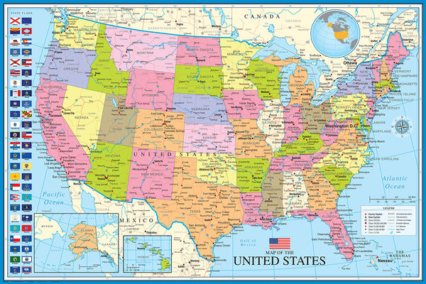
Map of The United States of America USA 24x36 Wall Poster - Eurographics Inc.
Item # EU2400-0788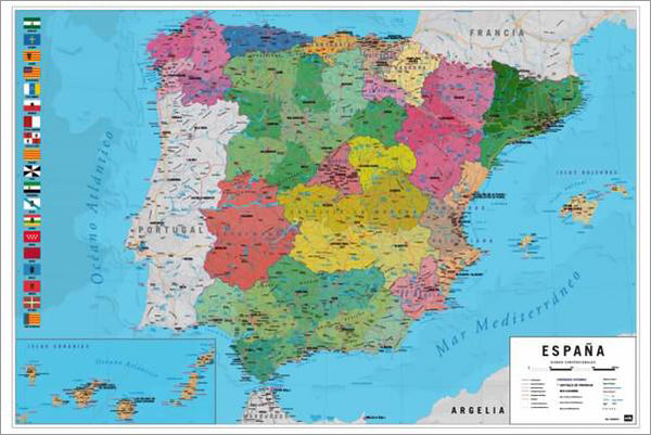
Map of Spain Wall Chart Poster (Regions, Capitals, Cities, Roads, Rivers, etc.) - Grupo Erik
Item # GE-GPE5030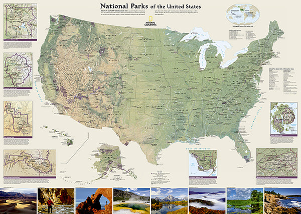
National Parks of the United States National Geographic 30x42 Wall Map Poster - NG Maps
Item # NG-RE01020599
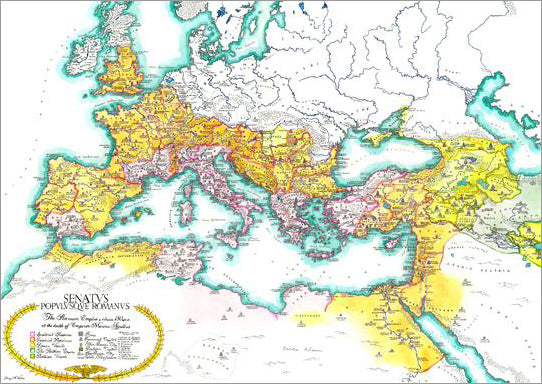
Map of the Roman Empire circa 180 CE Premium Wall Poster - Useful Charts
Item # UC-13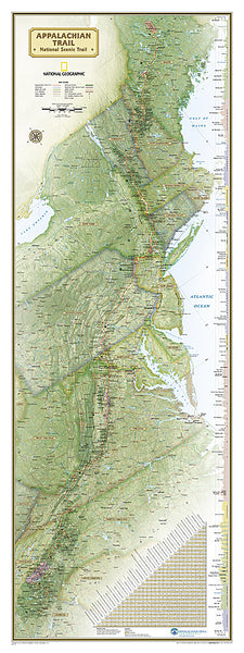
The Appalachian Trail National Geographic 18x48 Hiking Wall Map Poster - NG Maps
Item # NG-RE01020715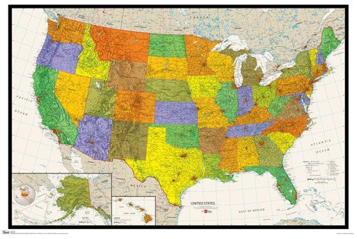
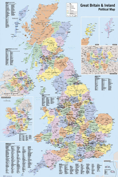
Map of Great Britain and Ireland Wall Poster - GB Eye Ltd.
Item # GB-GN0147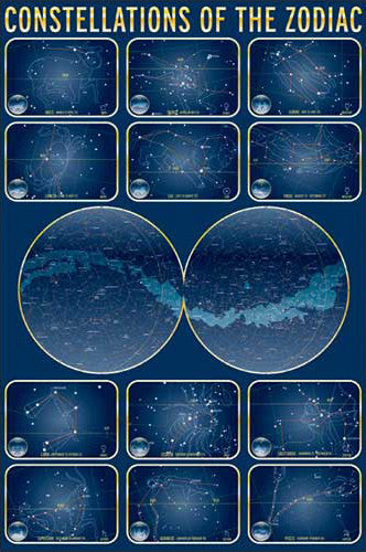
Constellations of the Zodiac Astronomy Wall Chart Poster - Eurographics Inc.
Item # EU2450-4450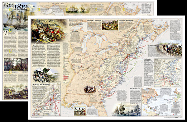
American Revolutionary War/War of 1812 National Geographic 24x36 History Wall Map 2-Sided Poster - NG Maps
Item # NG-RE01020603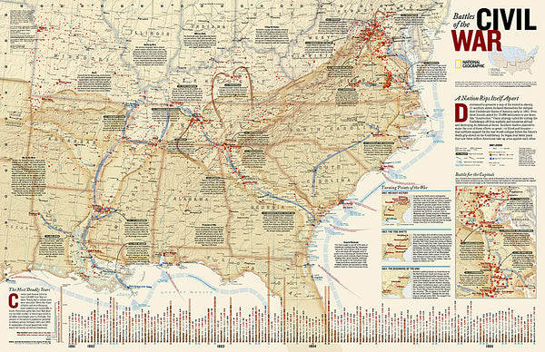
Battles of the American Civil War National Geographic 24x36 Wall Map Poster - NG Maps
Item # NG-RE00620346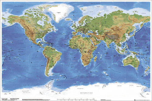
Planetary Visions Physical Map of the World (Miller Cylindrical Projection) Wall POSTER - GB Eye
Item # GB-GN0394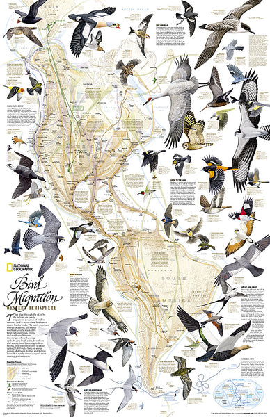
Bird Migration of the Western Hemisphere National Geographic 20x31 Wall Map Poster - NG Maps
Item # NG-RE01020304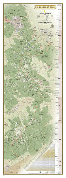
The Colorado Trail National Geographic 18x48 Hiking Wall Map Poster - NG Maps
Item # NG-RE01021199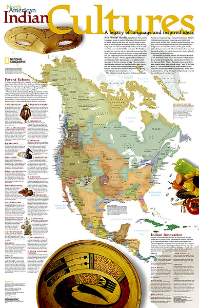
North American Indian Cultures National Geographic 24x36 Wall Map Poster - NG Maps
Item # NG-RE00620319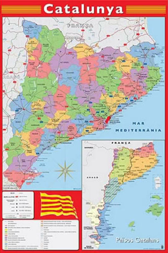
Map of Catalonia (Catalunya) Wall Chart Poster (Regions, Capitals, Cities, Roads, Rivers, etc.) - Grupo Erik
Item # GE-GPE4244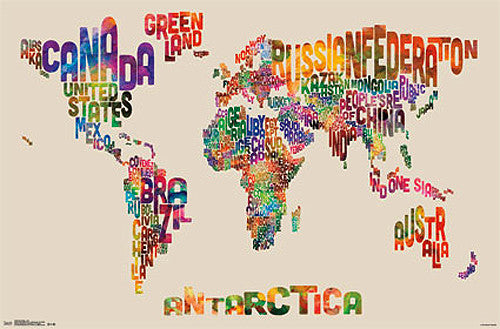
Map of the World Typography Text Map Poster by Michael Tompsett - Trends
Item # CN13480-14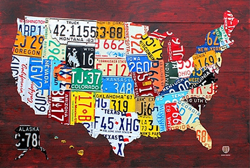
License Plates Map of the United States of America Poster - PosterService Inc.
Item # PS-10205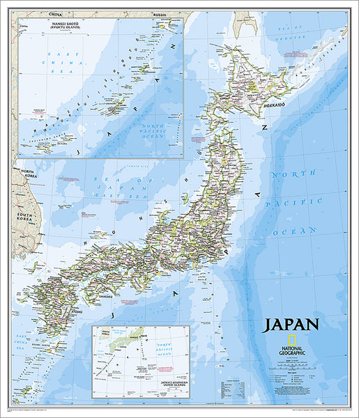
Map of JAPAN National Geographic Classic Edition 25x29 Wall Map Poster - NG Maps
Item # NG-RE01020670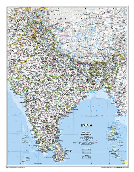
Map of INDIA National Geographic Classic Edition 23x30 Wall Map Poster - NG Maps
Item # NG-RE00620546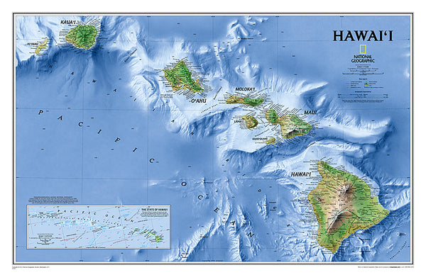
Map of Hawaii National Geographic Classic Edition 20x31 Wall Map Poster - NG Maps
Item # NG-RE00602061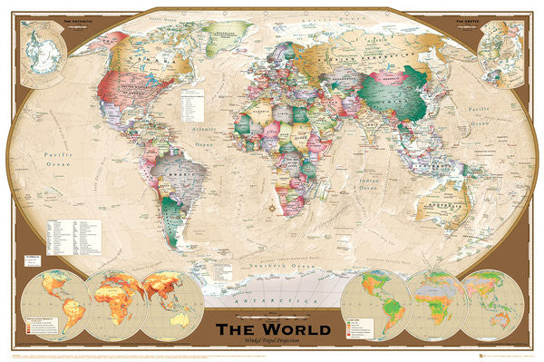
Wall Map of The World Poster (Winkel Tripel Projection) - GB Eye Ltd.
Item # GB-GN0532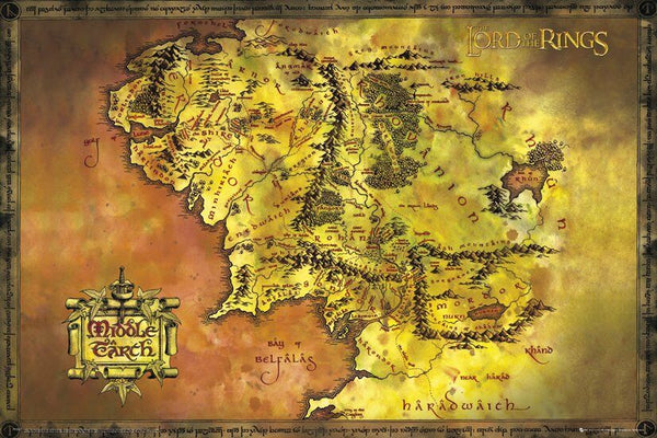
Map of Middle Earth Poster (from J.R.R. Tolkien's The Lord of the Rings) - GB Eye Inc.
Item # SB-GB-FP2647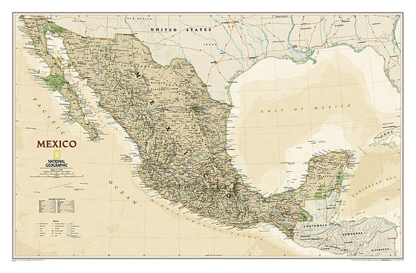
Map of MEXICO National Geographic Executive Edition 23x35 Wall Map Poster - NG Maps
Item # NG-RE01020515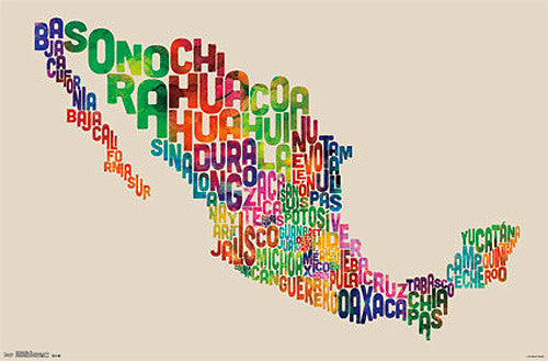
Map of Mexico Typography Text Map Wall Poster by Michael Tompsett - Trends International
Item # CN13491-14-L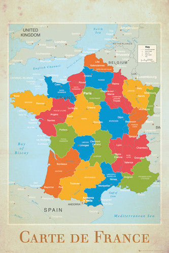
Map of France Wall Chart Poster (Regions, Capitals, Cities, Rivers, etc.) - GB Eye
Item # GB-GN0779
Bronze Age Mesopotamia (1700-600 BCE) Maps Premium 24x36 Reference Poster - Useful Charts/World History Encyclopedia
Item # UC-23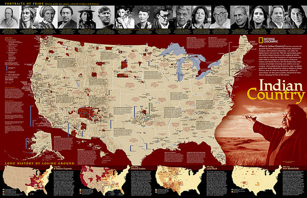
Indian Country Native Cultures of the United States National Geographic 20x31 Wall Map Poster - NG Maps
Item # NG-RE00620315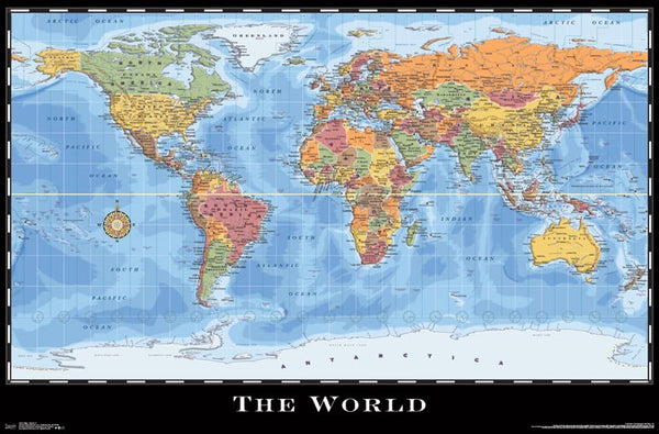
World Map Wall Poster (Modern Political) by Eureka Cartography - Trends International 2017
Item # CN15214-17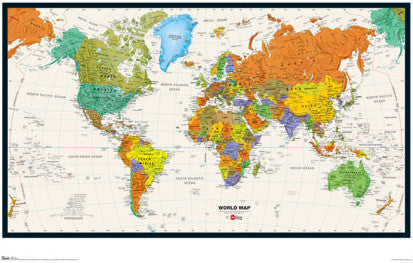
Map of the World Wall Poster - Trends International Inc.
Item # CN6131-09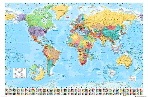
Map of the World 22x34 Wall Poster - Collins Bartholomew Ltd.
Item # CN10157-19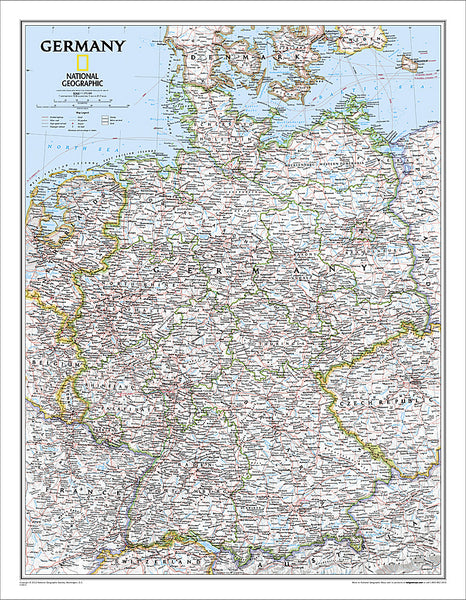
Map of Germany National Geographic Classic Edition 23x30 Wall Map Poster - NG Maps
Item # NG-RE00602814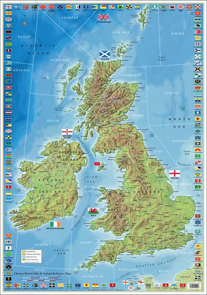
The Ultimate British Isles and Ireland Wall Map Poster w/120 County Flags - Chartex Inc. (UK)
Item # CX-1902A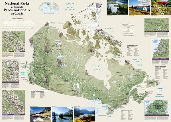
National Parks of the Canada National Geographic 30x42 Wall Map Poster - NG Maps
Item # NG-RE01020680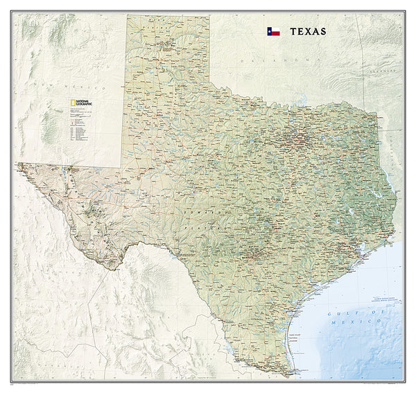
Map of TEXAS National Geographic Classic Edition 38x40 Wall Map Poster - NG Maps
Item # NG-RE01020408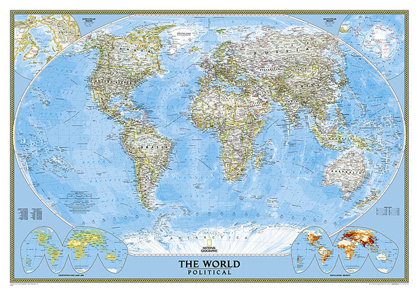
Map of the World National Geographic Classic Edition 30x43 Wall Map Poster - NG Maps
Item # NG-RE00622005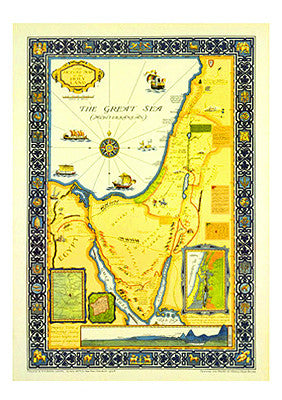
Picture Map of the Holy Land (Harold Brown c.1928) Extra-Large Israel Poster
Item # AAC-AM7021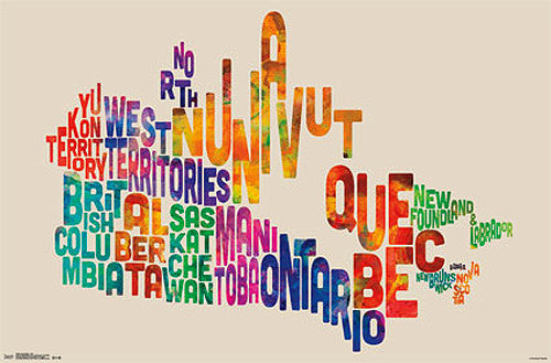
Map of Canada Typography Text Map Wall Poster by Michael Tompsett - Trends International
Item # CN13490-14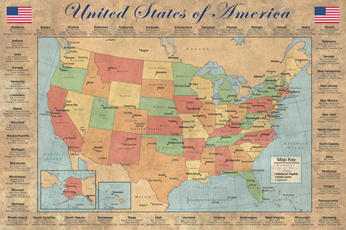
United States of America "States and Capitals" Wall Map Poster - Pyramid America
Item # PP-PAS0353
The Continental Divide Trail National Geographic 18x48 Hiking Wall Map Poster - NG Maps
Item # NG-RE01021202
Map of Europe (50 Nations) 24x36 Wall Poster - Eurographics Inc.
Item # EU2400-5374
Zion National Park National Geographic 24x36 Wall Map Poster - NG Maps
Item # NG-RE01020343
Map of ITALY National Geographic Executive Edition 23x34 Wall Map Poster - NG Maps
Item # NG-RE01020445