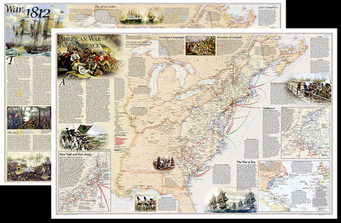
American Revolutionary War/War of 1812 National Geographic 24x36 History Wall Map 2-Sided Poster - NG Maps
Item #: NG-RE01020603
Bring your wall alive with the world's gold standard of wall maps! Take a trip back in time, and re-live the history of America's early history, with this entry from the greatest cartographers on the globe, National Geographic. From the map collection you've seen in classrooms, libraries, offices, coffee shops, and other public places all your life - now own one for yourself!
National Geographic's Battles of the Revolutionary War and War of 1812 map is rich with detail, illustrating significant battle sites and routes.
The front side of the map illustrates the American War for Independence fought from 1775-1783, which spread from New England through the Middle Atlantic and into the South. It delineates the boundaries of the British and Spanish territories and the thirteen American colonies as well as the battle sites, which are categorized based on their impact on the war. British Army and Naval bases and the movements of the British, Americans, French, and Spanish forces are also included on the map. Several inset maps are featured, illustrating the War at Sea, and arrival of British forces in New York Harbor in July 1776, and the Battle at Yorktown in 1781. Other key events, including the Saratoga Campaign and the Invasion of Canada, are featured on the map.
The reverse side of the print map illustrates the War of 1812, which was fought over maritime rights. It delineates the boundaries of the United States, the British territories, and unceded Indian lands, as well as the battle sites, which are categorized based on their impact on the war. British Army and Naval bases and the movements of the British and American forces are also included on the map. Several inset maps are featured, illustrating the Blue Water Naval Engagements and the battles of the Chesapeake, as well as the battles on the Niagra and the Detroit Frontier.
This 24" x 36" edition is the perfect size - not too big, not too small - ideal for any wall of your choosing. Everyone interested in America's dramatic history can use this piece as an accent to home, office, cottage, classroom, library, or other public facility. Make this yours!
Shop for more related posters in these collections:

We Also Recommend

Alex Ovechkin NHL's All-Time Leading Goal Scorer Washington Capitals Commemorative Poster - Costacos 2025
Item # CN26704-25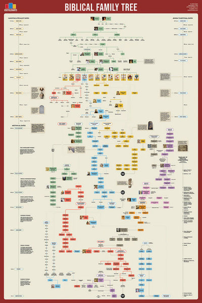
Biblical Family Tree and Historical Timeline Wall Chart Premium Reference Poster - Useful Charts
Item # UC-17
Bijan Robinson "Action" Atlanta Falcons NFL Action Poster - Costacos 2026
Item # CN28297-26
Bijan Robinson "Superstar" Atlanta Falcons NFL Action Poster - Costacos 2024
Item # CN25454-24
Caitlin Clark Indiana Fever 2024 WNBA Rookie of the Year Commemorative Poster - Costacos Sports
Item # CN26065-24
CeeDee Lamb "Trailblazer" Dallas Cowboys NFL Action Poster - Costacos 2024
Item # CN25459-24
Christian McCaffrey "Superstar" San Francisco 49ers NFL Action Wall Poster - Costacos 2024
Item # CN25478-24
Cincinnati Bengals Official NFL Football Team Helmet Logo Neon-Style Poster - Costacos Sports
Item # CN23838-23
Coach John Wooden's "Pyramid of Success" Motivational Inspirational Wall Poster - Classic Edition
Item # JWC-01-CL
Coach John Wooden's "Pyramid of Success" Motivational Inspirational Wall Poster - Executive Edition
Item # JWC-01
COMBO: Lionel Messi Inter Miami CF Official MLS Soccer Action 2-Poster Combo Set
Item # PSAC-129
COMBO: Vegas Golden Knights 2023 Stanley Cup Champions Commemorative 2-Poster Set - Costacos Sports
Item # CN23052-23053
Connor McDavid "Superstar" Edmonton Oilers NHL Hockey Poster - Costacos Sports 2022
Item # CN22885-22
Dak Prescott "Lone Star Great" Dallas Cowboys QB NFL Action Poster - Costacos Sports 2022
Item # CN22714-22
Denver Nuggets 2023 NBA Champions Official Commemorative Poster - Costacos Sports
Item # CN23048-23Detroit Lions Official NFL Football Team Helmet Logo Neon-Style Poster - Costacos Sports
Item # CN23842-23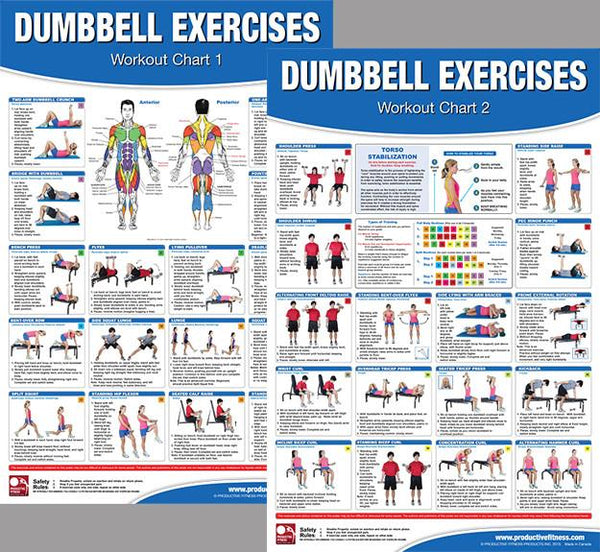
Dumbbell Exercises Workout 2-Poster Professional Wall Chart Combo - Productive Fitness
Item # PFP-DUMBELLS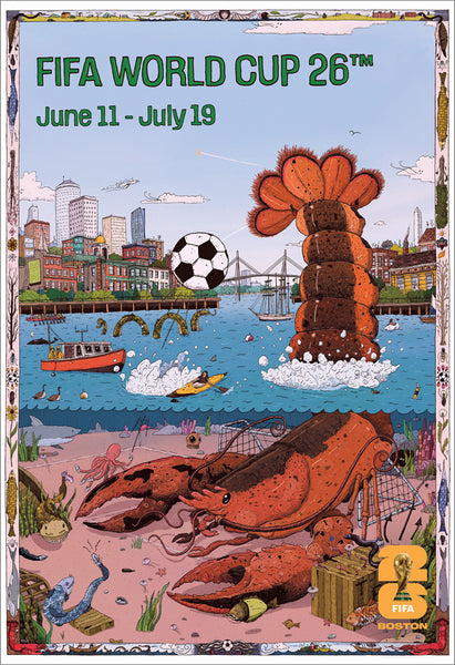
FIFA World Cup 2026 Host City Boston Official 24x36 Event Poster - MPW
Item # MPW-147946
Fitness Gym Motivational "Challenge Your Limits" Inspirational Quotes Wall Poster - Trends Int'l.
Item # CN15817-17
Ford F-150 F-Series Pickup Truck Evolution (26 Models Since 1948) Autophile Poster - Eurographics
Item # EU2400-0950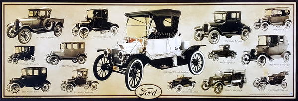
Ford Model T Automobiles (1908-1927) Official Ford Motor Company Commemorative Poster - Aquarius
Item # SB-P2030
Ford Mustang "Evolution" (29 Classic American Muscle Cars) Poster - Eurographics
Item # EU2450-0684Green Bay Packers Official NFL Football Team Helmet Logo Neon-Style Poster - Costacos Sports
Item # CN23843-23
Inter Miami CF 2025 MLS Cup Champions Official Commemorative Poster - Costacos 2025
Item # CN26557-25
Jalen Hurts "Roll Out" Philadelphia Eagles QB NFL Action Wall Poster - Costacos 2023
Item # CN23943-23
Jayden Daniels "Dynamo" Washington Commanders Official NFL Football Wall Poster - Costacos 2024
Item # CN26236-25
Josh Allen "Action" Buffalo Bills QB NFL Action Poster - Costacos 2026
Item # CN28299-26
Josh Allen "Touchdown Roar" Buffalo Bills QB NFL Action NFL Poster - Costacos 2023
Item # CN23937-23
Kansas City Chiefs Super Bowl LVII (2023) CHAMPIONS 6-Player Commemorative Poster - Costacos
Item # CN22969-23
Kansas City Chiefs Super Bowl LVIII (2024) CHAMPIONS 8-Player Commemorative Poster - Costacos
Item # CN23874-24
Kobe Bryant and Shaquille O'Neal "Showtime" Los Angeles Lakers Poster - Starline 1999
Item # S3568
Kylian Mbappé "Superstar" Real Madrid CF Official La Liga Football Action 24x36 Poster - Grupo Erik (Spain)
Item # GE-GPE6028
LeBron James "Legend" Los Angeles Lakers Official NBA Poster - Costacos Sports
Item # CN24074-23
LeBron James "Showtime 6" Los Angeles Lakers Official NBA Poster - Costacos 2022
Item # CN22691-22
Lionel Messi "Dynamo" Inter Miami CF MLS Soccer Action Poster - Costacos 2026
Item # CN27429-26
Lionel Messi "In Action" Inter Miami CF MLS Soccer Poster - Costacos 2025
Item # CN26226-25
Lionel Messi "Passion For The Game" Inter Miami CF MLS Soccer Poster - Costacos 2025
Item # CN26227-25Los Angeles Chargers Official NFL Football Team Helmet Logo Neon-Style Poster - Costacos Sports
Item # CN23849-23
Luka Doncic "Golden Star" Los Angeles Lakers Official NBA Basketball Action Poster - Costacos 2025
Item # CN26475-25
Marilyn Monroe "Pumping Iron" (Hollywood 1952) Poster Print - Image Conscious.
Item # IC-H353
Micah Parsons "Prowler" Dallas Cowboys Linebacker NFL Action Poster - Costacos Sports 2022
Item # CN22653-22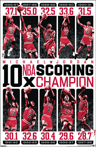
Michael Jordan "10-Time NBA Scoring Champion" Chicago Bulls Commemorative NBA Poster - Costacos Sports 2025
Item # CN27293-25
Michael Jordan "1987 Slam Dunk Classic" Chicago Bulls Commemorative NBA Poster - Costacos Sports 2022
Item # CN21923-22
Michael Jordan "23 Soaring Slam" Chicago Bulls Commemorative NBA Poster - Costacos Sports 2022
Item # CN21928-22
Michael Jordan "Championship History" Chicago Bulls Commemorative NBA Poster - Costacos Sports 2023
Item # CN24362-23
Michael Jordan "Cloudburst" Chicago Bulls Commemorative NBA Basketball Action Poster - Costacos Sports 2023
Item # CN23327-23
Michael Jordan "Fly" Chicago Bulls Slam Dunk Inspirational NBA Poster - Costacos Sports 2022
Item # CN21927-22
Michael Jordan "Pinstripes Slam" Chicago Bulls Commemorative NBA Poster - Costacos Sports
Item # CN21929-22
Michael Jordan "Six-Foot Slam" Chicago Bulls HUGE Door-Sized Poster - Costacos 1997
Item # CN8364-97
Michigan Wolverines 2026 NCAA Basketball Champions Commemorative 24x36 Poster - ProGraphs Inc.
Item # PG-089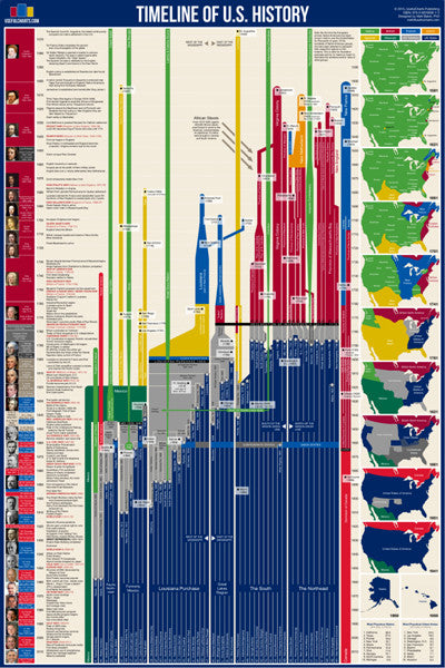
Timeline of U.S. History (American History from 1565 to Present) Premium Wall Chart Poster
Item # UC-03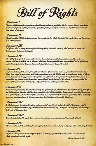
The Bill of Rights (First Ten Amendments to the United States Constitution) Poster - Trends International
Item # CN6908-13
History of World War II Educational Wall Chart Poster - Vanguard Publishing
Item # V005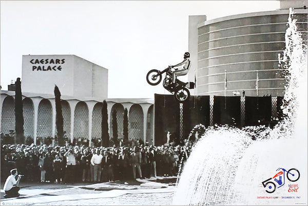
Evel Knievel Caesars Palace Fountain Jump 1967 Historic Daredevil Poster - Posterservice
Item # PS-10960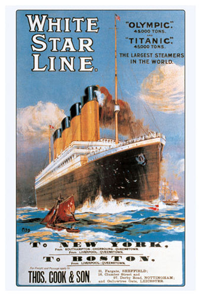
White Star Line The RMS TITANIC 1912 Travel Advertising Poster Reprint - Eurographics Inc.
Item # EU2400-1333
History of the American CIVIL WAR Educational Wall Chart Poster - Vanguard
Item # V006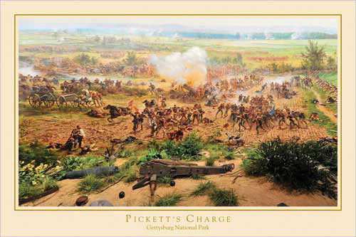
Gettysburg Cyclorama "Pickett's Charge Detail" Civil War Poster - Eurographics Inc.
Item # EU2400-0281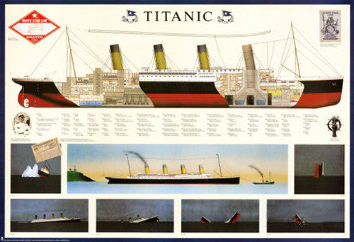
The RMS Titanic Historic Wall Chart 27x39 Poster - Nuova 1995
Item # EU2450-3510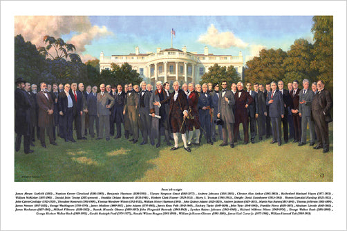
The American Presidents "South Lawn Portrait" (1789-2017) Premium Poster Print - Patriart USA
Item # BT-6667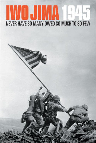
Iwo Jima 1945 "Never Have So Many" US Marines American Military Poster - American Image
Item # AIC-1022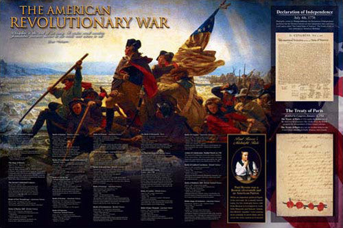
The American Revolutionary War (1775-83) History Educational Wall Chart Poster - Eurographics Inc.
Item # EU2450-4961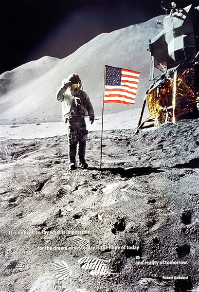
Neil Armstrong Apollo 11 Moon Landing 1969 "Reality of Tomorrow" Poster - ISI
Item # IS-36506
World War I and WWII Vintage American Posters Collage (36 Reproductions) Poster - Eurographics Inc.
Item # EU2400-0937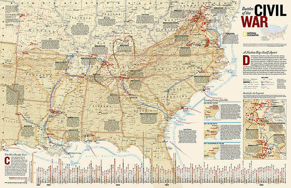
Battles of the American Civil War National Geographic 24x36 Wall Map Poster - NG Maps
Item # NG-RE00620346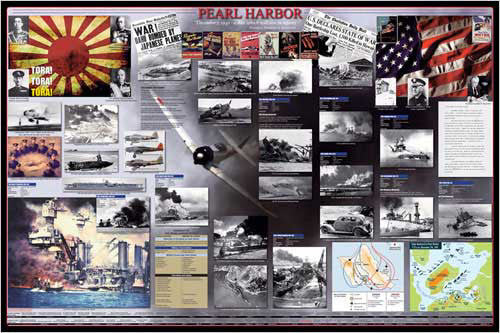
Attack on Pearl Harbor American History Wall Chart Poster - Eurographics Inc.
Item # EU2450-0252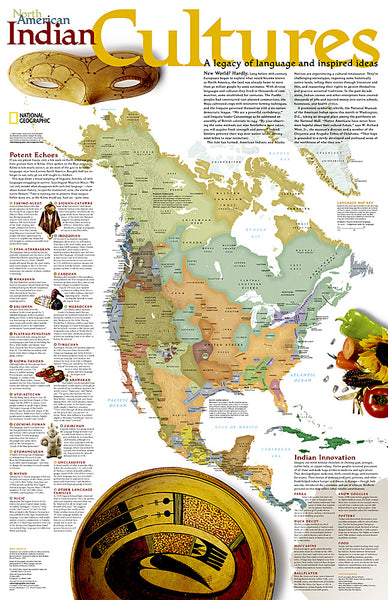
North American Indian Cultures National Geographic 24x36 Wall Map Poster - NG Maps
Item # NG-RE00620319
Rosie the Riveter "We Can Do It!" by J. Howard Miller WWII Vintage Poster Reprint (24"x36")
Item # EU2450-1292
Famous Inventors Historical Educational Wall Chart Poster - Eurographics Inc.
Item # EU2450-1999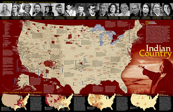
Indian Country Native Cultures of the United States National Geographic 20x31 Wall Map Poster - NG Maps
Item # NG-RE00620315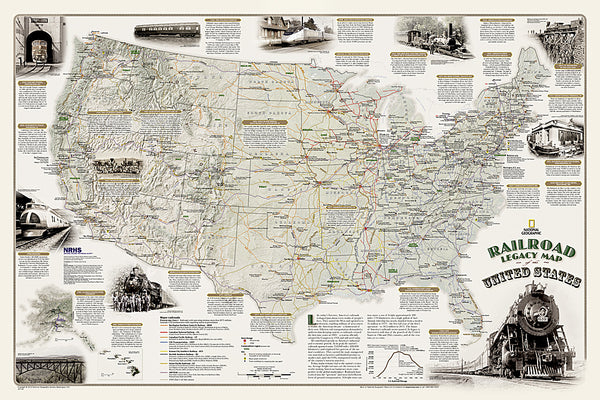
Railroad Legacy of the United States National Geographic 24x36 Wall Map Poster - NG Maps
Item # NG-RE01020718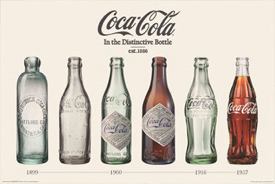
Coca-Cola "Evolution of the Bottle" (1899-1957) Poster - Aquarius Images Inc.
Item # AQ241095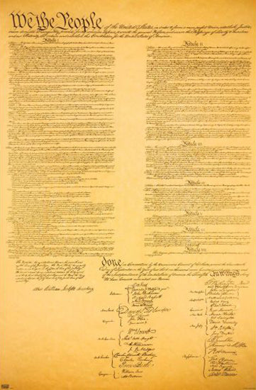
The United States Constitution (1787) Decorative 22x34 Wall Poster - Trends International
Item # CN18963-20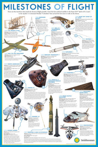
Milestones of Flight Smithsonian Museum Official Educational Reference Poster
Item # SB-N241212
Ronald Reagan Presidential Portrait 20x24 Poster Print - Photofile Inc.
Item # PF-L201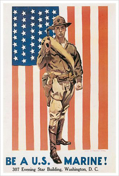
Be a U.S. Marine WWI Recruiting Poster Historic Reprint (James Montgomery Flagg)
Item # EU1700P-61771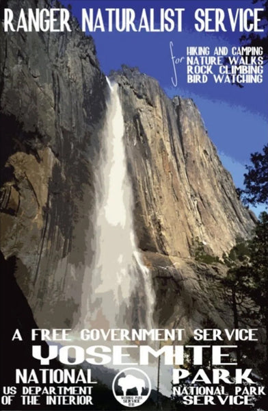
Yosemite National Park Yosemite Falls 1938 US National Park Service Poster Reproduction - Image Source
Item # IS-YOSEMITE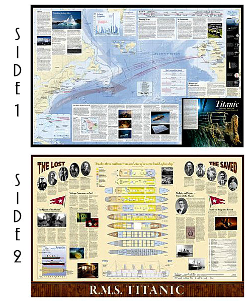
The Titanic National Geographic 26x39 History Wall Map 2-Sided Poster - NG Maps
Item # NG-RE01020684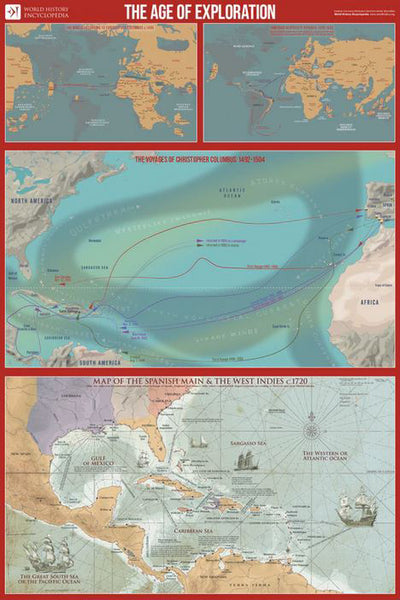
The Age of Exploration Maps Premium 24x36 Reference Poster - Useful Charts/World History Encyclopedia
Item # UC-24
Preamble to The United States of America Constitution "We the People" Poster - Trends International
Item # CN17649-19
Uncle Sam "I Want You for the US Army" WWI Recruiting Poster Reprint (James M. Flagg)
Item # PP-PAS0315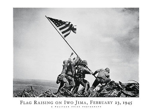
Flag Raising on Iwo Jima (February 23, 1945) Poster Print - NYGS
Item # NY30388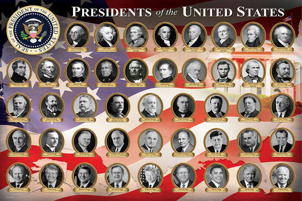
Presidents of the United States Washington-to-BIden Wall Poster - Eurographics Inc.
Item # EU2400-1432
Booker T Washington "American Hero" Historical Poster - Eurographics
Item # EU2450-0094
Rosa Parks "American Hero" Historical Educational Poster - Eurographics Inc.
Item # EU2450-0092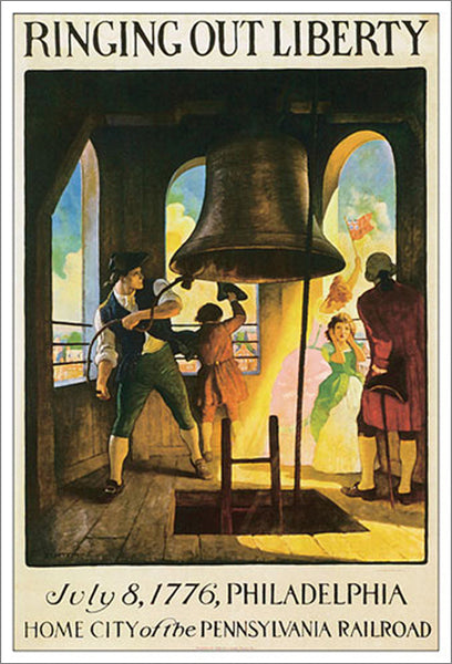
Ringing out Liberty (July 8, 1776, Philadelphia) Historic Poster Reproduction - Eurographics Inc.
Item # EU1700P-62812
Abraham Lincoln The Gettysburg Address Historical Poster Print - Patriart USA Inc.
Item # BT-6552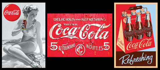
COMBO: Classic Coca-Cola 3-Poster Set - Aquarius Images
Item # AQ-COCATRIO
Grand Canyon National Park 1938 US National Park Service Poster Reproduction - Image Source
Item # IS-GRANDCANYON
Glacier Bay National Park 1938 US National Park Service Poster Reproduction - Image Source
Item # IS-GLACIERBAY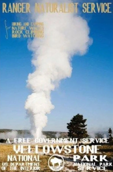
Yellowstone National Park "Old Faithful" 1938 US National Park Service Poster Reproduction - Image Source
Item # IS-YELLOWSTONE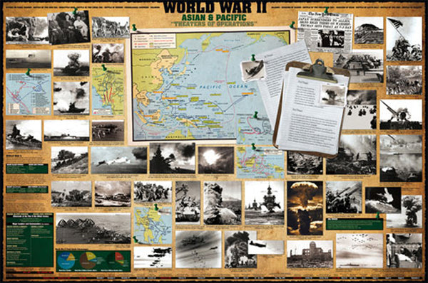
World War II Asian Pacific Theaters American History Wall Chart Poster - Eurographics Inc.
Item # EU2450-0261
Flag Raising at Iwo Jima 1945 "One Nation!" US Marines American Military Poster - Image Source
Item # IS-36507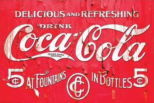
Coca-Cola "Delicious and Refreshing" c.1910-Style Retro Poster - Aquarius Images Inc.
Item # AQ241019
Martin Luther King Jr. "Content of their Character" Poster - Studio B Inc.
Item # SB-PO812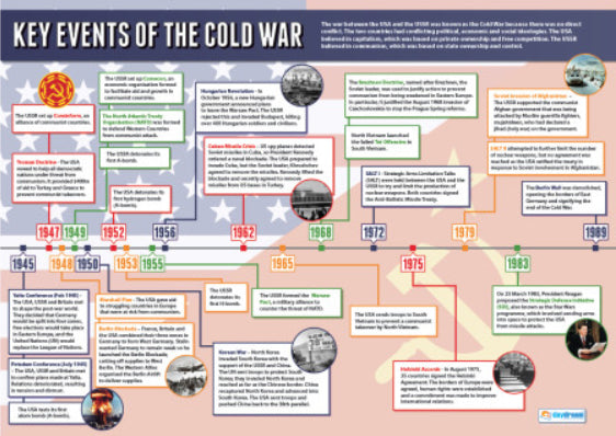
Key Events of the COLD WAR (1945-89) Educational History Wall Chart Poster - Daydream Publishing
Item # GYM-HI041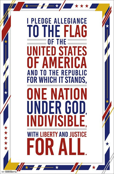
The United States of America Pledge of Allegiance Poster - Trends International
Item # CN17648-19
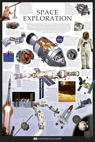
Space Exploration Educational Poster - DK Eyewitness Wallcharts/Pyramid
Item # PP32793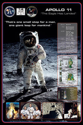
Apollo 11 (First Men on the Moon) Commemorative Poster - Pyramid 2009
Item # PP31897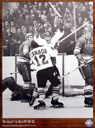
Paul Henderson "The Goal" Team Canada Summit Series 1972 Winning Goal Poster
Item # MH068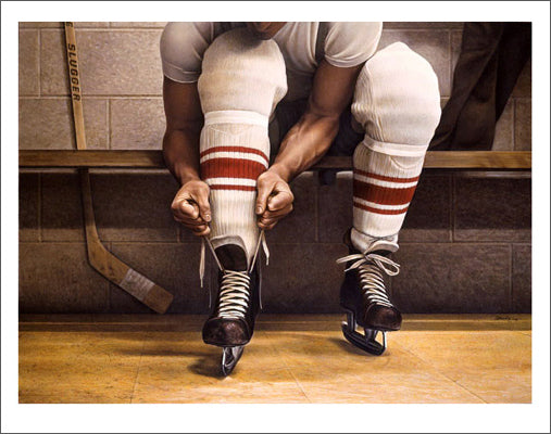
Lacing Up by Ken Danby Hockey Art Poster Print - Danby Studios
Item # KD-02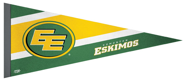
Edmonton Eskimos CFL Football Team Premium Felt Pennant - The Sports Vault Canada
Item # WI-PP-1812-SV
Rush "1978 Live On Stage" Rock Concert Action Music Poster - Aquarius Images
Item # PP-PAS2338
Toronto Raptors "WE THE NORTH" NBA Basketball 3'x5' Team Motto Banner FLAG - The Sports Vault
Item # SV-FLAG-001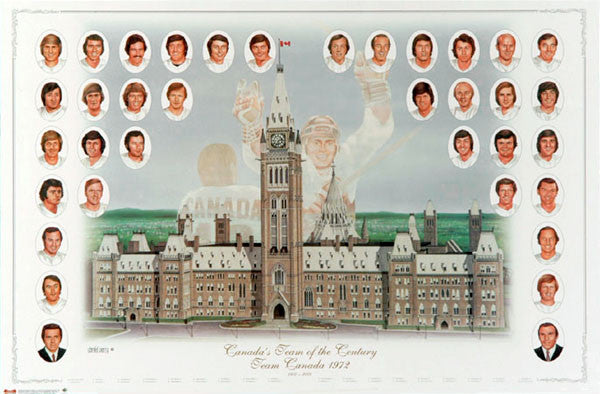
Team Canada 1972 "Canada's Team of the Century" Summit Series Roster Poster - Heritage Hockey
Item # MH070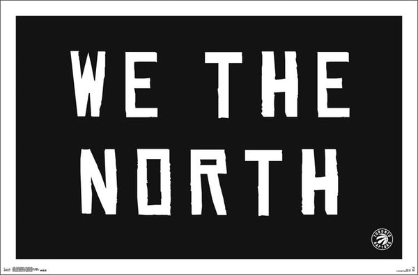
Toronto Raptors "We the North" NBA Basketball Team Theme Poster - Trends International
Item # CN15397-17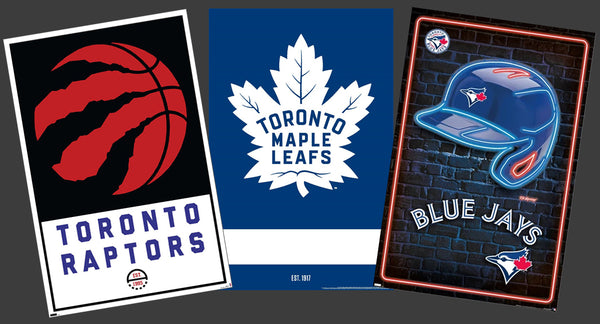
COMBO: Toronto Sports Teams 3-Poster Combo Set (Maple Leafs, Raptors, Blue Jays)
Item # PSAC-086
Team Canada Hockey Official 3'x5' FLAG - The Sports Vault (Canada)
Item # SV-FLAG-002Toronto Raptors Official NBA Basketball Team Logo Poster - Trends International
Item # CN14577-16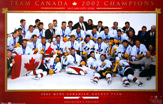
Team Canada 2002 Olympic Hockey Gold Medal Celebration Poster - Costacos Sports
Item # CN3139-02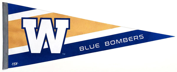
Winnipeg Blue Bombers CFL Football Team Premium Felt Pennant - The Sports Vault Canada
Item # WI-PP-2477-SV
Hamilton Tiger-Cats CFL Football 3'x5' Official Team Banner FLAG - The Sports Vault
Item # SV-FLAG-006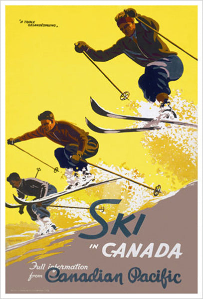
Ski in Canada "Triple Gelandesprung" c.1938 Canadian Pacific Railways Vintage Travel Poster Reprint
Item # EU1700P-65923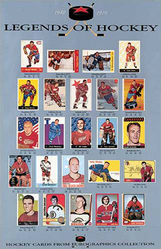
Legends of Hockey 1942-1972 Classic Hockey Cards Gallery Poster - Eurographics Inc.
Item # EU1000-46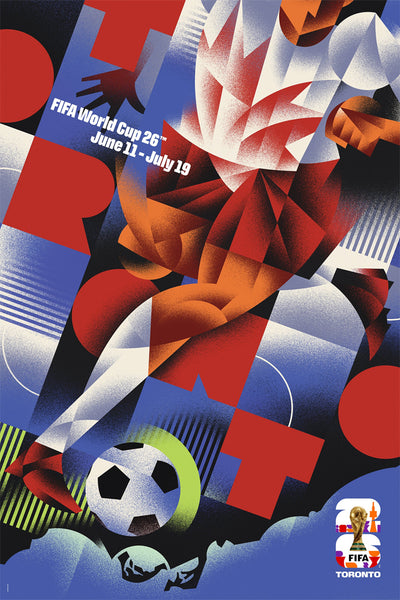
FIFA World Cup 2026 Host City Toronto Official 24x36 Event Poster - MPW (Canada)
Item # MPW-147785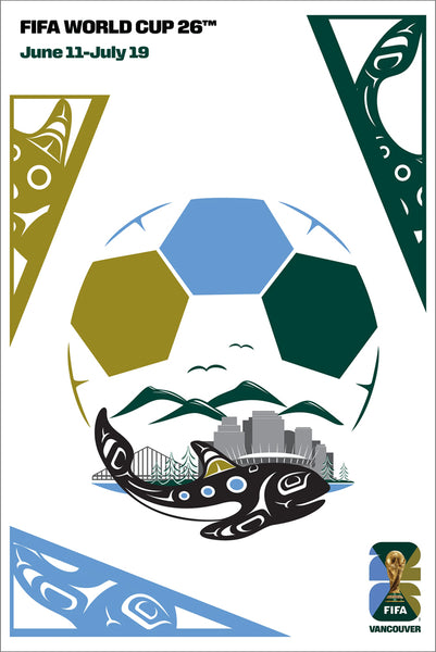
FIFA World Cup 2026 Host City Vancouver Official 24x36 Event Poster - MPW (Canada)
Item # MPW-147788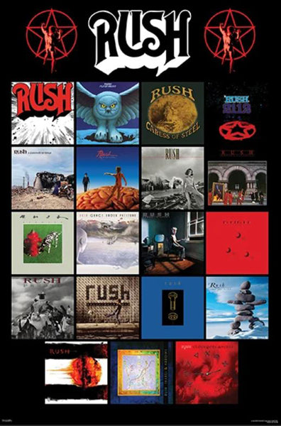
Rush Discography Classic Album Covers Progressive Rock Group Music Poster - Pyramid Posters
Item # PP-PAS1966
Banff-Lake Louise "Ski Racer" c.1953 CP Travel Poster Reprint (24x36 Edition)- Eurographics
Item # EU2400-0326
Quebec Nordiques NHL Hockey Classic 3'x5' Official Team Banner FLAG - InGlasCo
Item # SV-FLAG-008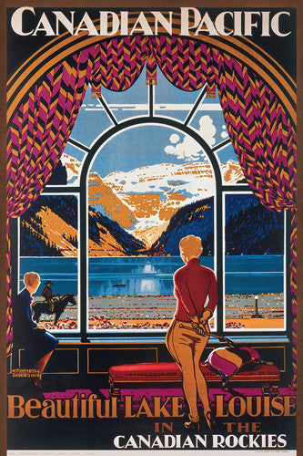
Canadian Pacific Railway "Lake Louise Picture Window" (1930) 24"x36" Poster Reproduction - Eurographics
Item # EU2400-0323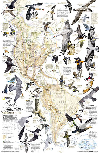
Bird Migration of the Western Hemisphere National Geographic 20x31 Wall Map Poster - NG Maps
Item # NG-RE01020304
Toronto Blue Jays 2025 World Series Game 1 at Rogers Centre Panoramic Poster Print - Everlasting Images (TOR-462)
Item # EI406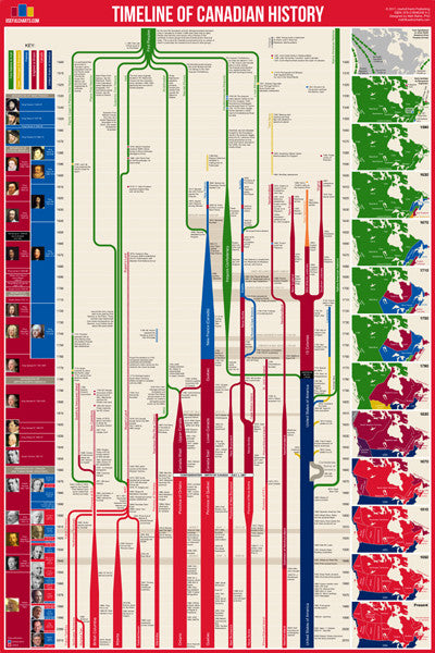
Timeline of Canadian History (Canada History from Contact to Present) Premium Wall Chart Poster
Item # UC-07
Canada Vintage Travel Posters Collage (31 Reproductions) 24x36 Poster - Eurographics Inc.
Item # EU2400-0778
Ski in the Canadian Rockies c.1945 Vintage Canadian Pacific Travel Poster Reprint - Eurographics Inc.
Item # EU1700P-65915Toronto Blue Jays Logo and Wordmark Official MLB Baseball Poster - Costacos Sports
Item # CN22193-22
Edmonton Elks CFL Football Team Premium Felt Pennant - The Sports Vault Canada
Item # WI-PP-2147-SV
Calgary Stampeders CFL Football Team Premium Felt Pennant - The Sports Vault Canada
Item # WI-PP-1809-SV
Winnipeg Blue Bombers CFL Football Official Team Banner 3'x5' FLAG - The Sports Vault
Item # SV-FLAG-015
North American Indian Cultures National Geographic 24x36 Wall Map Poster - NG Maps
Item # NG-RE00620319The Avro Arrow CF-105 Canadian Military Aviation History Poster - Eurographics Inc.
Item # EU2450-5380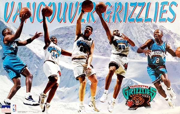
Vancouver Grizzlies "Superstars" NBA Action Poster (Shareef, Lynch, Reeves, G-Money, Blue) - Starline 1996
Item # MBB097
UFC 140 Official MMA Fight Bill Full-Sized 27x39 Poster (Toronto 12/10/2011)
Item # UFC-140-BILL
Joey Votto "Masher" Cincinnati Reds MLB Baseball Action Poster - Trends International
Item # CN13995-15
Saskatchewan Roughriders CFL Football 3'x5' Official Team Banner FLAG - The Sports Vault
Item # SV-FLAG-004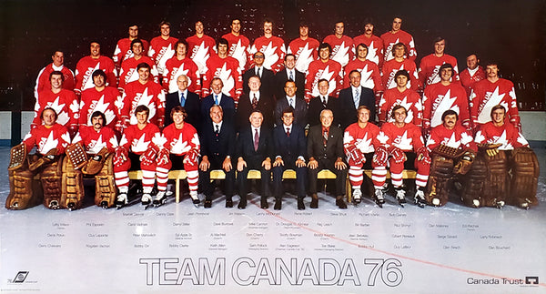
Team Canada Hockey 1976 Official Team Portrait Poster - Worldsport Properties
Item # MH036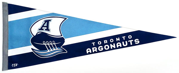
Toronto Argonauts CFL Football Team Premium Felt Pennant - The Sports Vault Canada
Item # WI-PP-2476-SV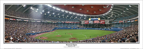
Montreal Expos Olympic Stadium Game Night (1992) Panoramic Poster Print - Everlasting Images
Item # EI380
Canadian Pacific "Banff Girl" (c.1930) Vintage Travel Poster Reprint - Eurographics Inc.
Item # EU1700P-65902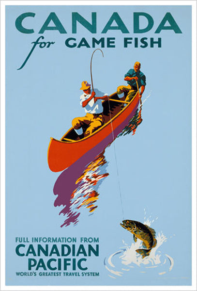
Canada For Game Fish c.1939 Vintage Fishing Canadian Pacific Travel Poster Reproduction - Canadian Pacific
Item # EU1700P-65884
Team Canada Hockey 2026 Olympics Official 3'x5' FLAG - InGlasCo (Canada)
Item # IGC-FLAG-040
Banff-Lake Louise "High Powder" c.1949 CP Travel Poster Reprint - Eurographics
Item # EU1700P-65917
Larry Walker "Slugger" Montreal Expos MLB Baseball Action Poster - Starline Inc. 1993
Item # MB052Montreal Expos est. 1969 Official MLB Baseball Classic Team Logo Poster - Trends International
Item # CN18169-20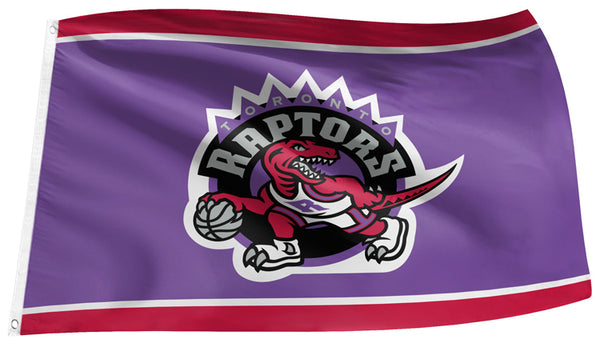
Toronto Raptors Hardwood Classic 1990s Purple-Dinosaur-Style NBA Basketball 3'x5' Banner FLAG - The Sports Vault
Item # SV-FLAG-010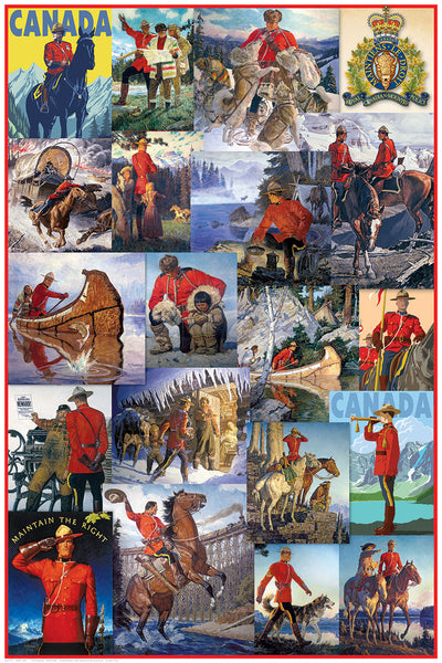
Royal Canadian Mounted Police "The Mounties" Classic Art Collage 24x36 Poster - Eurographics Inc.
Item # EU2400-0777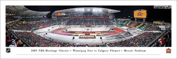
Winnipeg Jets vs. Calgary Flames at Mosaic Stadium 2019 Heritage Classic Panoramic Poster Print - Blakeway
Item # BL-545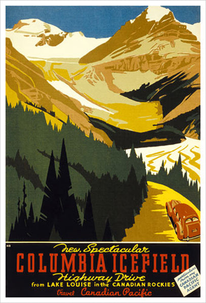
Lake Louise, Alberta Columbia Icefield Drive Vintage Travel Poster Reprint (c.1933) - Eurographics Inc.
Item # EU1700P-65897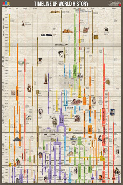
Timeline of World History (Human Civilization from 3,000 BCE to Present) Premium Wall Chart Poster
Item # UC-01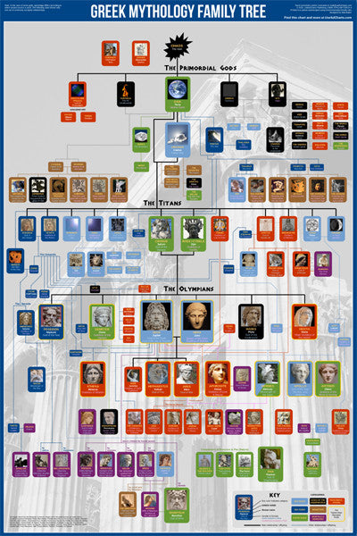
Greek Mythology Family Tree Wall Chart Premium Reference Poster - Useful Charts
Item # UC-04
Biblical Family Tree and Historical Timeline Wall Chart Premium Reference Poster - Useful Charts
Item # UC-17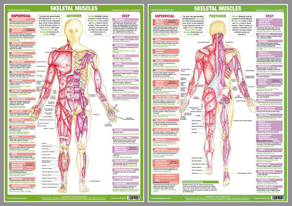
Major Skeletal Muscles Anatomy Wall Chart Poster Set (2 Posters) - Chartex Ltd.
Item # CX-MAJORMUSC-2
Anatomy of The Human Heart Wall Chart Poster - Eurographics
Item # EU2450-0257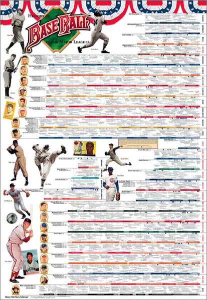
History of Major League Baseball Wall Chart Poster (to 2016) - Vanguard Sports Publishing
Item # V002
Islamic Prophets Family Tree Wall Chart Premium Reference Poster - Useful Charts
Item # UC-18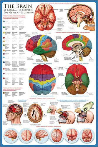
Anatomy of The Human Brain Wall Chart Poster - Eurographics
Item # EU2450-0256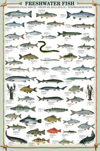
Freshwater Fish (53 Species) Wall Chart Poster - Eurographics
Item # EU2450-0312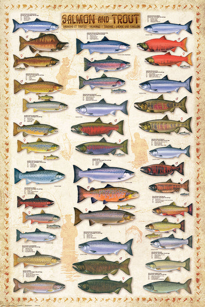
Salmon and Trout Fishing Wall Chart (17 Species) Poster - Eurographics
Item # EU2450-0311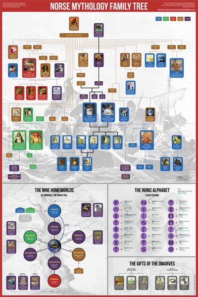
Norse Mythology Family Tree Wall Chart Premium Reference Poster - Useful Charts
Item # UC-05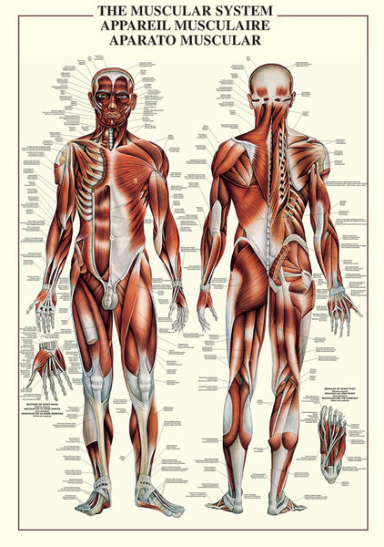
The Muscular System Human Anatomy Wall Chart Reference Poster - Ricordi Arte/Eurographics
Item # EU2450-4460
Evolutionary Tree of Life Wall Chart Premium 24x36 Reference Poster - Useful Charts
Item # UC-12
The Great Composers of History Classical Music Wall Chart Poster - Eurographics Inc.
Item # EU2450-2007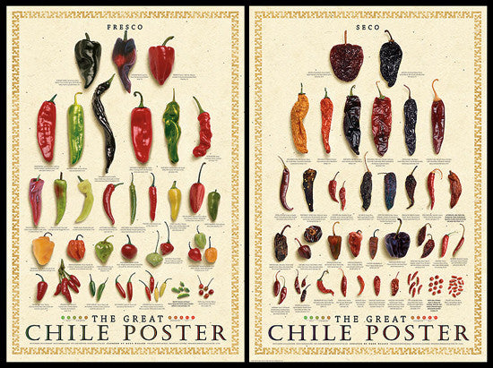
The Great Chile Poster 2-Poster Combo (Fresco & Seco) - American Image
Item # IC-CHILEPOSTERS
Timeline of U.S. History (American History from 1565 to Present) Premium Wall Chart Poster
Item # UC-03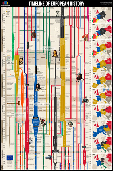
Timeline of European History (History from 14th Century CE to Present) Premium Wall Chart Poster
Item # UC-02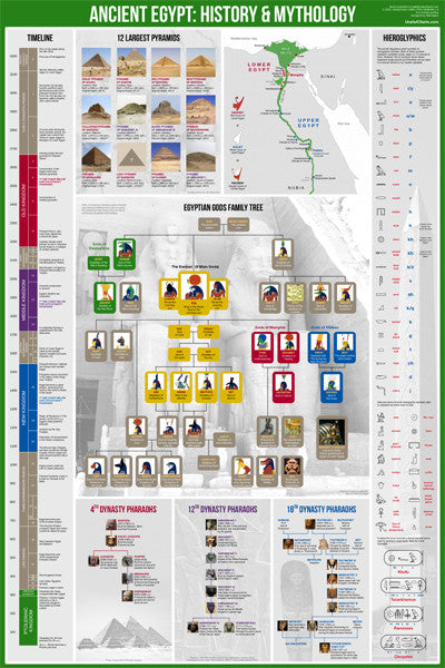
Ancient Egypt History and Mythology Premium Timeline Educational Wall Chart Poster
Item # UC-06
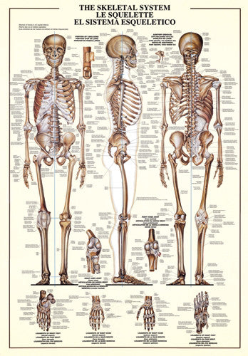
The Skeletal System Human Anatomy Large 27x39 Wall Chart Poster - Nuova
Item # EU2450-3970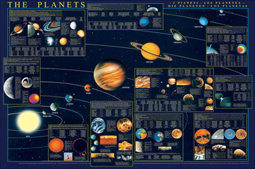
The Planets of the Solar System Science Educational 27x39 Poster - Eurographics Inc.
Item # EU2450-4790
The Bill of Rights (First Ten Amendments to the United States Constitution) Poster - Trends International
Item # CN6908-13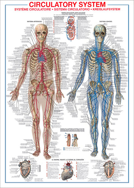
The Circulatory System Human Anatomy Wall Chart 27x39 Reference Poster - Ricordi Arte/Eurographics
Item # EU2450-4940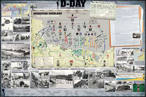
D-Day WWII Normandy Invasion Military History Wall Chart Poster - Eurographics Inc.
Item # EU2450-0295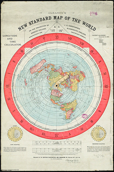
Gleason's New Standard MAP OF THE WORLD (1892) 24x36 Wall POSTER Reproduction - Posterservice Inc. 2020
Item # PS-11565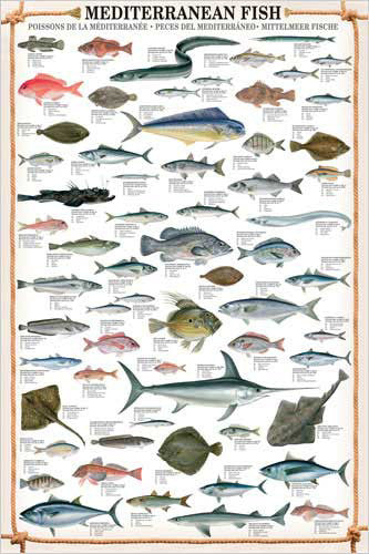
Mediterranean Fish Wall Chart Poster (61 Saltwater Species) Poster - Eurographics
Item # EU2450-0315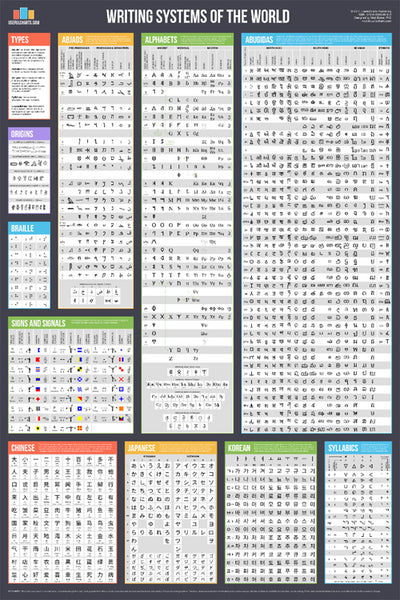
Writing Systems of the World Educational Reference Wall Chart Poster - Useful Charts
Item # UC-08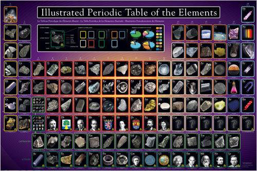
Illustrated Periodic Table of the Elements Poster - Eurographics Inc.
Item # EU2450-0258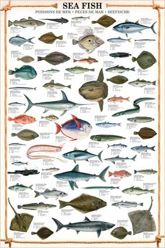
Sea Fish Wall Chart (59 Saltwater Species) Poster - Eurographics
Item # EU2450-0313
The Wisdom of Albert Einstein Poster (22 Quotations) - Eurographics Inc.
Item # EU2400-0287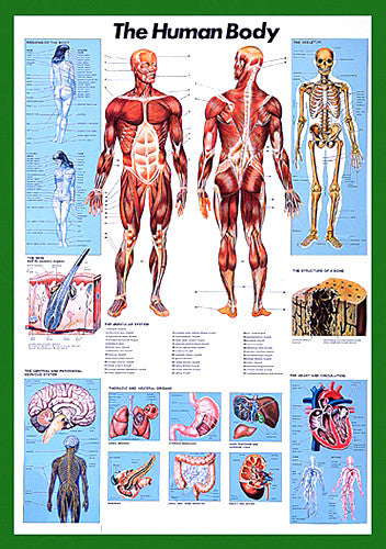
The Human Body Anatomy Large 27x39 Wall Chart Poster - Nuova Arti Grafiche
Item # EU2450-1570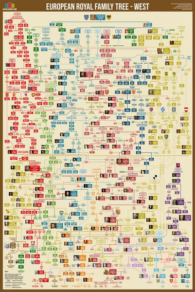
Western European Royal Family Tree Wall Chart Premium Reference Poster - Useful Charts
Item # UC-15
Roman Emperors Family Tree Wall Chart Premium Reference Poster - Useful Charts
Item # UC-09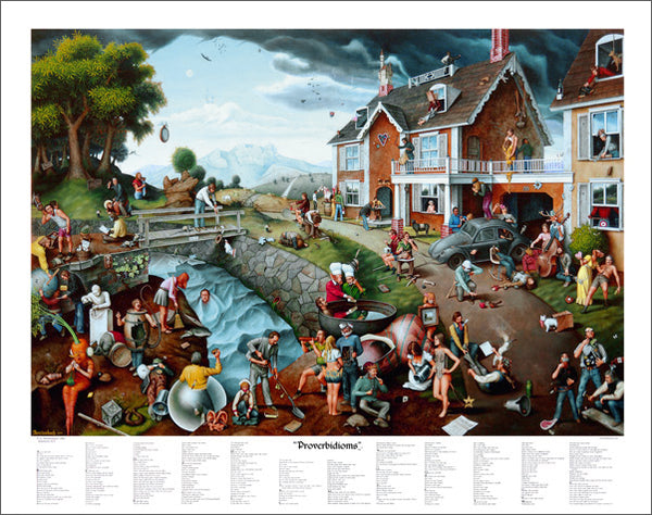
Proverbidioms by T.E. Breitenbach Official 22x28 Poster Print
Item # BREIT-01
History of World War II Educational Wall Chart Poster - Vanguard Publishing
Item # V005
Chakras of the Human Body Yoga Wall Chart - Ricordi Arte 2005
Item # EU2450-4960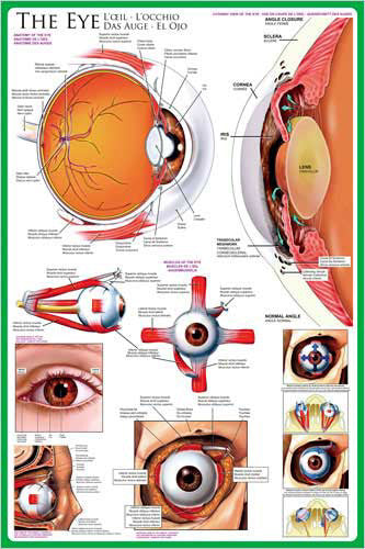
Anatomy of The Human Eye Wall Chart Poster - Eurographics Inc.
Item # EU2450-0260
Top 10 Legendary Black Sports Figures Historical Wall Chart Poster - African-American Athletes
Item # EU2450-0003
Child Choking First Aid Wall Chart Poster (AHA/ARC Guidelines)- Fitnus Corp.
Item # FI-FA05
History of the American CIVIL WAR Educational Wall Chart Poster - Vanguard
Item # V006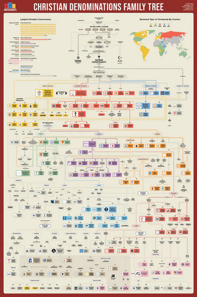
Christian Denominations Family Tree and Historical Timeline Wall Chart Premium Reference Poster - Useful Charts
Item # UC-27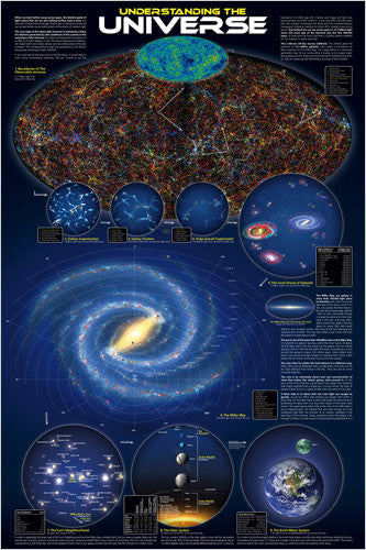
Understanding the Universe Educational Wall Chart Poster - Eurographics Inc.
Item # EU2450-0279
Vitamins Food Nutritional Wall Chart Poster - Eurographics
Item # EU2450-1016
Child CPR First Aid Wall Chart Poster (2017 AHA Guidelines) - Fitnus Corp.
Item # FI-FA02A
Gettysburg Cyclorama "Pickett's Charge Detail" Civil War Poster - Eurographics Inc.
Item # EU2400-0281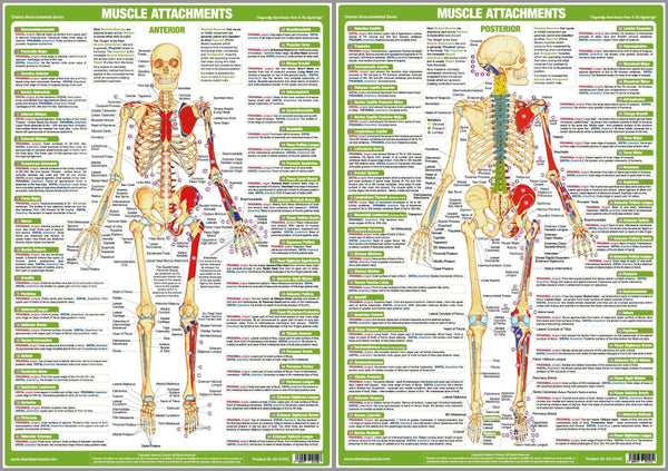
Major Muscle Attachments Human Physical Anatomy 2-Poster Combo Set - Chartex Ltd
Item # CX-MUSCATT-2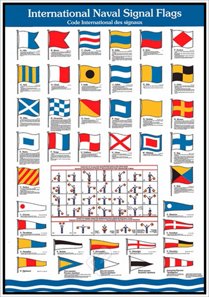
International Naval Signal Flags for Yachting and Sailing Wall Chart Poster - Eurographics Inc.
Item # EU2450-2740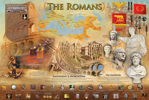
The Romans Classical Civilization Roman Empire Educational Historical Poster - Eurographics Inc.
Item # EU2450-0584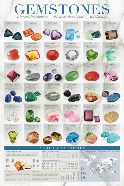
Gemstones (Geology Minerals for Jewelry) Wall Chart Poster - Eurographics Inc.
Item # EU2450-0582
Asian Royal Family Trees (China, Japan, Korea, Mongols) Wall Chart Premium Reference Poster - Useful Charts
Item # UC-10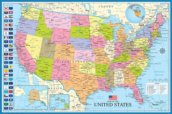
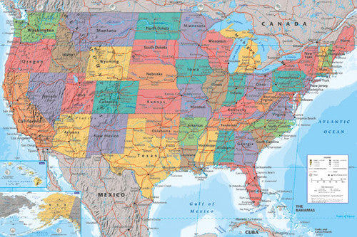
Map of The United States of America USA 24x36 Wall Poster - Eurographics Inc.
Item # EU2400-0788
Bird Migration of the Western Hemisphere National Geographic 20x31 Wall Map Poster - NG Maps
Item # NG-RE01020304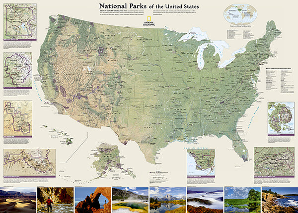
National Parks of the United States National Geographic 30x42 Wall Map Poster - NG Maps
Item # NG-RE01020599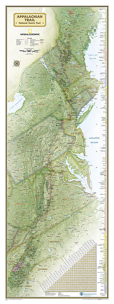
The Appalachian Trail National Geographic 18x48 Hiking Wall Map Poster - NG Maps
Item # NG-RE01020715
Battles of the American Civil War National Geographic 24x36 Wall Map Poster - NG Maps
Item # NG-RE00620346
North American Indian Cultures National Geographic 24x36 Wall Map Poster - NG Maps
Item # NG-RE00620319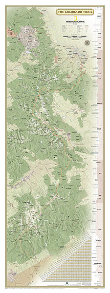
The Colorado Trail National Geographic 18x48 Hiking Wall Map Poster - NG Maps
Item # NG-RE01021199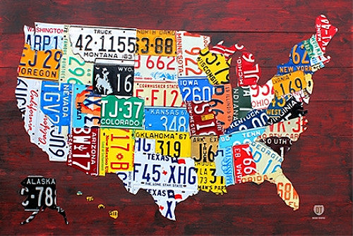
License Plates Map of the United States of America Poster - PosterService Inc.
Item # PS-10205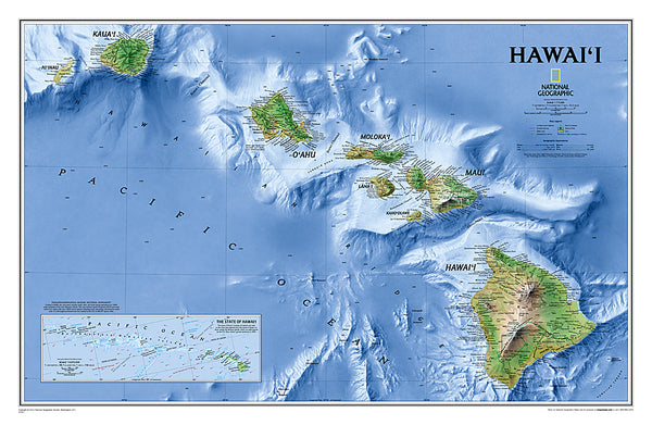
Map of Hawaii National Geographic Classic Edition 22x35 Wall Map Poster - NG Maps
Item # NG-RE00602061
Indian Country Native Cultures of the United States National Geographic 20x31 Wall Map Poster - NG Maps
Item # NG-RE00620315
Railroad Legacy of the United States National Geographic 24x36 Wall Map Poster - NG Maps
Item # NG-RE01020718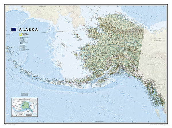
Map of Alaska National Geographic Classic Edition 30x40 Wall Map Poster - NG Maps
Item # NG-RE01020587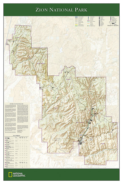
Zion National Park National Geographic 24x36 Wall Map Poster - NG Maps
Item # NG-RE01020343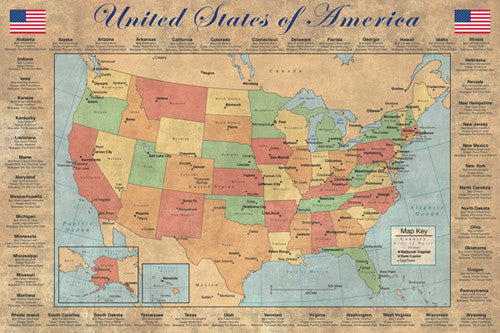
United States of America "States and Capitals" Wall Map Poster - Pyramid America
Item # PP-PAS0353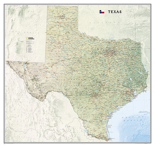
Map of TEXAS National Geographic Classic Edition 38x40 Wall Map Poster - NG Maps
Item # NG-RE01020408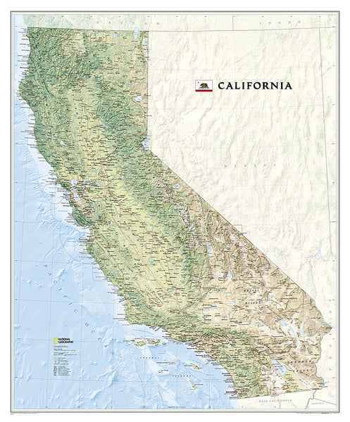
Map of California National Geographic Classic Edition 33x40 Wall Map Poster - NG Maps
Item # NG-RE01020371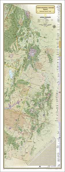
The Continental Divide Trail National Geographic 18x48 Hiking Wall Map Poster - NG Maps
Item # NG-RE01021202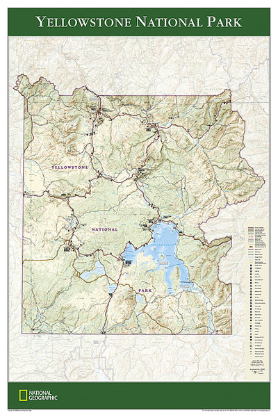
Yellowstone National Park National Geographic 24x36 Wall Map Poster - NG Maps
Item # NG-RE01020307
Map of the United States of America National Geographic Decorator-Edition 30x43 Wall Map Poster - NG Maps
Item # NG-RE00622081
Map of the United States of America National Geographic Classic Edition 30x43 Wall Map Poster - NG Maps
Item # NG-RE00602003
United States of America Typography Text Map Poster by Michael Tompsett - Trends
Item # CN13479-14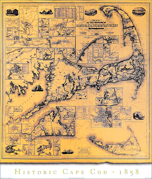
Historic Cape Cod Wall Map (1858) Poster Reproduction - Image Source International
Item # IS-AMC001
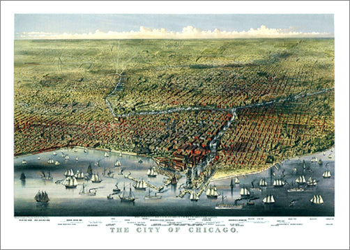
Chicago, Illinois 1874 Classic Aerial Panorama Premium Poster Reproduction (Parsons and Atwater)
Item # BM-P4159-5P
Battles of the American Civil War National Geographic 24x36 Wall Map Poster - NG Maps
Item # NG-RE00620346
Bird Migration of the Western Hemisphere National Geographic 20x31 Wall Map Poster - NG Maps
Item # NG-RE01020304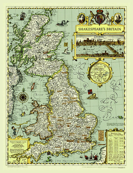
Illustrated Map of Shakespeare's Britain National Geographic 21x27 Wall Map Poster - NG Maps
Item # NG-RE00620097
Indian Country Native Cultures of the United States National Geographic 20x31 Wall Map Poster - NG Maps
Item # NG-RE00620315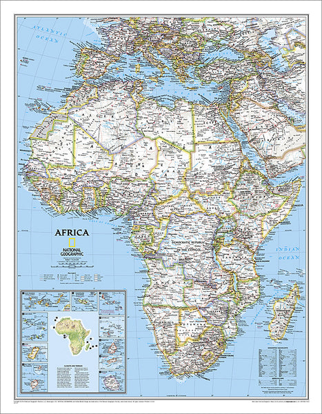
Map of Africa National Geographic Classic Edition 24x31 Wall Map Poster - NG Maps
Item # NG-RE00622110
Map of Alaska National Geographic Classic Edition 30x40 Wall Map Poster - NG Maps
Item # NG-RE01020587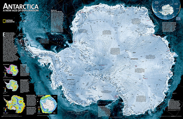
Map of ANTARCTICA National Geographic Classic Edition 20x30 Wall Map Poster - NG Maps
Item # NG-RE00620091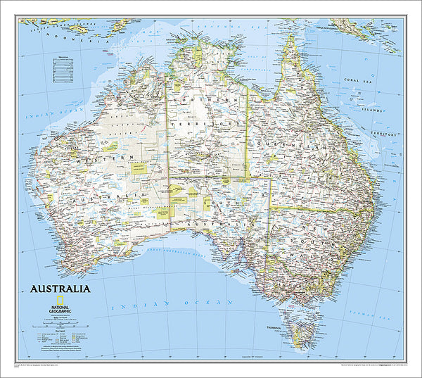
Map of AUSTRALIA National Geographic Classic Edition 27x30 Wall Map Poster - NG Maps
Item # NG-RE00620002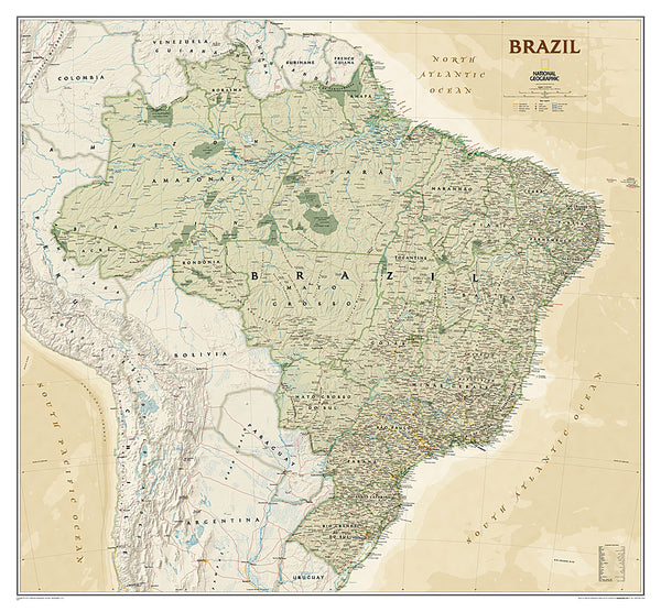
Map of BRAZIL National Geographic Executive Edition 38x41 Brasil Wall Map Poster - NG Maps
Item # NG-RE01020611
Map of California National Geographic Classic Edition 33x40 Wall Map Poster - NG Maps
Item # NG-RE01020371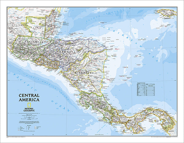
Map of CENTRAL AMERICA National Geographic Classic Edition 22x29 Wall Map Poster - NG Maps
Item # NG-RE00620011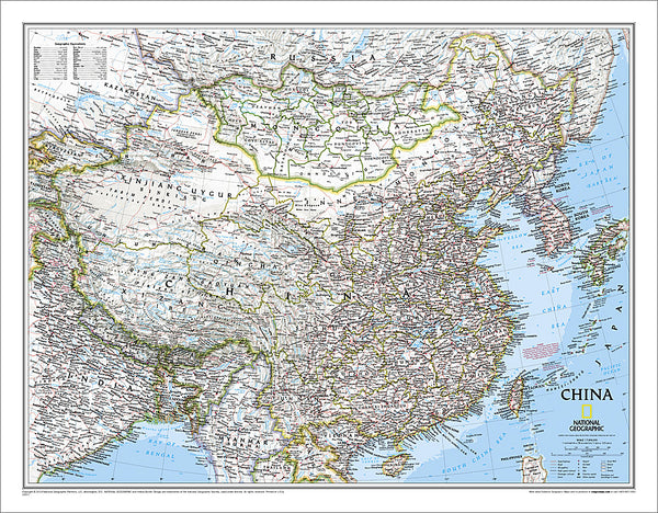
Map of CHINA National Geographic Classic Edition 24x30 Wall Map Poster - NG Maps
Item # NG-RE00620057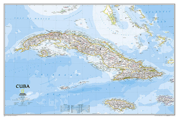
Map of CUBA National Geographic Classic Edition 24x36 Wall Map Poster - NG Maps
Item # NG-RE01020614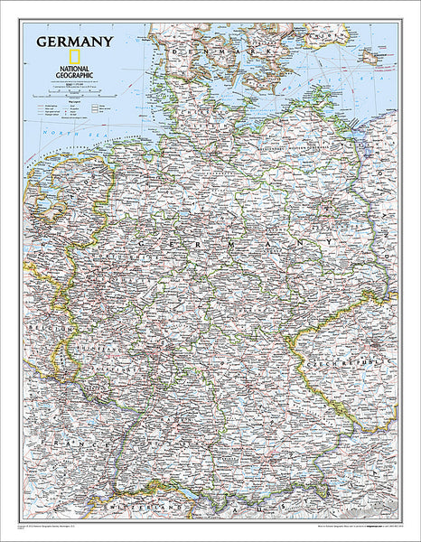
Map of Germany National Geographic Classic Edition 23x30 Wall Map Poster - NG Maps
Item # NG-RE00602814
Map of GREECE AND THE AEGEAN National Geographic Classic Edition 23x30 Wall Map Poster - NG Maps
Item # NG-RE00622111
Map of Hawaii National Geographic Classic Edition 22x35 Wall Map Poster - NG Maps
Item # NG-RE00602061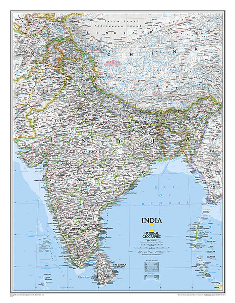
Map of INDIA National Geographic Classic Edition 23x30 Wall Map Poster - NG Maps
Item # NG-RE00620546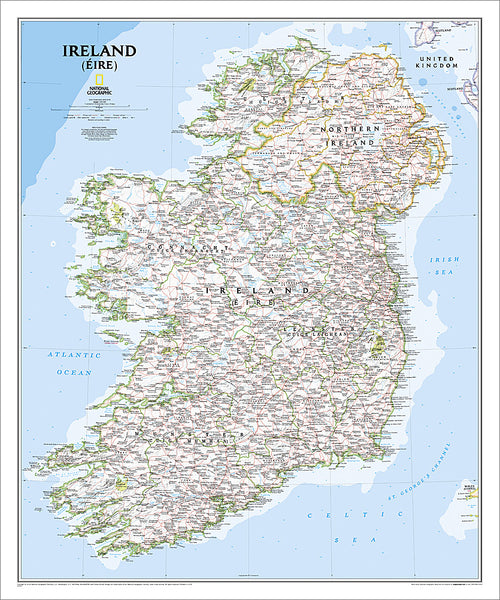
Map of IRELAND National Geographic Classic Edition 30x36 Wall Map Poster - NG Maps
Item # NG-RE01020427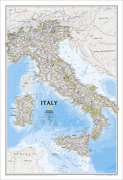
Map of ITALY National Geographic Classic Edition 23x34 Wall Map Poster - NG Maps
Item # NG-RE00602297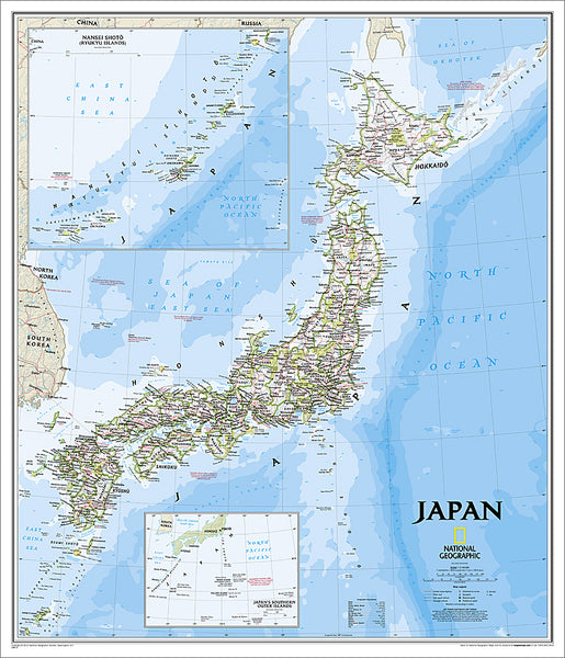
Map of JAPAN National Geographic Classic Edition 25x29 Wall Map Poster - NG Maps
Item # NG-RE01020670
Map of Korea THE KOREAN PENINSULA National Geographic Classic Edition 23x35 Wall Map Poster - NG Maps
Item # NG-RE01020740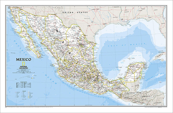
Map of MEXICO National Geographic Classic Edition 23x35 Wall Map Poster - NG Maps
Item # NG-RE00602295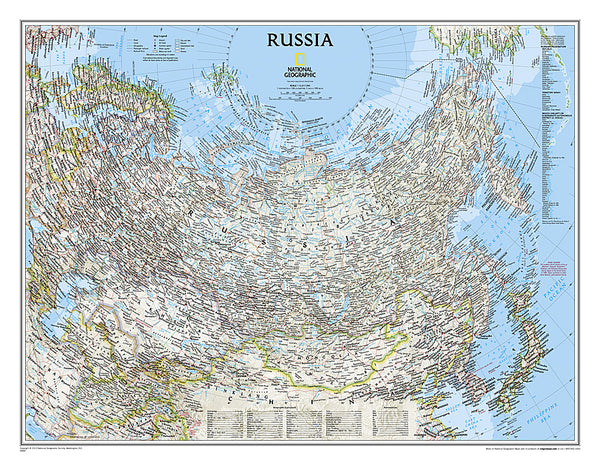
Map of RUSSIA National Geographic Classic Edition 23x30 Wall Map Poster - NG Maps
Item # NG-RE00622091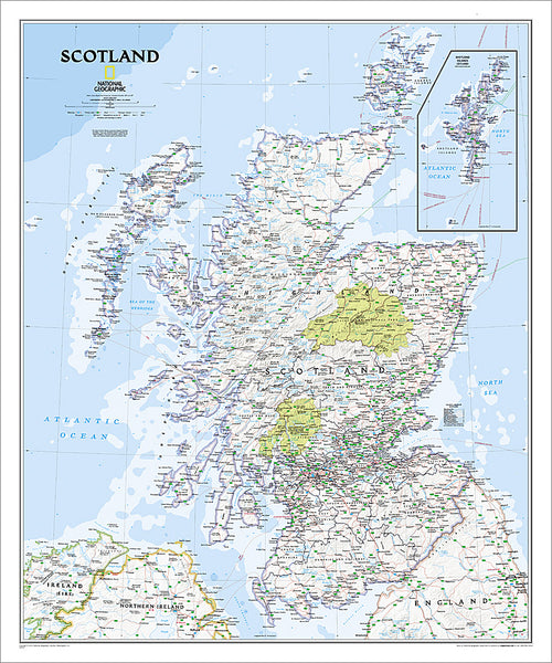
Map of SCOTLAND National Geographic Classic Edition 30x36 Wall Map Poster - NG Maps
Item # NG-RE01020533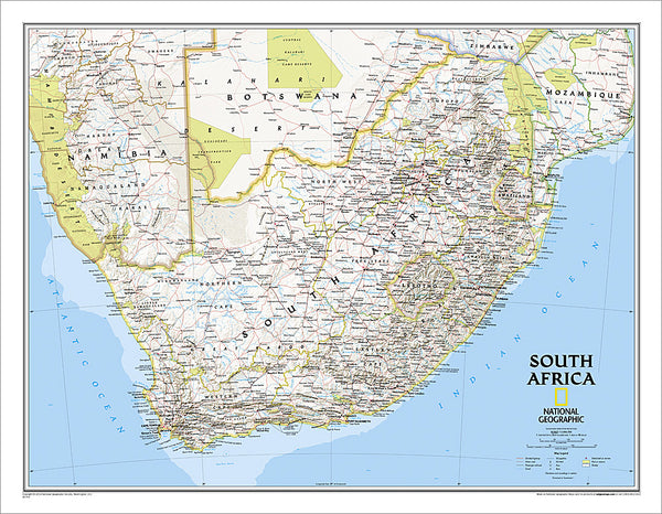
Map of SOUTH AFRICA National Geographic Classic Edition 23x30 Wall Map Poster - NG Maps
Item # NG-RE01020763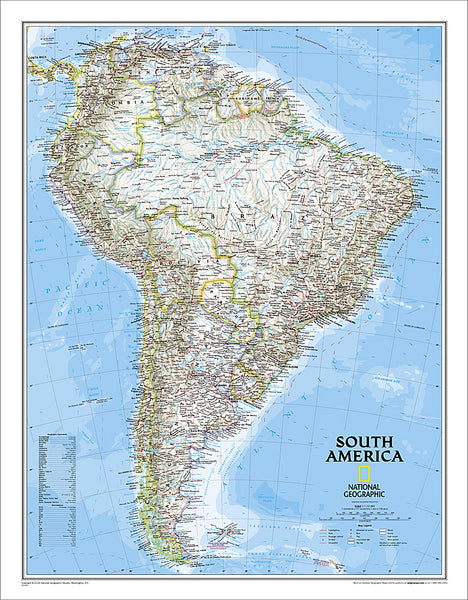
Map of SOUTH AMERICA National Geographic Classic Edition 23x30 Wall Map Poster - NG Maps
Item # NG-RE00622110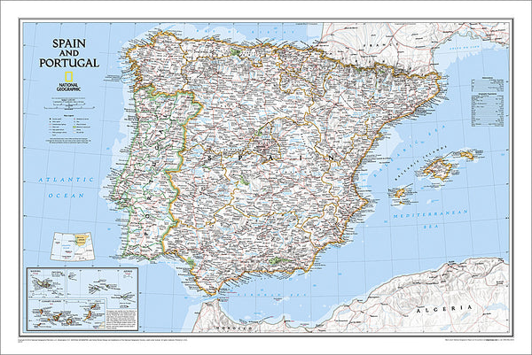
Map of Spain and Portugal National Geographic Classic Edition 22x33 Wall Map Poster - NG Maps
Item # NG-RE00622070
Map of TEXAS National Geographic Classic Edition 38x40 Wall Map Poster - NG Maps
Item # NG-RE01020408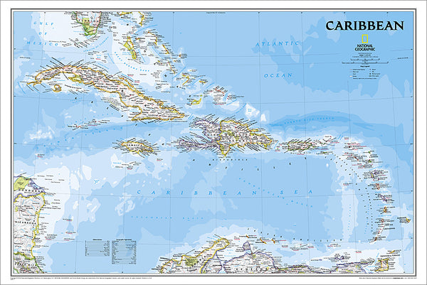
Map of THE CARIBBEAN National Geographic Classic Edition 24x36 Wall Map Poster - NG Maps
Item # NG-RE01020617
Map of the United States of America National Geographic Classic Edition 30x43 Wall Map Poster - NG Maps
Item # NG-RE00602003
Map of the United States of America National Geographic Decorator-Edition 30x43 Wall Map Poster - NG Maps
Item # NG-RE00622081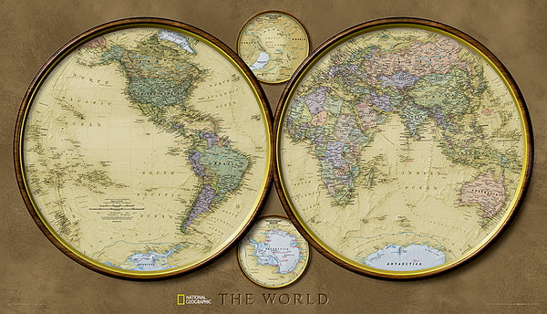
Map of the World "Hemispheres" Retro 1940s Style National Geographic 25x43 Wall Map Poster - NG Maps 2010
Item # NG-RE00620547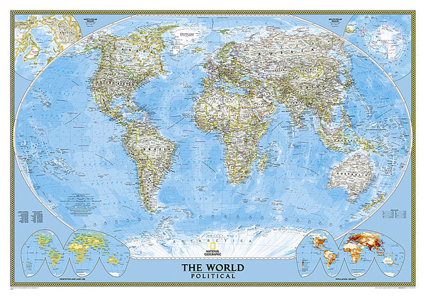
Map of the World National Geographic Classic Edition 30x43 Wall Map Poster - NG Maps
Item # NG-RE00622005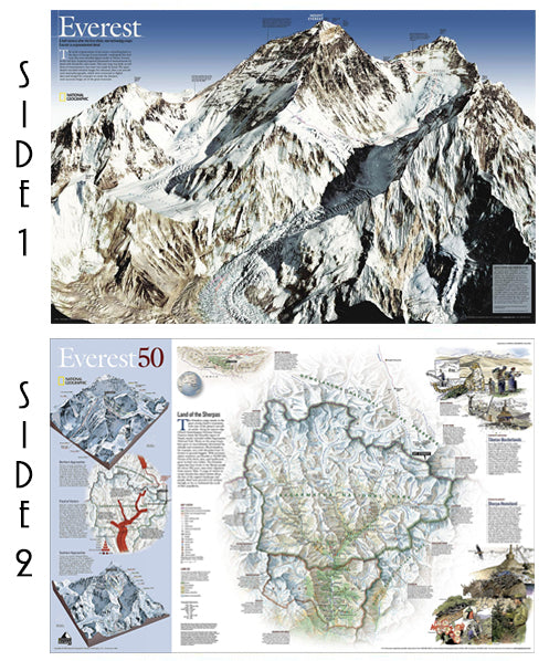
Mount Everest National Geographic 30x47 Wall Map 2-Sided Poster - NG Maps
Item # NG-RE00620098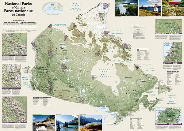
National Parks of the Canada National Geographic 30x42 Wall Map Poster - NG Maps
Item # NG-RE01020680
National Parks of the United States National Geographic 30x42 Wall Map Poster - NG Maps
Item # NG-RE01020599
North American Indian Cultures National Geographic 24x36 Wall Map Poster - NG Maps
Item # NG-RE00620319
Railroad Legacy of the United States National Geographic 24x36 Wall Map Poster - NG Maps
Item # NG-RE01020718
The Appalachian Trail National Geographic 18x48 Hiking Wall Map Poster - NG Maps
Item # NG-RE01020715
The Colorado Trail National Geographic 18x48 Hiking Wall Map Poster - NG Maps
Item # NG-RE01021199
The Continental Divide Trail National Geographic 18x48 Hiking Wall Map Poster - NG Maps
Item # NG-RE01021202
The Titanic National Geographic 26x39 History Wall Map 2-Sided Poster - NG Maps
Item # NG-RE01020684
Yellowstone National Park National Geographic 24x36 Wall Map Poster - NG Maps
Item # NG-RE01020307
Zion National Park National Geographic 24x36 Wall Map Poster - NG Maps
Item # NG-RE01020343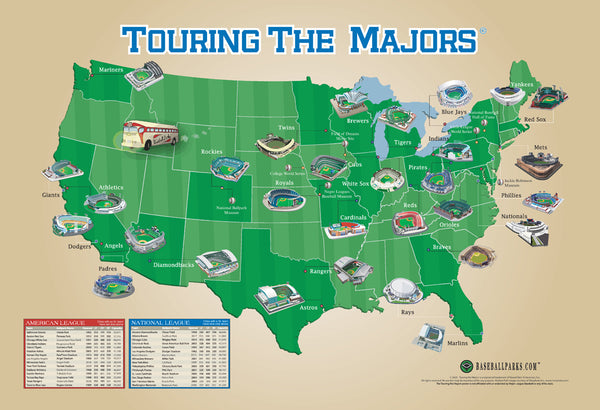
Touring the Majors MLB Ballparks Map of America Poster - Grand Slam Enterprises
Item # GSM-01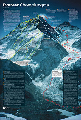
Mount Everest Revealed Mountain Climbing Wall Chart Poster - Yumz
Item # YU-01
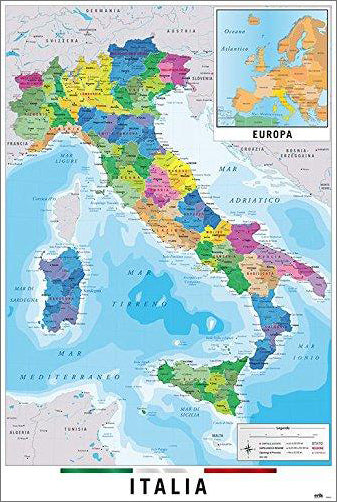
Map of Italy Italia Wall Chart Poster (Regions, Capitals, Cities, Roads, Rivers, etc.) - Grupo Erik
Item # GE-GPE5125
Gleason's New Standard MAP OF THE WORLD (1892) 24x36 Wall POSTER Reproduction - Posterservice Inc. 2020
Item # PS-11565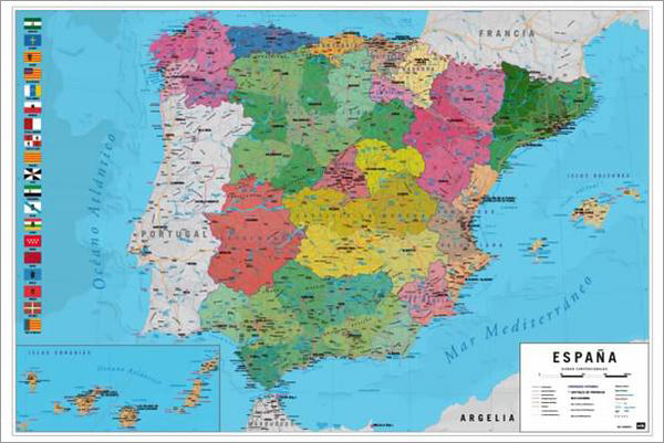
Map of Spain Wall Chart Poster (Regions, Capitals, Cities, Roads, Rivers, etc.) - Grupo Erik
Item # GE-GPE5030
Map of The United States of America USA 24x36 Wall Poster - Eurographics Inc.
Item # EU2400-0788
Bird Migration of the Western Hemisphere National Geographic 20x31 Wall Map Poster - NG Maps
Item # NG-RE01020304
National Parks of the United States National Geographic 30x42 Wall Map Poster - NG Maps
Item # NG-RE01020599
Map of JAPAN National Geographic Classic Edition 25x29 Wall Map Poster - NG Maps
Item # NG-RE01020670
The Appalachian Trail National Geographic 18x48 Hiking Wall Map Poster - NG Maps
Item # NG-RE01020715
Battles of the American Civil War National Geographic 24x36 Wall Map Poster - NG Maps
Item # NG-RE00620346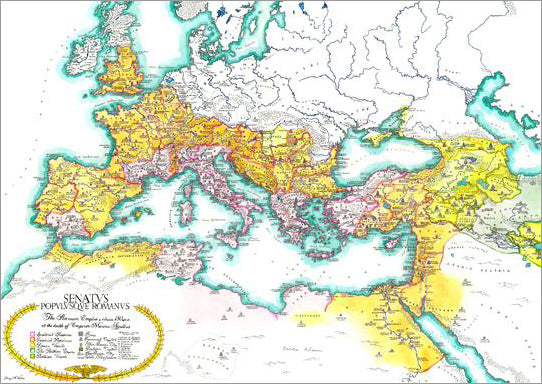
Map of the Roman Empire circa 180 CE Premium Wall Poster - Useful Charts
Item # UC-13
North American Indian Cultures National Geographic 24x36 Wall Map Poster - NG Maps
Item # NG-RE00620319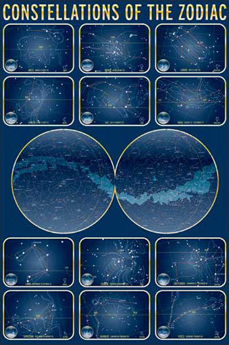
Constellations of the Zodiac Astronomy Wall Chart Poster - Eurographics Inc.
Item # EU2450-4450
Map of INDIA National Geographic Classic Edition 23x30 Wall Map Poster - NG Maps
Item # NG-RE00620546
The Colorado Trail National Geographic 18x48 Hiking Wall Map Poster - NG Maps
Item # NG-RE01021199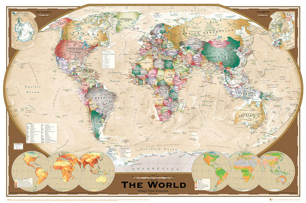
Wall Map of The World Poster (Winkel Tripel Projection) - GB Eye Ltd.
Item # GB-GN0532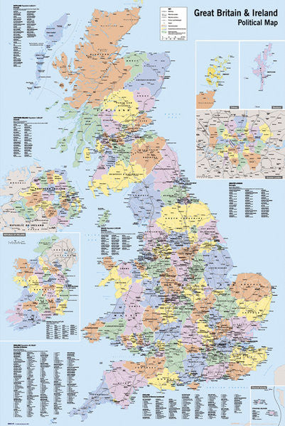
Map of Great Britain and Ireland Wall Poster - GB Eye Ltd.
Item # GB-GN0147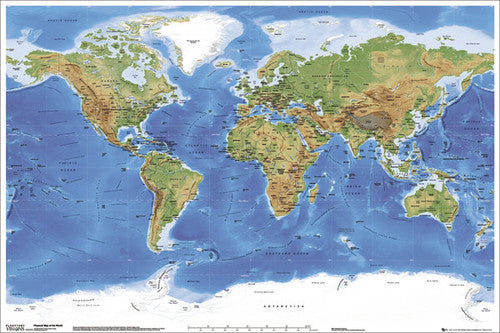
Planetary Visions Physical Map of the World (Miller Cylindrical Projection) Wall POSTER - GB Eye
Item # GB-GN0394
License Plates Map of the United States of America Poster - PosterService Inc.
Item # PS-10205
Map of Germany National Geographic Classic Edition 23x30 Wall Map Poster - NG Maps
Item # NG-RE00602814
Map of Hawaii National Geographic Classic Edition 22x35 Wall Map Poster - NG Maps
Item # NG-RE00602061
Flags of the World (197 Countries) Educational Wall Chart 24x36 Poster - Eurographics Inc.
Item # EU2450-0128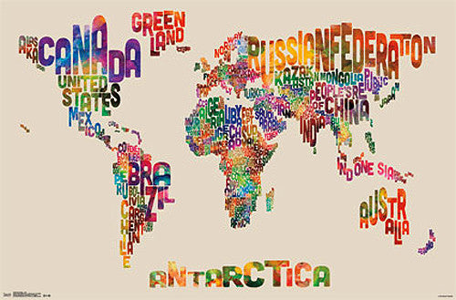
Map of the World Typography Text Map Poster by Michael Tompsett - Trends
Item # CN13480-14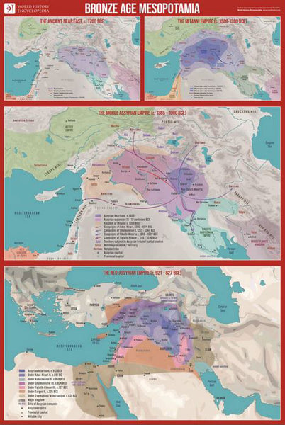
Bronze Age Mesopotamia (1700-600 BCE) Maps Premium 24x36 Reference Poster - Useful Charts/World History Encyclopedia
Item # UC-23
Indian Country Native Cultures of the United States National Geographic 20x31 Wall Map Poster - NG Maps
Item # NG-RE00620315
Railroad Legacy of the United States National Geographic 24x36 Wall Map Poster - NG Maps
Item # NG-RE01020718
Map of France Wall Chart Poster (Regions, Capitals, Cities, Rivers, etc.) - GB Eye
Item # GB-GN0779
Mount Everest National Geographic 30x47 Wall Map 2-Sided Poster - NG Maps
Item # NG-RE00620098
Map of the World 22x34 Wall Poster - Collins Bartholomew Ltd.
Item # CN10157-19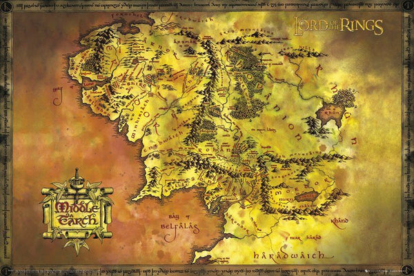
Map of Middle Earth Poster (from J.R.R. Tolkien's The Lord of the Rings) - GB Eye Inc.
Item # SB-GB-FP2647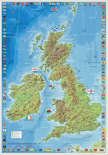
The Ultimate British Isles and Ireland Wall Map Poster w/120 County Flags - Chartex Inc. (UK)
Item # CX-1902A
National Parks of the Canada National Geographic 30x42 Wall Map Poster - NG Maps
Item # NG-RE01020680
Map of Alaska National Geographic Classic Edition 30x40 Wall Map Poster - NG Maps
Item # NG-RE01020587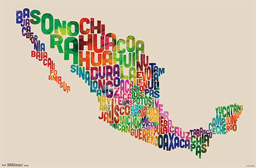
Map of Mexico Typography Text Map Wall Poster by Michael Tompsett - Trends International
Item # CN13491-14-L
Map of Korea THE KOREAN PENINSULA National Geographic Classic Edition 23x35 Wall Map Poster - NG Maps
Item # NG-RE01020740
Zion National Park National Geographic 24x36 Wall Map Poster - NG Maps
Item # NG-RE01020343
Map of CUBA National Geographic Classic Edition 24x36 Wall Map Poster - NG Maps
Item # NG-RE01020614
Map of the World National Geographic Classic Edition 30x43 Wall Map Poster - NG Maps
Item # NG-RE00622005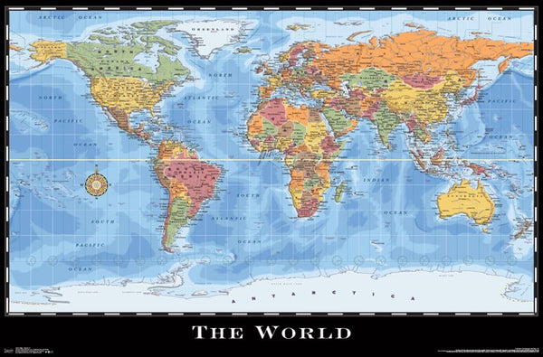
World Map Wall Poster (Modern Political) by Eureka Cartography - Trends International 2017
Item # CN15214-17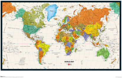
Map of the World Wall Poster - Trends International Inc.
Item # CN6131-09
United States of America "States and Capitals" Wall Map Poster - Pyramid America
Item # PP-PAS0353
Map of ITALY National Geographic Classic Edition 23x34 Wall Map Poster - NG Maps
Item # NG-RE00602297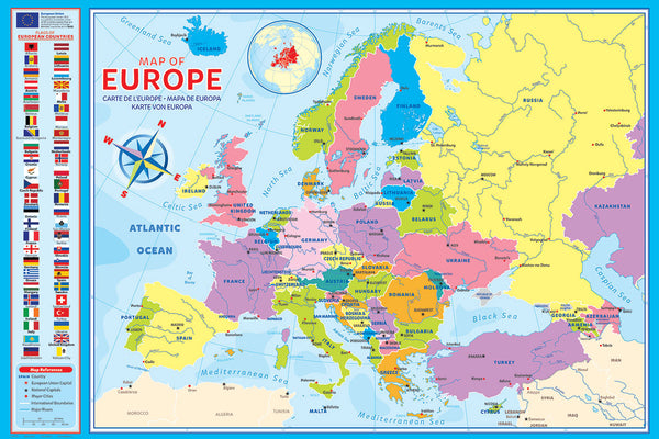
Map of Europe (50 Nations) 24x36 Wall Poster - Eurographics Inc.
Item # EU2400-5374
Map of RUSSIA National Geographic Classic Edition 23x30 Wall Map Poster - NG Maps
Item # NG-RE00622091
Map of TEXAS National Geographic Classic Edition 38x40 Wall Map Poster - NG Maps
Item # NG-RE01020408
Map of California National Geographic Classic Edition 33x40 Wall Map Poster - NG Maps
Item # NG-RE01020371