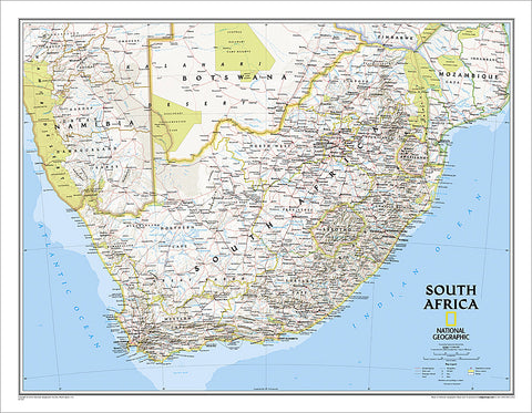
Map of SOUTH AFRICA National Geographic Classic Edition 23x30 Wall Map Poster - NG Maps
Item #: NG-RE01020763
Bring your wall alive with the world's gold standard of wall maps! Take a trip to the magical southern tip of the African continent, and the fascinating, beloved country of South Africa, with this Classic Edition Map from the greatest cartographers on the globe, National Geographic. From the map collection you've seen in classrooms, libraries, offices, coffee shops, and other public places all your life - now own one for yourself.
As attractive as it is functional, National Geographic's wall map of South Africa features the country's nine provinces along with the bordering countries of Namibia, Botswana, Zimbabwe, Mozambique, Swaziland, and Lesotho. Also included are southern Africa's premier wildlife venues—its national parks and reserves. Many local language place-names are used reflecting the region's rich cultural diversity. Physical geography details include shaded relief and cartographic patterns used to depict sand, salt pans, and swamps. This map also features a detailed transportation network including highways, roads, passenger railroads, and major airports. The signature Classic style map uses a bright, easy to read color palette featuring blue oceans and stunning shaded relief that has been featured on National Geographic wall maps for over 75 years.
This 23" x 30" edition is the perfect size - not too big, not too small - ideal for any wall of your choosing. Every lover of South Africa can use this piece as an accent to home, office, classroom, library, or other public facility. Make this yours!
Shop for more related posters in these collections:
We Also Recommend

Alex Ovechkin NHL's All-Time Leading Goal Scorer Washington Capitals Commemorative Poster - Costacos 2025
Item # CN26704-25
Biblical Family Tree and Historical Timeline Wall Chart Premium Reference Poster - Useful Charts
Item # UC-17
Bijan Robinson "Action" Atlanta Falcons NFL Action Poster - Costacos 2026
Item # CN28297-26
Bijan Robinson "Superstar" Atlanta Falcons NFL Action Poster - Costacos 2024
Item # CN25454-24
Caitlin Clark Indiana Fever 2024 WNBA Rookie of the Year Commemorative Poster - Costacos Sports
Item # CN26065-24
CeeDee Lamb "Trailblazer" Dallas Cowboys NFL Action Poster - Costacos 2024
Item # CN25459-24
Christian McCaffrey "Superstar" San Francisco 49ers NFL Action Wall Poster - Costacos 2024
Item # CN25478-24
Cincinnati Bengals Official NFL Football Team Helmet Logo Neon-Style Poster - Costacos Sports
Item # CN23838-23
Coach John Wooden's "Pyramid of Success" Motivational Inspirational Wall Poster - Classic Edition
Item # JWC-01-CL
Coach John Wooden's "Pyramid of Success" Motivational Inspirational Wall Poster - Executive Edition
Item # JWC-01
COMBO: Lionel Messi Inter Miami CF Official MLS Soccer Action 2-Poster Combo Set
Item # PSAC-129
COMBO: Vegas Golden Knights 2023 Stanley Cup Champions Commemorative 2-Poster Set - Costacos Sports
Item # CN23052-23053
Connor McDavid "Superstar" Edmonton Oilers NHL Hockey Poster - Costacos Sports 2022
Item # CN22885-22
Dak Prescott "Lone Star Great" Dallas Cowboys QB NFL Action Poster - Costacos Sports 2022
Item # CN22714-22
Denver Nuggets 2023 NBA Champions Official Commemorative Poster - Costacos Sports
Item # CN23048-23Detroit Lions Official NFL Football Team Helmet Logo Neon-Style Poster - Costacos Sports
Item # CN23842-23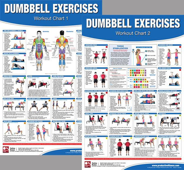
Dumbbell Exercises Workout 2-Poster Professional Wall Chart Combo - Productive Fitness
Item # PFP-DUMBELLS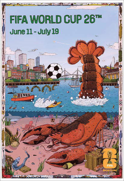
FIFA World Cup 2026 Host City Boston Official 24x36 Event Poster - MPW
Item # MPW-147946
Fitness Gym Motivational "Challenge Your Limits" Inspirational Quotes Wall Poster - Trends Int'l.
Item # CN15817-17
Ford F-150 F-Series Pickup Truck Evolution (26 Models Since 1948) Autophile Poster - Eurographics
Item # EU2400-0950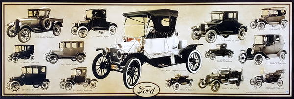
Ford Model T Automobiles (1908-1927) Official Ford Motor Company Commemorative Poster - Aquarius
Item # SB-P2030
Ford Mustang "Evolution" (29 Classic American Muscle Cars) Poster - Eurographics
Item # EU2450-0684Green Bay Packers Official NFL Football Team Helmet Logo Neon-Style Poster - Costacos Sports
Item # CN23843-23
Inter Miami CF 2025 MLS Cup Champions Official Commemorative Poster - Costacos 2025
Item # CN26557-25
Jalen Hurts "Roll Out" Philadelphia Eagles QB NFL Action Wall Poster - Costacos 2023
Item # CN23943-23
Jayden Daniels "Dynamo" Washington Commanders Official NFL Football Wall Poster - Costacos 2024
Item # CN26236-25
Josh Allen "Action" Buffalo Bills QB NFL Action Poster - Costacos 2026
Item # CN28299-26
Josh Allen "Touchdown Roar" Buffalo Bills QB NFL Action NFL Poster - Costacos 2023
Item # CN23937-23
Kansas City Chiefs Super Bowl LVII (2023) CHAMPIONS 6-Player Commemorative Poster - Costacos
Item # CN22969-23
Kansas City Chiefs Super Bowl LVIII (2024) CHAMPIONS 8-Player Commemorative Poster - Costacos
Item # CN23874-24
Kobe Bryant and Shaquille O'Neal "Showtime" Los Angeles Lakers Poster - Starline 1999
Item # S3568
Kylian Mbappé "Superstar" Real Madrid CF Official La Liga Football Action 24x36 Poster - Grupo Erik (Spain)
Item # GE-GPE6028
LeBron James "Legend" Los Angeles Lakers Official NBA Poster - Costacos Sports
Item # CN24074-23
LeBron James "Showtime 6" Los Angeles Lakers Official NBA Poster - Costacos 2022
Item # CN22691-22
Lionel Messi "Dynamo" Inter Miami CF MLS Soccer Action Poster - Costacos 2026
Item # CN27429-26
Lionel Messi "In Action" Inter Miami CF MLS Soccer Poster - Costacos 2025
Item # CN26226-25
Lionel Messi "Passion For The Game" Inter Miami CF MLS Soccer Poster - Costacos 2025
Item # CN26227-25Los Angeles Chargers Official NFL Football Team Helmet Logo Neon-Style Poster - Costacos Sports
Item # CN23849-23
Luka Doncic "Golden Star" Los Angeles Lakers Official NBA Basketball Action Poster - Costacos 2025
Item # CN26475-25
Marilyn Monroe "Pumping Iron" (Hollywood 1952) Poster Print - Image Conscious.
Item # IC-H353
Maxx Crosby "Superstar" Las Vegas Raiders NFL Action Wall Poster - Costacos 2024
Item # CN25466-24
Micah Parsons "Prowler" Dallas Cowboys Linebacker NFL Action Poster - Costacos Sports 2022
Item # CN22653-22
Michael Jordan "10-Time NBA Scoring Champion" Chicago Bulls Commemorative NBA Poster - Costacos Sports 2025
Item # CN27293-25
Michael Jordan "1987 Slam Dunk Classic" Chicago Bulls Commemorative NBA Poster - Costacos Sports 2022
Item # CN21923-22
Michael Jordan "23 Soaring Slam" Chicago Bulls Commemorative NBA Poster - Costacos Sports 2022
Item # CN21928-22
Michael Jordan "Championship History" Chicago Bulls Commemorative NBA Poster - Costacos Sports 2023
Item # CN24362-23
Michael Jordan "Cloudburst" Chicago Bulls Commemorative NBA Basketball Action Poster - Costacos Sports 2023
Item # CN23327-23
Michael Jordan "Fly" Chicago Bulls Slam Dunk Inspirational NBA Poster - Costacos Sports 2022
Item # CN21927-22
Michael Jordan "Pinstripes Slam" Chicago Bulls Commemorative NBA Poster - Costacos Sports
Item # CN21929-22
Michael Jordan "Six-Foot Slam" Chicago Bulls HUGE Door-Sized Poster - Costacos 1997
Item # CN8364-97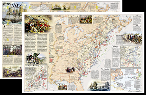
American Revolutionary War/War of 1812 National Geographic 24x36 History Wall Map 2-Sided Poster - NG Maps
Item # NG-RE01020603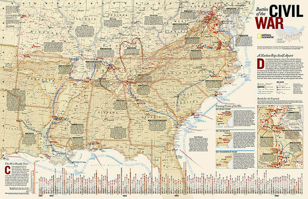
Battles of the American Civil War National Geographic 24x36 Wall Map Poster - NG Maps
Item # NG-RE00620346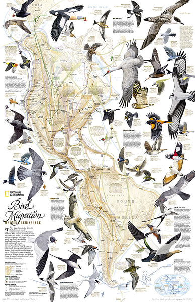
Bird Migration of the Western Hemisphere National Geographic 20x31 Wall Map Poster - NG Maps
Item # NG-RE01020304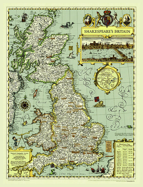
Illustrated Map of Shakespeare's Britain National Geographic 21x27 Wall Map Poster - NG Maps
Item # NG-RE00620097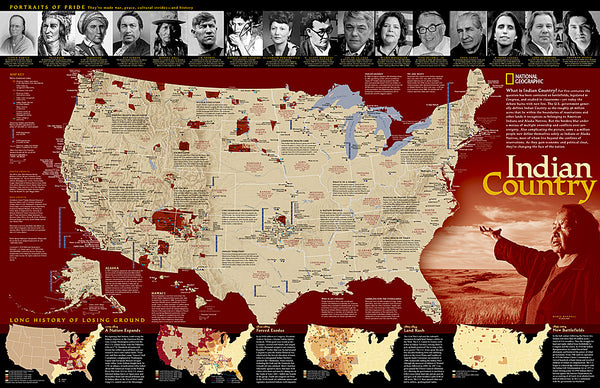
Indian Country Native Cultures of the United States National Geographic 20x31 Wall Map Poster - NG Maps
Item # NG-RE00620315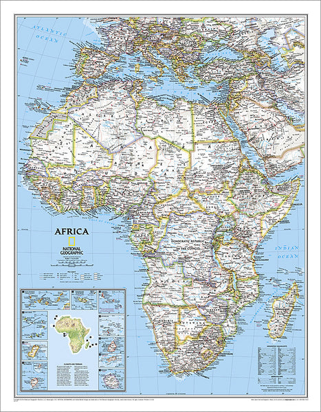
Map of Africa National Geographic Classic Edition 24x31 Wall Map Poster - NG Maps
Item # NG-RE00622110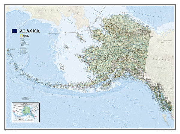
Map of Alaska National Geographic Classic Edition 30x40 Wall Map Poster - NG Maps
Item # NG-RE01020587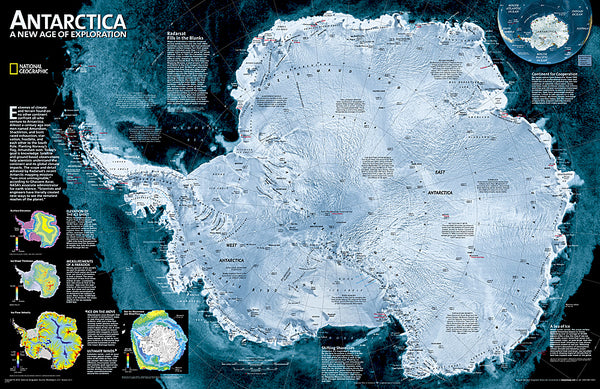
Map of ANTARCTICA National Geographic Classic Edition 20x30 Wall Map Poster - NG Maps
Item # NG-RE00620091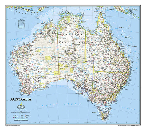
Map of AUSTRALIA National Geographic Classic Edition 27x30 Wall Map Poster - NG Maps
Item # NG-RE00620002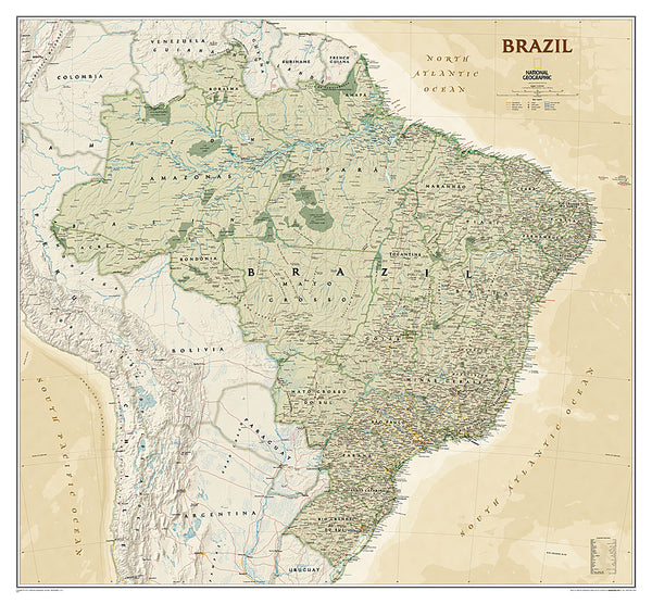
Map of BRAZIL National Geographic Executive Edition 38x41 Brasil Wall Map Poster - NG Maps
Item # NG-RE01020611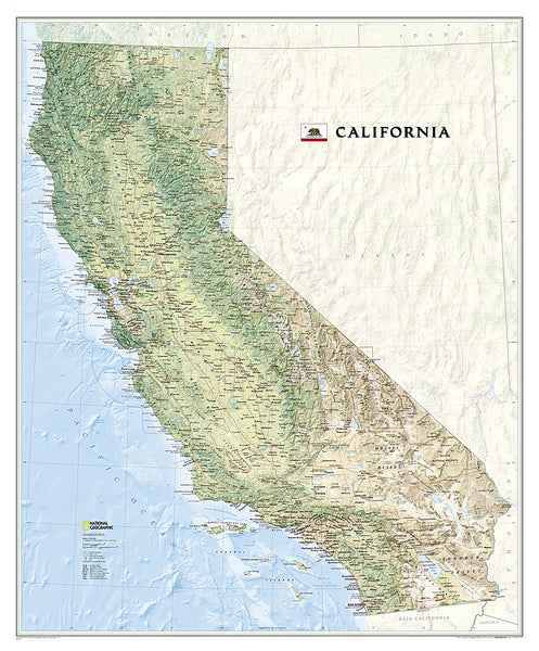
Map of California National Geographic Classic Edition 33x40 Wall Map Poster - NG Maps
Item # NG-RE01020371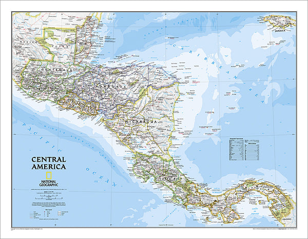
Map of CENTRAL AMERICA National Geographic Classic Edition 22x29 Wall Map Poster - NG Maps
Item # NG-RE00620011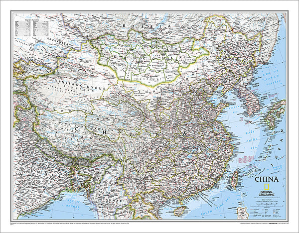
Map of CHINA National Geographic Classic Edition 24x30 Wall Map Poster - NG Maps
Item # NG-RE00620057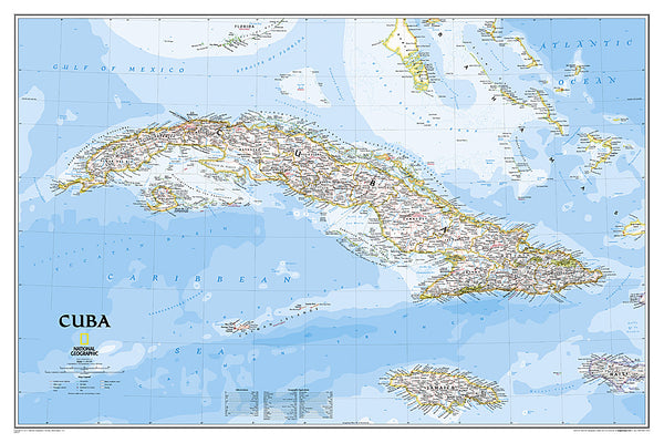
Map of CUBA National Geographic Classic Edition 24x36 Wall Map Poster - NG Maps
Item # NG-RE01020614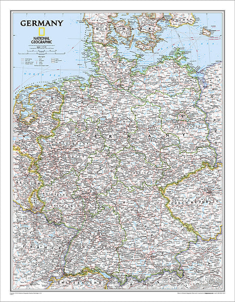
Map of Germany National Geographic Classic Edition 23x30 Wall Map Poster - NG Maps
Item # NG-RE00602814
Map of GREECE AND THE AEGEAN National Geographic Classic Edition 23x30 Wall Map Poster - NG Maps
Item # NG-RE00622111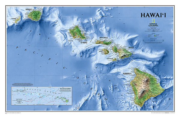
Map of Hawaii National Geographic Classic Edition 22x35 Wall Map Poster - NG Maps
Item # NG-RE00602061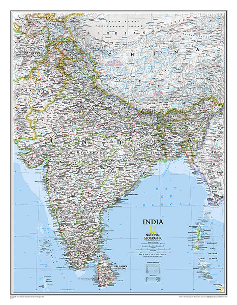
Map of INDIA National Geographic Classic Edition 23x30 Wall Map Poster - NG Maps
Item # NG-RE00620546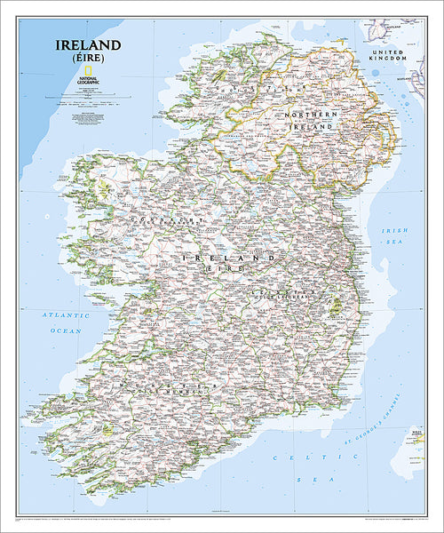
Map of IRELAND National Geographic Classic Edition 30x36 Wall Map Poster - NG Maps
Item # NG-RE01020427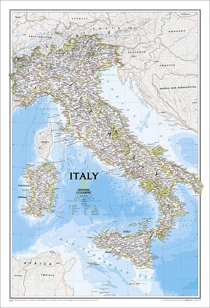
Map of ITALY National Geographic Classic Edition 23x34 Wall Map Poster - NG Maps
Item # NG-RE00602297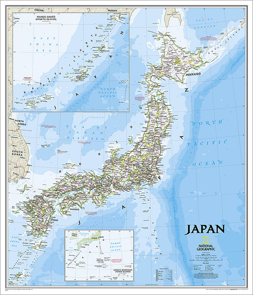
Map of JAPAN National Geographic Classic Edition 25x29 Wall Map Poster - NG Maps
Item # NG-RE01020670
Map of Korea THE KOREAN PENINSULA National Geographic Classic Edition 23x35 Wall Map Poster - NG Maps
Item # NG-RE01020740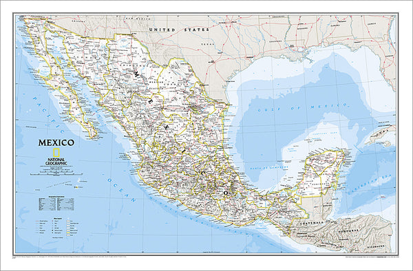
Map of MEXICO National Geographic Classic Edition 23x35 Wall Map Poster - NG Maps
Item # NG-RE00602295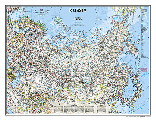
Map of RUSSIA National Geographic Classic Edition 23x30 Wall Map Poster - NG Maps
Item # NG-RE00622091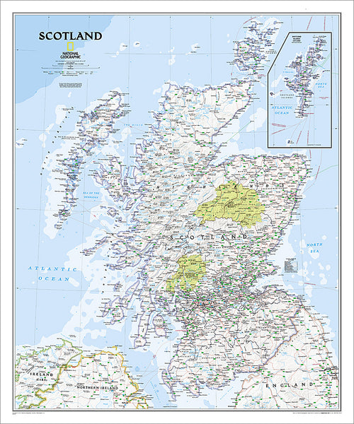
Map of SCOTLAND National Geographic Classic Edition 30x36 Wall Map Poster - NG Maps
Item # NG-RE01020533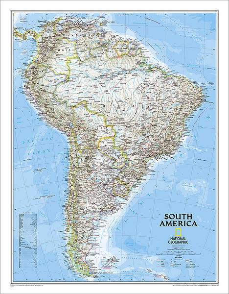
Map of SOUTH AMERICA National Geographic Classic Edition 23x30 Wall Map Poster - NG Maps
Item # NG-RE00622110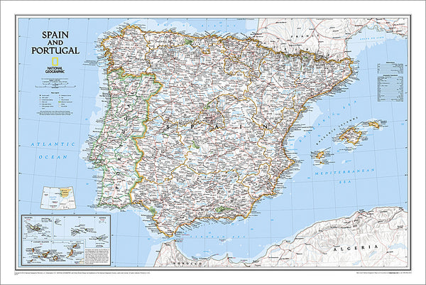
Map of Spain and Portugal National Geographic Classic Edition 22x33 Wall Map Poster - NG Maps
Item # NG-RE00622070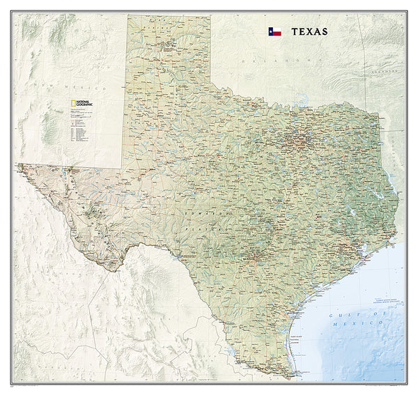
Map of TEXAS National Geographic Classic Edition 38x40 Wall Map Poster - NG Maps
Item # NG-RE01020408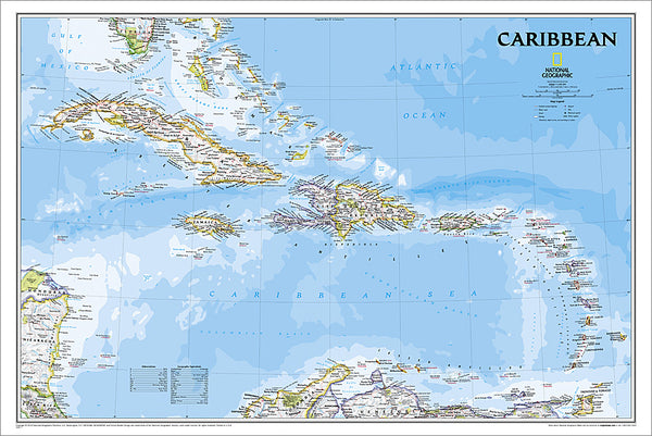
Map of THE CARIBBEAN National Geographic Classic Edition 24x36 Wall Map Poster - NG Maps
Item # NG-RE01020617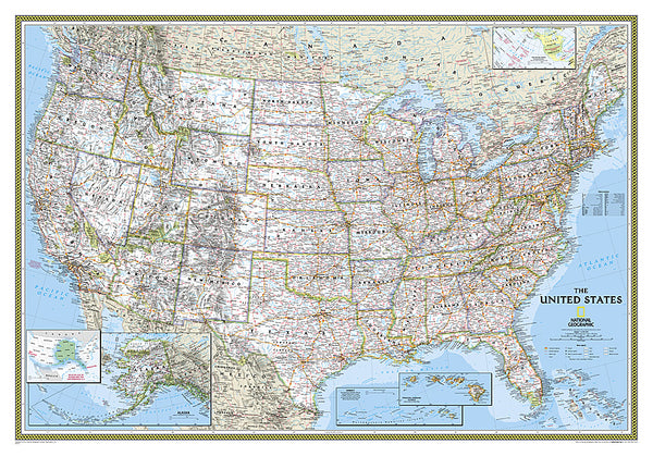
Map of the United States of America National Geographic Classic Edition 30x43 Wall Map Poster - NG Maps
Item # NG-RE00602003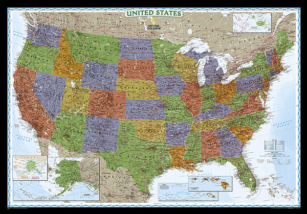
Map of the United States of America National Geographic Decorator-Edition 30x43 Wall Map Poster - NG Maps
Item # NG-RE00622081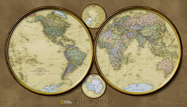
Map of the World "Hemispheres" Retro 1940s Style National Geographic 25x43 Wall Map Poster - NG Maps 2010
Item # NG-RE00620547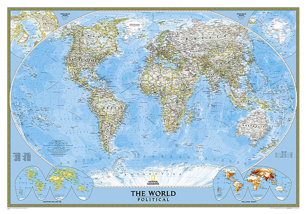
Map of the World National Geographic Classic Edition 30x43 Wall Map Poster - NG Maps
Item # NG-RE00622005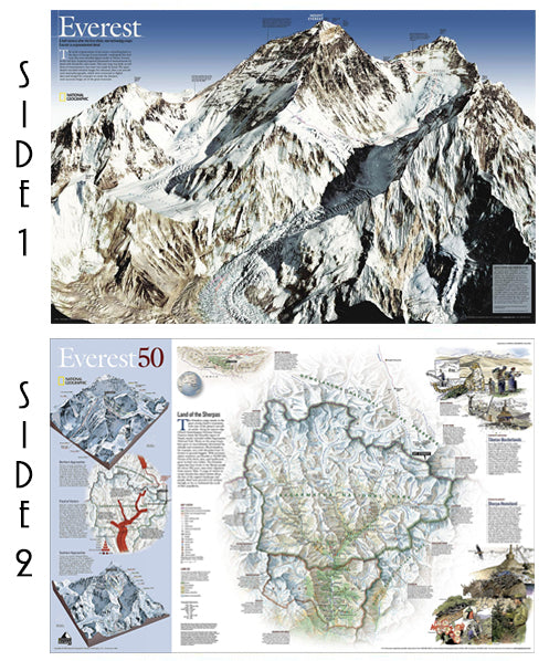
Mount Everest National Geographic 30x47 Wall Map 2-Sided Poster - NG Maps
Item # NG-RE00620098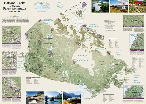
National Parks of the Canada National Geographic 30x42 Wall Map Poster - NG Maps
Item # NG-RE01020680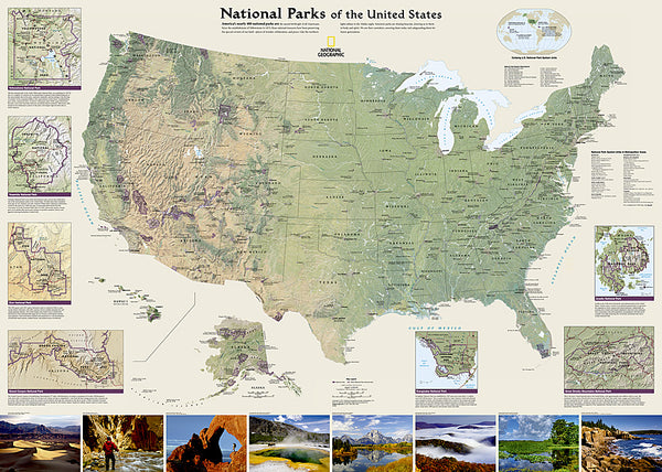
National Parks of the United States National Geographic 30x42 Wall Map Poster - NG Maps
Item # NG-RE01020599
North American Indian Cultures National Geographic 24x36 Wall Map Poster - NG Maps
Item # NG-RE00620319
Railroad Legacy of the United States National Geographic 24x36 Wall Map Poster - NG Maps
Item # NG-RE01020718
The Appalachian Trail National Geographic 18x48 Hiking Wall Map Poster - NG Maps
Item # NG-RE01020715
The Colorado Trail National Geographic 18x48 Hiking Wall Map Poster - NG Maps
Item # NG-RE01021199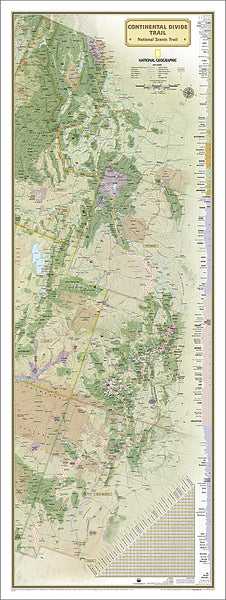
The Continental Divide Trail National Geographic 18x48 Hiking Wall Map Poster - NG Maps
Item # NG-RE01021202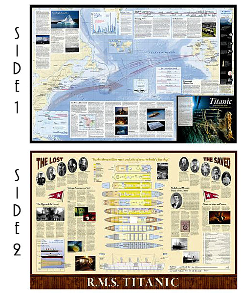
The Titanic National Geographic 26x39 History Wall Map 2-Sided Poster - NG Maps
Item # NG-RE01020684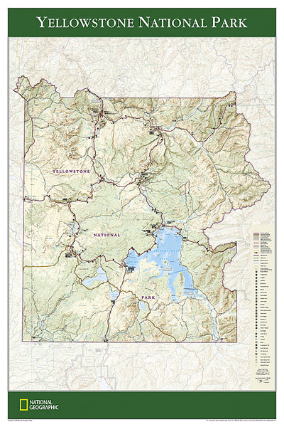
Yellowstone National Park National Geographic 24x36 Wall Map Poster - NG Maps
Item # NG-RE01020307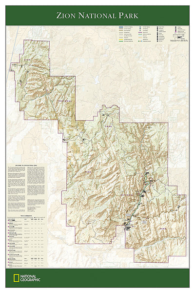
Zion National Park National Geographic 24x36 Wall Map Poster - NG Maps
Item # NG-RE01020343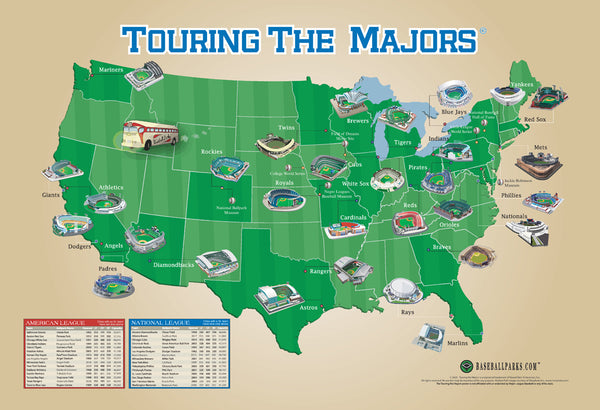
Touring the Majors MLB Ballparks Map of America Poster - Grand Slam Enterprises
Item # GSM-01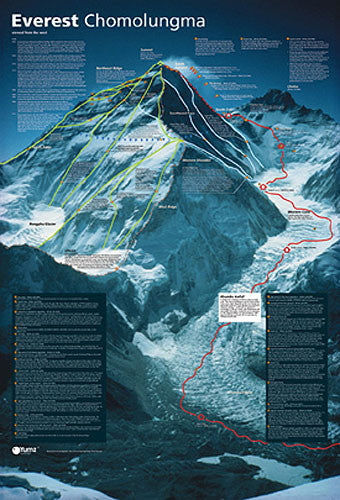
Mount Everest Revealed Mountain Climbing Wall Chart Poster - Yumz
Item # YU-01
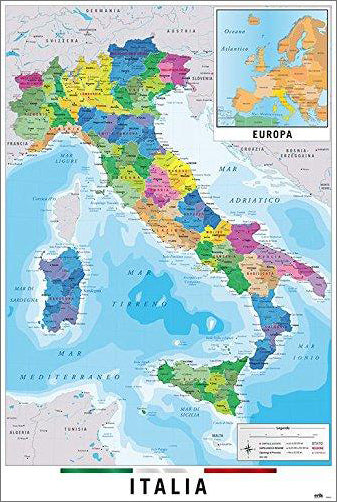
Map of Italy Italia Wall Chart Poster (Regions, Capitals, Cities, Roads, Rivers, etc.) - Grupo Erik
Item # GE-GPE5125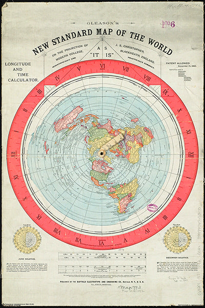
Gleason's New Standard MAP OF THE WORLD (1892) 24x36 Wall POSTER Reproduction - Posterservice Inc. 2020
Item # PS-11565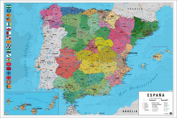
Map of Spain Wall Chart Poster (Regions, Capitals, Cities, Roads, Rivers, etc.) - Grupo Erik
Item # GE-GPE5030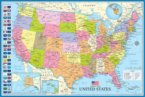
Map of The United States of America USA 24x36 Wall Poster - Eurographics Inc.
Item # EU2400-0788
Bird Migration of the Western Hemisphere National Geographic 20x31 Wall Map Poster - NG Maps
Item # NG-RE01020304
National Parks of the United States National Geographic 30x42 Wall Map Poster - NG Maps
Item # NG-RE01020599
American Revolutionary War/War of 1812 National Geographic 24x36 History Wall Map 2-Sided Poster - NG Maps
Item # NG-RE01020603
Map of JAPAN National Geographic Classic Edition 25x29 Wall Map Poster - NG Maps
Item # NG-RE01020670
The Appalachian Trail National Geographic 18x48 Hiking Wall Map Poster - NG Maps
Item # NG-RE01020715
Battles of the American Civil War National Geographic 24x36 Wall Map Poster - NG Maps
Item # NG-RE00620346
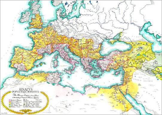
Map of the Roman Empire circa 180 CE Premium Wall Poster - Useful Charts
Item # UC-13
North American Indian Cultures National Geographic 24x36 Wall Map Poster - NG Maps
Item # NG-RE00620319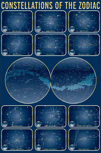
Constellations of the Zodiac Astronomy Wall Chart Poster - Eurographics Inc.
Item # EU2450-4450
Map of INDIA National Geographic Classic Edition 23x30 Wall Map Poster - NG Maps
Item # NG-RE00620546
The Colorado Trail National Geographic 18x48 Hiking Wall Map Poster - NG Maps
Item # NG-RE01021199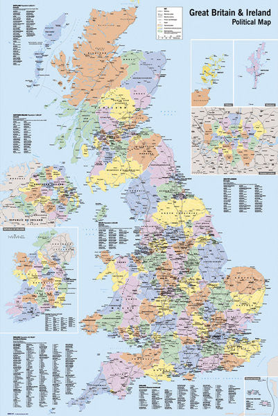
Map of Great Britain and Ireland Wall Poster - GB Eye Ltd.
Item # GB-GN0147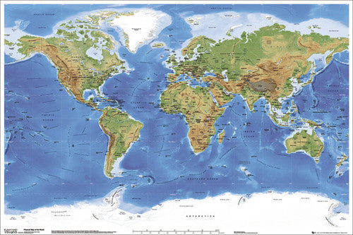
Planetary Visions Physical Map of the World (Miller Cylindrical Projection) Wall POSTER - GB Eye
Item # GB-GN0394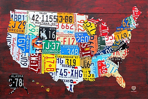
License Plates Map of the United States of America Poster - PosterService Inc.
Item # PS-10205
Map of Germany National Geographic Classic Edition 23x30 Wall Map Poster - NG Maps
Item # NG-RE00602814
Map of Hawaii National Geographic Classic Edition 22x35 Wall Map Poster - NG Maps
Item # NG-RE00602061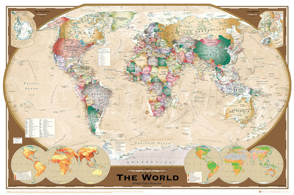
Wall Map of The World Poster (Winkel Tripel Projection) - GB Eye Ltd.
Item # GB-GN0532
Flags of the World (197 Countries) Educational Wall Chart 24x36 Poster - Eurographics Inc.
Item # EU2450-0128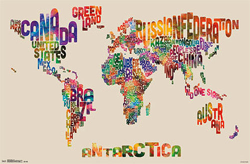
Map of the World Typography Text Map Poster by Michael Tompsett - Trends
Item # CN13480-14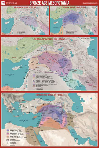
Bronze Age Mesopotamia (1700-600 BCE) Maps Premium 24x36 Reference Poster - Useful Charts/World History Encyclopedia
Item # UC-23
Indian Country Native Cultures of the United States National Geographic 20x31 Wall Map Poster - NG Maps
Item # NG-RE00620315
Railroad Legacy of the United States National Geographic 24x36 Wall Map Poster - NG Maps
Item # NG-RE01020718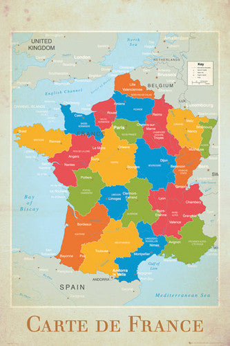
Map of France Wall Chart Poster (Regions, Capitals, Cities, Rivers, etc.) - GB Eye
Item # GB-GN0779
Mount Everest National Geographic 30x47 Wall Map 2-Sided Poster - NG Maps
Item # NG-RE00620098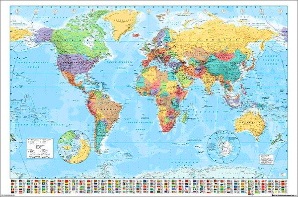
Map of the World 22x34 Wall Poster - Collins Bartholomew Ltd.
Item # CN10157-19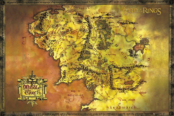
Map of Middle Earth Poster (from J.R.R. Tolkien's The Lord of the Rings) - GB Eye Inc.
Item # SB-GB-FP2647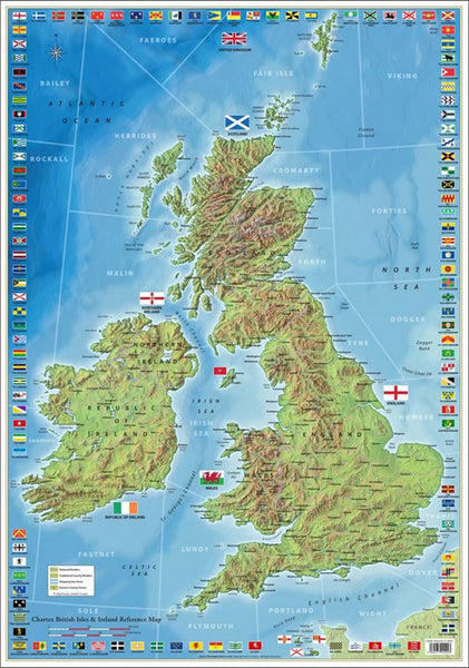
The Ultimate British Isles and Ireland Wall Map Poster w/120 County Flags - Chartex Inc. (UK)
Item # CX-1902A
National Parks of the Canada National Geographic 30x42 Wall Map Poster - NG Maps
Item # NG-RE01020680
Map of Alaska National Geographic Classic Edition 30x40 Wall Map Poster - NG Maps
Item # NG-RE01020587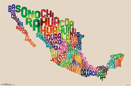
Map of Mexico Typography Text Map Wall Poster by Michael Tompsett - Trends International
Item # CN13491-14-L
Map of Korea THE KOREAN PENINSULA National Geographic Classic Edition 23x35 Wall Map Poster - NG Maps
Item # NG-RE01020740
Zion National Park National Geographic 24x36 Wall Map Poster - NG Maps
Item # NG-RE01020343
Map of CUBA National Geographic Classic Edition 24x36 Wall Map Poster - NG Maps
Item # NG-RE01020614
Map of the World National Geographic Classic Edition 30x43 Wall Map Poster - NG Maps
Item # NG-RE00622005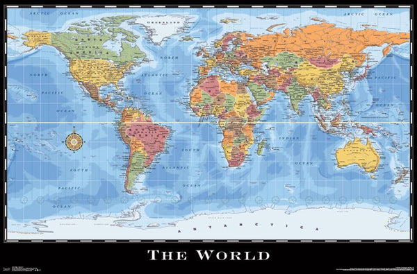
World Map Wall Poster (Modern Political) by Eureka Cartography - Trends International 2017
Item # CN15214-17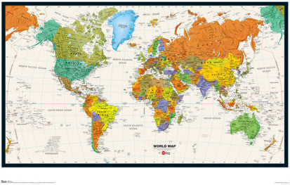
Map of the World Wall Poster - Trends International Inc.
Item # CN6131-09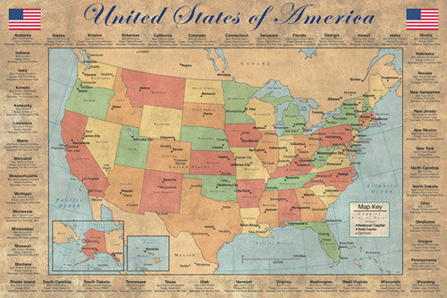
United States of America "States and Capitals" Wall Map Poster - Pyramid America
Item # PP-PAS0353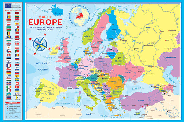
Map of Europe (50 Nations) 24x36 Wall Poster - Eurographics Inc.
Item # EU2400-5374
Map of RUSSIA National Geographic Classic Edition 23x30 Wall Map Poster - NG Maps
Item # NG-RE00622091
Map of TEXAS National Geographic Classic Edition 38x40 Wall Map Poster - NG Maps
Item # NG-RE01020408
Map of California National Geographic Classic Edition 33x40 Wall Map Poster - NG Maps
Item # NG-RE01020371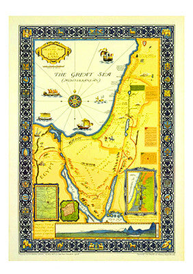
Picture Map of the Holy Land (Harold Brown c.1928) Extra-Large Israel Poster
Item # AAC-AM7021